Significant Rains and Potential Severe Weather On Tap for the Next Several Days

SPEAKERS

Jim du Bois, Kenny Blumenfeld


Jim du Bois  00:00

Well, somebody's about to get pounded. This is Way Over Our Heads. It's a weather and climate podcast. I'm Jim du Bois, Kenny Blumenfeld's a climatologist. Kenny, where you kind of roused from your sleep in the early morning hours of Tuesday, August 24 by rumbling and the sound of something we haven't heard very often this spring and summer...raindrops and, in my case, a NOAA Weather Radio awakened me before the storm actually got here.


Kenny Blumenfeld  00:28

Yeah, I'm glad that you have that available. Everybody should have a NOAA Weather Radio, just like you have a smoke detector. Because, you know, when the storms come up in the middle of the night, how else are you going to know, and sometimes you need to get to safety. So yeah, Jim I, I woke up to the sound of thunder and rain. And then when I looked out the window, there was some wind too. It was quite a storm. You know, and it dropped some decent precipitation across parts of southern Minnesota, right around an inch in most of the Twin Cities area, but areas to the south got anywhere from an inch and a half to three inches of rain, not far from Northfield over towards Red Wing, and then out into parts of Sibley and Renville Counties. So, it was a nice rainfall event. And of course, there had been some, some other rains over the past week in parts in northwestern Minnesota. So, not a bad week--at least in the context of the dry conditions--has not so far been a bad week.


Jim du Bois  01:33

Well, here in the backyard rain gauge, we had 1.22 inches of rain on Tuesday morning. And probably the most dramatic indication of the power of that rainfall was the effect on Minnehaha Creek which happens to flow right behind our house. And I had taken a photo literally standing in the creek bed the day before, that'd be Monday, August 23, And it was virtually entirely dry. And I took another photo in the exact same location, although not standing in the creek bed because the creek bed now had water in it and water flowing at a pretty impressive rate. So, that to me was even beyond what I saw on my rain gauge that really drove home just how impactful that rain was.


Kenny Blumenfeld  02:20

Yeah, you know, Minnehaha Falls had been basically shut off. I mean, it was reduced to just a trickle like a, you know, like a faucet leak essentially over the weekend. And so, to have it flowing and raging, I think the falls would probably be on the very low end of of what's kind of normal the day after that rain. But it's good to know that the creek came back to life a little bit anyway.


Jim du Bois  02:48

Yeah, it was pretty impressive. Well, Kenny, was that kind of the debut performance of a series of rainfall events and possibly severe weather events we will see over the next several days?


Kenny Blumenfeld  03:00

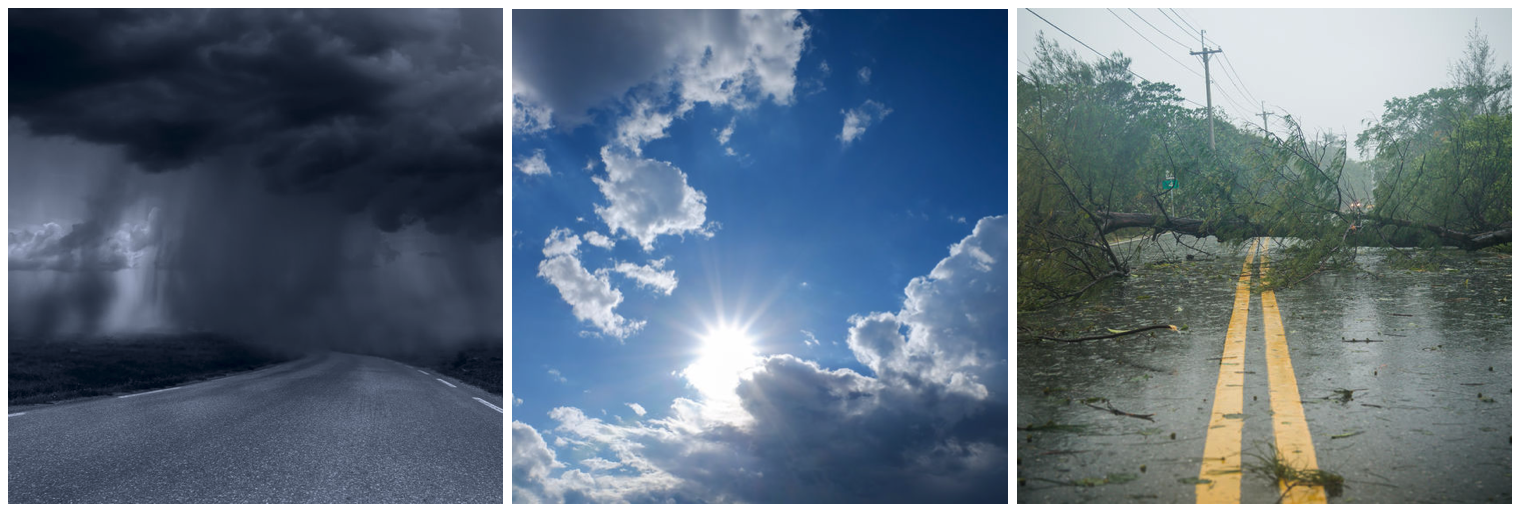
Yeah, it's a, that's a good way of putting it. Jim, I would say that the, you know, so that was Tuesday, then we kind of took Wednesday off, didn't have much. And now on Thursday, when we're recording this, we're kind of looking ahead to a fairly intense rainfall event in parts of southern Minnesota. Don't know exactly where, there's all kinds of uncertainty, even just hours ahead of it. And then kind of a, you know, on and off fairly busy weekend covering a little bit more of the state. So yeah, I think that, you know, you could say that that was a Roman numeral one or I. And now, and then, and then the main event is right now, is going to happen Thursday afternoon and evening and overnight. And then there'll be other follow up events. I mean, these all have some potential for severe weather. But, you know, I think meteorologically, the most interesting aspect is the potential for the first system, the one on Thursday night, to produce some extraordinary rainfall amounts.


Jim du Bois  04:06

Are we talking the possibility of flash flooding in certain areas?


Kenny Blumenfeld  04:12

I think that's accurate. You know, there's a little bit of a disconnect in some of the official products that we're seeing. And when we say products, of course, we're talking about basically, the way that the weather gets summarized by some official forecasting entity, usually part of the National Weather Service. And one of the products that we look at a lot that anybody who follows the weather looks at is this excessive rainfall risk. And it actually is very similar to the severe weather risk categories that the Storm Prediction Center uses. This is a different arm within NOAA. It's called the Weather Prediction Center. It used to be the Hydro Meteorological Prediction Center, but I think that, that wasn't very, that wasn't very friendly to lay populations so they changed it to the Weather Prediction Center. But they do most of the, the large area rainfall forecasting, and they have, they have much of Minnesota, southern half or so of Minnesota and then the northern half or so of Iowa and the western third or so of Wisconsin in a slight risk for excessive rainfall. When they say excessive rain, they mean rain that exceeds the current flash flood guidance. And what that means is that the rainfall rates, there's a slight chance that the rainfall rate, and that would be a 10 to 20% chance that rainfall rates would actually be high enough to exceed capacity and cause some flash flooding. The reason I said that there's a disconnect is I think that that slight risk area that they're using actually is also being used to express some uncertainty. We don't know exactly where the heaviest rains will be. But some of the, some of the models, Jim, have been showing very, very high rainfall totals up to, you know, eight, nine inches in narrow swaths. And of course, these swaths have been anywhere from entral Iowa up to central Minnesota. And so, that's the uncertainty is we don't know exactly where the heaviest rain will be. If I had to guess it would be somewhere along or south of that western arm of the Minnesota River into far southern Minnesota. And it might not be as high as, you know, some of those models might be getting a little bit carried away, but there's a lot of moisture in the atmosphere. And so, the conditions are at least supportive for some training thunderstorms. Those are the repeat thunderstorms that kind of form and move over the same areas, and also for very high rainfall rates during those thunderstorms. So, you know, we could be looking at a major flood event in at least a small area. And of course, this is inside one of the driest summers we've had in a long time. So, it's kind of surreal to be talking about it.


Jim du Bois  07:01

Now, when we're running a significant soil moisture deficit as we are this summer, what happens when it rains heavily? Now, we would tend to think that if the soil is dry, it might absorb the rain, like a sponge, but the reality may be something very different. Is it like the first inch of rain maybe will be absorbed like a sponge, and then any rainfall amount beyond that begins to run off? I mean, it seems almost counterintuitive because you would logically think if soil was saturated with moisture, then additional rains would run off. But it sounds like the contrary might be the case.


Kenny Blumenfeld  07:40

Yeah, I mean, I, you know, honestly, there's going to be soil physicists and hydrologists, who who probably understand these processes better than I do, but I think the harder it rains, well first of all, when it's really dry, we've seen this before, too, when it's really dry, and you have dried dusty topsoil, which is certainly the case in some parts of Minnesota, then actually, the first thing that happens is the heavy rain doesn't even soak into that topsoil, it just washes it away. And that's definitely not great. That's something that you want. So, you actually get some erosion from the heavy rain because there's nothing kind of binding the topsoil down to the rest of the profile. But beyond that, it kind of depends on the rainfall rate. You know, if we were to get a really slow, you know, if we were to get several inches of additional rain but say distributed over a month, which is kind of what the DNR, that's sort of the DNR's message that if we made up five to eight inches over the course of a month, that would significantly alleviate drought conditions, because over the course of a month, there's probably enough time for the soils to absorb a lot of that moisture. I think another way you could look at it as you know, rather than getting it all at once, you'd prefer to have it over a prolonged period of weeks, or even months. So, when you get it all at once, I don't know what the exact quantity is that goes in, it's going to be determined by the rate but you're going to get some of the moisture into the soil but it can only go in so fast. And so then what doesn't make it into the soil while sort of waiting to percolate down, that is then going to start forming puddles and start running off, and that's when you get extra, and especially in urban areas where you have more pavement than soil, you're going to see a lot of runoff if, if it's raining really hard. So, I don't know the exact answer, Jim, but I would say you know, if you are getting several inches of rain in a 24 hour period, don't expect the majority of it to go into, you know, replenish your groundwater and and your soil moisture but expect a lot of it to run off instead.


Jim du Bois  09:51

So in other words, if we're thinking this great rainfall that's coming is going to pull us out of the drought situation, not going to happen, correct?


Kenny Blumenfeld  09:59

Yeah. I mean, you know, it's certainly going to have the potential to undo, or at least, maybe start reducing some of those major deficits in whichever areas get hit the hardest. I think that the long term deficits numerically might get reduced or even in small areas, erased. But that wouldn't necessarily end the drought for those people. Because, again, those are just precipitation deficits. It doesn't account for the this, you know, we've had months and months and months to deplete soil moisture and to deplete the groundwater, the aquifers, those kind of underwater lakes, or underground lakes. And we've had months and months and months to drop the river stream and lake levels. And that's going to all take time to get back. And those are, of course, the major indicators of drought. So yeah, I wouldn't, you know, pin your hopes on getting out of drought with one event, even if the numbers in small areas do support, you know, the deficit being gone. Remember, if it rains really hard, somewhere, within a few days, all that water that fell, or a lot of that water that fell is going to be off in some stream or river 500 miles away. So. it's not entirely local.


Jim du Bois  11:19

Well, Kenny, we are recording this on the morning of Thursday, August 26. And it looks like for each of the next three days, we in parts of Minnesota are going to have the risk of severe weather. And it looks like from the forecast discussions from the National Weather Service that all modes of severe weather potentially might come into the mix. So, what do you think, is this going to be pretty isolated, popping up in very isolated areas? Or could it be something on a grander scale?


Kenny Blumenfeld  11:52

Yeah, I think that, you know, for Thursday, the Storm Prediction Center definitely is looking at the Minnesota-Iowa border as having the highest risk. And that's the area that's going to be the warmest, have the most instability, and that's the area where I think the strong winds in particular, from the squall line would, would tend to be most likely. And that also seems to be the case as we get into Friday because there will be an additional round of storms. But there's, on both of those days, there's a marginal risk for severe weather that does extend up into the Twin Cities area roughly. And then we get into the weekend. And it appears that we have another risk for severe weather on Saturday afternoon, and that covers more of Minnesota. That, that covers the St. Cloud and Twin Cities area. And this, of course will change also, as we get more information, and as some of the forecast confidence increases on where the storms will be. But yeah, I think that in addition to heavy rains over the next three days, you're going to see the potential for some storms to produce hail, high winds, and and even isolated tornadoes. The winds aloft, especially in central and northern Minnesota, are actually pretty strong. And that would be conducive to organizing some of the thunderstorms so that they could either form really large, powerful storm complexes, or even in some cases become supercell thunderstorms. The only real limitation there is that where those strongest winds aloft occur, we might not see the most instability, might be a little cool, not quite humid enough. So, there's not a perfect match there. But it looks like a busy, kind of active weekend. I would say the biggest rainfall event looks like it would be Thursday into Friday morning where there is a potential for some flash flooding and very heavy rains, at least in narrow axes of southern Minnesota somewhere with maybe a more general one to two inch soaking rain type event surrounding that generally in the southern third, maybe southern half of Minnesota, but then additional rainfall chances as we get into Friday afternoon, and then again on Saturday afternoon. And we, you know, might take a couple days off and get back in business again on, as we get into next week. So it's a busy, active time.


Jim du Bois  14:17

Well, definitely keep an eye on the sky and an ear to your favorite source or an eye to your favorite source of weather information and be aware of the potential for severe weather. Let's hope we get some much needed rain but obviously not to the extreme point where we get flash flooding. So, hopefully it hits, it hits that sweet spot.


Kenny Blumenfeld  14:37

Yeah, I wish I could promise that. One of the things that the storm has is a huge amount of what meteorologists called precipitable water. That's basically if you take all of the moisture in the atmosphere, if you were able to just turn that into rain, some of the precipitable water quantities coming off of these climate models will be approaching, you know, all time highs for the date. And so, there's a lot of moisture, it's kind of highly anomalous or unusual quantities of moisture. And because of the mechanisms with these storms, they will have the ability to stay in place. So, I do think that at least localized flash flooding is very likely somewhere in southern Minnesota. But, you know, let's hope that surrounding that there's just a kind of general widespread soaking rain that could be quite beneficial to at least start, you know, or help dent further the ongoing drought conditions.


Jim du Bois  15:38

Well, Kenny, always great chatting with you and look forward to talking with you again early next week.


Kenny Blumenfeld  15:45

Very good. Thanks, Jim. You have a good rest of your day.


Jim du Bois  15:48

You as well, Kenny. This is Way Over Our Heads. It's a weather and climate podcast. I'm Jim du Bois. Kenny Blumenfeld is a climatologist. We'll see you next time.

James du Bois
Rain And Severe Weather Possible This Weekend


SPEAKERS

Jim du Bois, Kenny Blumenfeld


Jim du Bois  00:00

The hunt for meaningful rain continues. This is Way Over Our Heads. It's a weather and climate podcast. I'm Jim du Bois. Kenny Blumenfeld's climatologist. Kenny, you're back in town after a little vacation in the northwestern part of the state. How does it feel to be back here in the Twin Cities and kind of anticipating the possibility that we're going to get some rain?


Kenny Blumenfeld  00:23

It feels familiar. By now, Jim, I'm, you know, I think I've learned how to temper my expectations. I actually think some of the areas, I was West Central Minnesota, Northwest Minnesota, kind of Otter Tail County area, I think some of those areas are going to do pretty well, this weekend. Twin Cities it's iffy. So I'm excited at the prospect of rain and, you know, always sort of eager and cautiously anticipate potential for severe weather, which we have today. Also, and I'm also thinking about our friends up in northeast Minnesota with the Greenwood fire, which of course is not the only fire but it's the kind of biggest one in the state right now and thinking about their prospects for precipitation, which are not stellar. So, yeah. And how are you?


Jim du Bois  01:11

Kenny, I'm doing well. Interesting that you bring up the Greenwood fire because in an email you sent out today, you talked about a couple of scenarios with the Greenwood fire, one that would be good, and one that would be bad. And there was a person...I can't remember his exact title, but he's involved in the firefighting activities with the Greenwood fire. He was on Minnesota Public Radio this morning, and he had pretty much the same analysis that if they get some good rain up there, that will be wonderful. But if there is little to no rain, and there is a wind shift, and the winds increase, obviously from a fire control standpoint, that would be a bad case scenario. So, that seems to be what we're confronting. Either, we can get some great rains that can help extinguish the fire or get some winds that will increase the area the fire is covering.


Kenny Blumenfeld  02:03

Yeah, that's exactly right. I mean, so, I guess one of the interesting things about this setup is that for the first time in months, we're actually talking about a real weather system, a low pressure system, you know, counterclockwise rotation with a strong cold front. And in a tight pressure gradient, and I think the savvy listeners probably remember that it's that pressure gradient, that change in pressure over a relatively short distance that actually drives the winds. So, you name two scenarios, one where you get wet, and one where you get the winds. Well, the second of those two is guaranteed. It's going to be windy on Saturday, especially in northern and northeastern Minnesota, you know, not not a howling, you know, driving gale or anything like that, but you know, 20, 25 mile an hour winds with some gusts up around 30, 35 miles an hour. So, that wind is all but guaranteed tomorrow, and the real wildcard is does it rain? And you know, I'm not sure exactly how much rain is required to extinguish a fire or even just to kind of slow it down. But I have poured water on bonfires before and know that, and anyone who's done that knows that, you know, the first part you pour just goes right back into the air. You hear sizzle and, you know, maybe the fire slows down a bit, but it takes quite a lot to put it out. So, I'm not sure if it's a quarter of an inch or a half an inch of rain or how much rain it would take to really notably affect this fire. But I don't think it's likely to happen. I think it's possible that they get enough rain up there, but it's just as likely that they, you know, end up with a 10th of an inch or less, and it's it's remotely possible that they get virtually nothing. And that all they really get out of this is a cooler air mass and that wind shift with stronger winds on Saturday.


Jim du Bois  03:59

So, Kenny, what you're saying is this could be another hit or miss scenario for large portions of Minnesota.


Kenny Blumenfeld  04:07

Yeah, so the system is like I said, it's strong. It has a nice arcing cold front. So, what it has going for it, which I really like, it's actually really good ingredients, is it has this increasingly powerful cold front slamming into a warm and humid airmass. I mean we've had temperatures in the 80s and 90s across the entire state for the last few days. And that airmass is still in place today on Friday. And this cold front is going to plow into it, so that's good. Along that cold front thunderstorms will develop, and the low pressure system, the anchor of it, the middle of it, is kind of going to be pushing northeast word across North Dakota into far northwest Minnesota and in Manitoba. The problem is is when these systems start to really wind up after the cold front ignites the main round of thunderstorms, give it three to six hours or so, the storms start to migrate towards the low pressure area though, so they kind of, you'll see them sort of moving leftward towards that low pressure area. And so, initially, you might see a really impressive band or arc of intense thunderstorms but as it moves east across Minnesota, I would expect it to start to become more fragmented and fractured. And so, the eastern parts of Minnesota including Rochester, the Twin Cities and the Arrowhead region are definitely in a more of a hit or miss type of situation where they could get clocked with a good thunderstorm and maybe an inch of rain, or they could get shut out of this thing entirely. And in general, I'd say the best chances of heavy precipitation are in northwest Minnesota, which is good, because that's where the drought is most extreme, or it's actually in the exceptional category right now. But even in northwest Minnesota, the rainfall is not going to be complete, it's not going to cover everyone.


Jim du Bois  06:04

So, we are recording this on Friday morning, August 20. And we may have over the weekend here two rounds of potentially severe weather, the first of which happens late this afternoon, starting in western Minnesota, and then moves eastward. And then another round potentially on Sunday. So, which one do you think has the potential to pack the most punch?


Kenny Blumenfeld  06:31

Honestly, to me, the one today it just has more going for it on a wider over a wider area. To me it looks like the Friday night, Friday afternoon, evening and early overnight storms will just be stronger and have more energy, in general. Mostly, it's because the airmass out ahead of it is stronger, the winds aloft are kind of the same today and Sunday. Sunday's system, I would imagine it's going to focus more to the southwest, maybe South Dakota, Nebraska and Iowa. And I don't think there'll be much in the way of truly severe weather covering large areas of Minnesota. Whereas tonight, honestly, on Friday evening, I could see some wind damage and maybe even some tornadoes in parts of western Minnesota, especially in the first few hours as these thunderstorms really get going. There's a couple missing ingredients here. Usually with a good severe weather outbreak, you'd like to see the air mass kind of dry off quickly as you ascend through the atmosphere. And you also like to see it cool off kind of quickly. And in this particular case, there's a little too much summer left in this airmass. So, it stays a little warmer with height than it would be ideal. And it stays a little too moist with height compared to what would be ideal. And so, that leaves us just a little bit short. But if those ingredients were not missing, we would be actually looking at tonight a very high-end potential for a really powerhouse severe weather event. Instead, I think because we're short those two ingredients. It's more like a good old fashioned severe weather risk with, you know, some storms that are going to approach kind of almost get unhinged, but not quite make it all the way there, you know. Maybe they get uncorked for a half an hour or an hour. So, we're just sitting short of what would be required for a major, major outbreak. And I think on Sunday, we're even farther away from that because we lose not just those two ingredients, but we lose other ones too. So, I would say today's the more potent of the two days. There's also scattered precipitation chances across much of Minnesota on Sunday. But I wouldn't be surprised if by the time we get to Monday morning, more than half of the state did not receive a quarter of an inch total. I wouldn't be surprised of that at all. So, it's still...so it's still the precipitation lottery.


Jim du Bois  09:03

Well, as we look ahead to next week, any change in the pattern that becomes apparent?


Kenny Blumenfeld  09:09

Yeah, that's a good question. Everything that I can see and what the forecasters have been talking about suggests that we at least have more and perhaps better opportunities for precipitation next week. We don't know how long that kind of pattern shift will last. And we don't know if it's a seasonally permanent one, or if it's a temporary one. But what it looks like is going to happen is the whole kind of summertime pattern that we've been in for not all of but most of the summer with a big ridge of high pressure out to the west and a big trough of low pressure to our east that that whole pattern is going to flatten and shift to the south a little bit and it's going to put Minnesota much closer to the transition zone where you've got cooler, more mild air to the north and then warm, humid summer like here to the south. And that transition zone looks like it'll be pretty active with disturbances kind of moving along it. So, we don't know exactly where the kind of a front separating the two air masses will be, but it looks like it'll be somewhere in the region. And so, it's possible that we'll see chances of precipitation Tuesday, Wednesday, Thursday and Friday of next week. And again, we don't know exactly how long this will last. I just like the idea that we have, you know, potentially several days in a row with precipitation chances, and these could be healthy thunderstorms, too. So, although there's no smoking gun signal that the state's gonna get, you know, widespread one-to-three-inch rainfall or anything like that, certainly, the chances are as good next week as they have been at any point since the beginning of May. So, I'm happy to be able to say that. What it means for the drought is that some areas might be able to at least stall the drought's progress. You might be able to slow down the development or the accel, you know, at least stop it from accelerating a bit. Halt its expansion, maybe even make up a little bit of lost ground. That would be good. And if we're lucky, then we could maybe even stay in that pattern for more than a week. And, you know, have say, a whole period of above normal precipitation. Oh, wow, that would, that would be nice if we had kind of two or three weeks of above normal precipitation. I think people would be really happy with that. But all of this is just speculation at this point. For all we know, this whole transition zone ends up in Iowa, and we end up high and dry here in Minnesota. Or on the other hand, maybe we do get lucky. Something we'll have to revisit as we, as we turn the corner into the beginning of next week.


Jim du Bois  11:45

Well, fingers crossed on the rain, and be sure and monitor your favorite media source to stay on top of any potential severe weather, especially this afternoon into this evening, this is Friday, the 20th of August. But also on Sunday, keep an eye out for any severe weather activity. And Kenny, we'll check in with you next week, and maybe there'll be some, some good news.


Kenny Blumenfeld  12:09

Oh, we can hope so, Jim. I mean, at a minimum, you know, we're going to cool down this weekend, and that's going to be nice. I think people will welcome something that doesn't feel like the middle of summer. I think that'll be that'll be welcomed. We just hope that it's not fanning the flames too much in the, in the northeast parts of the state. And yeah, hopefully if you get rain, enjoy it, because it's been hard to find this summer.


Jim du Bois  12:33

Well, Kenny, enjoy the weekend. We'll keep our fingers crossed on the rain and stay safe.


Kenny Blumenfeld  12:40

Yeah, thanks. You too, Jim.


Jim du Bois  12:41

This is Way Over Our Heads. It's a weather and climate podcast. I'm Jim du Bois, Kenny Blumenfeld's a climatologist. We'll catch you next time.

James du Bois
Grab Your Ticket For The Precipitation Lottery!

SPEAKERS

Jim du Bois, Kenny Blumenfeld


Jim du Bois  00:00

Another rainfall lottery. Who will get the winning ticket? This is Way Over Our Heads. It's weather and climate podcast. I'm Jim du Bois. Kenny Blumenfeld's climatologist. Kenny, as promised, we are back with a special edition because we heard something, well, some of us did, on our roofs last night that we hadn't heard for a while. The sound of rain drops.


Kenny Blumenfeld  00:23

Yeah, you might have even heard those raindrops land in the garden or on the grass, or probably in many cases, right on the driveway into the sewer it went. But yeah, it was, we had some nice thunderstorms, you know, the pattern has been eastern Minnesota, and so whether it's northeastern, east central or southeastern Minnesota, the areas kind of hugging the boundary with Wisconsin and with Lake Superior. These are the areas that have been seeing precipitation, and on Thursday, August 5, that was no exception. We had scattered areas receiving a half an inch to in some cases over an inch of precipitation. But again, this, this was only a small percentage of the total area of the state of Minnesota. Most people saw a little or nothing. And so, if you're celebrating all the rainfall that you got, just know that your neighbor a few miles up the road might not have gotten that.


Jim du Bois  01:24

Well, that's a good point, Kenny. And you and I were talking right before we started recording about how sporadic and isolated these heavy rains can be. So last night, I got a little over half an inch here in south Minneapolis. You're in St. Paul, and you got considerably less.


Kenny Blumenfeld  01:41

Yeah, I'm about four or five miles by the flight of the crow. And we got 14 hundreths of an inch. And yeah, so the airport got a little more. There will be areas in the northwest Metro and north Metro that got nothing out of this thing. So, whereas you know, Washington County did pretty well. Some areas to the south did reasonably well. But it's just been hit or miss all summer. You're right. You know, Duluth gets an inch, but nobody else does. Or St. Cloud gets an inch, and nobody else does. Or Rochester gets, you know, two inches, nobody else does. It's just been very hit or miss. And this event on Thursday was was no exception.


Jim du Bois  02:26

Well, Kenny, as you mentioned to me when we were chatting before we started recording, my half an inch is about three days worth of rainfall. And you had a great scenario as to how much rain I'm going to need to get the garden to where it should be, at this time of the year, in terms of overall rainfall.


Kenny Blumenfeld  02:45

Yeah, I mean, honestly, you've probably heard people say, oh, well we're, you know, the state is six to 10 inches behind on precipitation. That's true. But obviously, you don't want it all comin' at once. Because you won't, you won't end up being able to use it, a lot of it'll run off and just feed the rivers and won't help out. So I think, you know, if you got three days of precipitation in one day, you got about a half an inch, you need that now, 'bout every three days for at least three months. That'll be a good way to start pulling out of this thing. So, get a steady diet of moderate to heavy precipitation. Because what, every three days, that would be about 10 times a month that you get half an inch. Okay, that gives us five inches per month. And if you did that into September and into October, we'd end up with surplus, big surpluses for those months, and we'd have taken a big bite out of these precipitation deficits. So yeah, I'm sticking with that.


Jim du Bois  03:45

Okay.


Kenny Blumenfeld  03:46

Three days worth of precipitation every three days. For three months.


Jim du Bois  03:50

Right.


Jim du Bois  03:50

It won't get you out, but it'll certainly help. We won't see those all, we won't have as many reds and oranges all over the Minnesota drought map.


Jim du Bois  03:58

Well, we mentioned the rainfall lottery, and it looks like it's coming again. And perhaps this evening, actually more into early Saturday morning and then a second round potentially Saturday, late afternoon and night. Is that correct?


Kenny Blumenfeld  04:16

Yeah, I mean, there's a lot of uncertainty because we don't know exactly how widespread the activity will be on Saturday morning. It does look like, though, we're gonna see some showers and thunderstorms over central and southern Minnesota, late tonight and into Saturday morning and possibly through the early afternoon on Saturday. And you know, some of these could produce again, if they line up over the right areas, you might get an inch, maybe even more precipitation. Then the atmosphere kind of reloads, and if we can get enough instability built up, then we get another round of thunderstorms on Saturday night. I would say of the two, the Saturday morning activity looks more likely, but the Saturday evening activity would be more potent, a higher potential to produce not just heavy rain, but also severe weather. Although I don't think the severe weather risk is all that great. The ingredients for rotating thunderstorms are all kind of marginal. So there would be no chances for some hail and some high winds and maybe isolated small tornadoes. But I would say the bigger story would be some areas could wind up with a couple inches of rain. And then the conditions sort of continue. This low pressure system is going to be winding itself up off in Wisconsin, and the cool easterly kind of moist flow coming out of that might keep the precipitation in Minnesota even into Sunday, so we could get another round of precipitation. I'd say that chances are the majority of the state, the majority of the listenership by area, will get less than a half an inch of precipitation over this period. However, and I would say they're going to be, they're going to be areas of the state that get virtually nothing. If I were to guess, I would say about, you know, the northern and northwestern parts of Minnesota stand the best chance of getting completely skunked on this from say International Falls over towards the Fargo-Moorhead area. But to the south and east of there, I guess I would say probably half of that area will get a half an inch of rain. And then maybe 20% of the state in total will see over an inch of rain. It's going to be some get it some don't. But there's a potential for some, you know, some enhanced precipitation where you get two or three inches of rain. That would be very helpful, although it's going to come down in buckets, this not going to be a gentle rain. So yeah, we might not get all of the rain. We might not be able to retain all of the rain that we get because some of its going to run off but I think people would will appreciate seeing some heavy rain falling.


Jim du Bois  07:05

Well, yesterday, that would be Thursday, August 5, we got an updated drought monitor. How are things looking now? I assumed the drought continues to worsen.


Kenny Blumenfeld  07:15

Yeah, you're correct. You know, there's this little nugget of southeastern Minnesota that actually got removed from drought altogether isn't even abnormally dry. This is very small part of the state kind of near Winona, centered on Winona in Winona County, that area, kind of the eastern half of Winona County, they're not even abnormally dry. That's about, you know, a percent or so of the state of Minnesota. The rest of the state, almost the entirety of the rest of the state is in not just abnormally dry but drought conditions with severe drought taking up over three quarters of the state. And even extreme drought, accounting for about 35% of the state, that's the red if you see those, those drought monitor maps, the red, that's that extreme or D3. Fortunately, we don't have any of that exceptional D4 category drought in Minnesota at this point. But yeah, the dry July did not help things out, we got kind of lucky, actually, Jim, that we, the smoke in the sky kept the temperatures down. And with lower temperatures, we didn't lose as much water to evaporation. So, we actually did, as dry as it was, we did a little better than we would have done if there hadn't been all those fires off to the northwest. So you know, when you put the things together, we've got this long term drought, that's going to require a long time to get out of it. But in the short term, we have, you know, the promise of some precipitation that I think will keep some areas from having their drought categories worsen or expand as we get into next week. That's kind of, that's my takeaway from the, from the forecasts. I don't see a ton of improvement coming just yet in the drought, but at least a prevention of worsening.


Jim du Bois  09:07

Okay, well, fingers crossed that we will have the winning ticket in our backyards, and we have a chance obviously for some rain late tonight into Saturday morning, and then potentially round two late Saturday afternoon and Saturday night, so we'll watch for that. And then also the chance of severe weather you said not a great chance but still worth keeping an eye on the sky, correct?


Kenny Blumenfeld  09:33

Yeah, of course, you know, especially if it gets really steamy on Saturday. That's when the chances for kind of a more significant thunderstorm event in the evening start, start popping up. I would say kind of a typical summertime severe weather risk. Nothing that in normal times we would call a special show for but the Storm Prediction Center is monitoring the risk for, you know, hail, high winds and isolated tornadoes. It's currently at a kind of slight risk, which is, you know, there's three categories of risk above that. So it's it's it's not a negligible risk, but it's also not a major risk.


Jim du Bois  10:15

Okay, well, we'll keep an eye on the sky and fingers crossed for some much needed rain. Kenny, enjoy. I will hope that the winning lottery ticket is held by you and you get some good rain in St. Paul.


Kenny Blumenfeld  10:30

I mean, I hope the winning lottery ticket, because honestly, we don't care about our yard, we're trying to...


Jim du Bois  10:36

Good, point...good point.


Kenny Blumenfeld  10:37

...we're trying to convert our yard from lawn to ground cover. So this is a great year for us to have these conditions. So I would say let's put the rainfall where it's needed most. So I'd be happy to give my ticket to some farmers in the, that are in the D3 areas of central Minnesota. Maybe, maybe out in southwestern Minnesota where you've been visiting.


Jim du Bois  11:00

Yeah, I think that would be great, Kenny. You bring up a very good point. That's where it's needed the most. All right, Kenny, good talking to you. As always, this is Way Over Our Heads. It's a weather and climate podcast. I'm Jim du Bois. Kenny Blumenfeld's a climatologist Kenny, we'll see in a week.


Kenny Blumenfeld  11:17

See ya in n a week, Jim. Thanks.

James du Bois
No Surprise...July Was Hot And Dry (But Maybe Not Quite As Hot As You Thought)

SPEAKERS

Jim du Bois, Kenny Blumenfeld


Jim du Bois  00:00

Will the carrot dangling in front of us be yanked back again? This is Way Over Our Heads. It's a weather and climate podcast. I'm Jim du Bois, Kenny Blumenfeld's a climatologist Kenny, are you surviving this smoky air?


Kenny Blumenfeld  00:18

I am. I mean, I'm here.


Jim du Bois  00:19

Yeah.


Kenny Blumenfeld  00:20

I feel bad for people who have respiratory problems, because it's been, It's been tough. How about you? Are you, are you making it?


Jim du Bois  00:29

Yeah, I'm lucky. I don't have any conditions that would cause problems. However, I did notice on Thursday, my eyes were burning a little bit. So, that was a really, really bad day. Friday, we actually escaped to the University of Minnesota Landscape Arboretum. And it was interesting with all the trees and the vegetation, the air quality there was a lot better. So, we put in about three miles of hiking, which was fun. But yeah, this has not been pleasant. And it's been downright dangerous for a lot of people.


Kenny Blumenfeld  00:59

Yeah, yeah. You know, so we could just start there. On, I think it was Thursday, but at some point, last week, we actually had the lowest air quality ever measured in Minnesota. Now, the asterisk there is that, that we've, depending on which site, you know, there's only between several and a couple dozen years of record. So, it's not a super long record. And there must have been times before the, you know, Clean Air Act was passed, or think of the 1900s, when we were just burning coal, and just spitting it right into the air. And you know, everything was with coated with dust and coal dust. I'm sure we've had worse air quality. But in the modern era, and since there's been the kind of awesome surveillance that the Pollution Control Agency has, this was the lowest. It was measured up at, I believe it was Brainerd, and it was 422 micrograms of particulate matter per cubic meter of air. And that's a very high concentration that would be unhealthy for everyone. And especially, you know, of course, sensitive groups would be especially affected but, and on that day, we were hearing from people in northern Minnesota, because colleagues across the state, were saying, yeah, I just took my dog outside, and I had to come back in because the air was so acrid, and it was burning my eyes, and I couldn't catch my breath. My younger son, Jim, is one of those kind of bulletproof young teenagers who, you know, does everything and is super active, and he and his friend were biking on Thursday, and we're not aware of how bad the error was. And they had to take multiple breaks. I mean, you know, things are bad if, you know, vibrant, teenagers who are not generally attuned to their environment had to sort of stop and slow down and catch their breath. Again, I think there've probably been other seasons before we had the kind of surveillance that we had, where where there was so much smoke in the air. I think of, you know, the big fire seasons during other drought, particularly in the 1930s. There must have been lots of smoke in the air from fire at times. But in the modern era, we're pushing it now in terms of days with smoke. So, if listeners think it's been unusual, they're correct. You know, you can think back probably to your childhood, Jim. I mean, I remember a couple times during the 80s where a cold front would come through, and we'd get some smoke high in the air from Canadian Rocky Mountain forest fires, but I don't remember being able to smell it the way we have been recently. And having multiple days on end. And the Pollution Control Agency's relatively short record of stats does show that, you know, the last several years have had more than than kind of the typical number of smoke days. And I think this year is going to be close to off the charts.


Jim du Bois  04:03

Well, last week, we had some severe weather in Minnesota and Wisconsin as well. That was last Wednesday, which would have been July 28.


Kenny Blumenfeld  04:15

Oh, yeah. We had with the biggest storms actually came on Monday. So...


Jim du Bois  04:20

We gotta go back, yeah, yeah.


Kenny Blumenfeld  04:23

You don't have to worry.


Jim du Bois  04:24

It all becomes a blur after a while, Kenny.


Kenny Blumenfeld  04:26

Yeah.


Jim du Bois  04:27

So let's talk about the severe weather last week.


Kenny Blumenfeld  04:30

Yeah. So, so really, it was an interesting situation, I have to say, on Monday, so we're going way back Monday, July 26. Northern Minnesota in particular was in a first a slight risk and then an enhanced risk for severe weather. And it was kind of centered not too far from the Duluth area, that risk was, and it was really interesting because, you know, we've had this massive heat wave building this big ridge of high pressure and all this intense heat kind of building in from the southwest. And we're on the east side of that ridge. So I just need listeners to kind of close your eyes and picture a clock, right, because air flows around high pressure ridges in a clockwise manner. So, if you're on the right side, or the east side of a high pressure ridge, the air is basically starting to flow out of the north. It's kind of coming, you know, down, just like the hand of the clock would be sweeping downwards, the hand would be pointed horizontally, but its motion is downwards, and the air would be coming down or from the north, also. So we had this really interesting situation with very warm humid air building in from the southwest. But the winds aloft that steer thunderstorms were coming almost out of the north. This actually set up a very ripe environment for supercell thunderstorms. And you know, supercell thunderstorms are the ones that they're kind of the most intense class of thunderstorms, they rotate, they tend to self-isolate, and they tend to kind of hog the local meteorological environment. And so they they shield themselves from kind of normally destructive forces that that break thunderstorms apart. And so they can last a while. So they isolate, they rotate. And they often end up very large and producing, you know, large hail is, is something that you find with the majority of supercell thunderstorms. Some of them produce tornadoes, and a lot of them also, maybe a little bit later in their lives, start producing downburst and straight line winds. And this, this group of thunderstorms did all of those things. It produced...fortunately, nobody got hurt. That's good. It produced the tornado off of lower, that came off of Lower Red Lake, went into the Red Lake Community right there as part of the Red Lake Nation, and then continued moving southeasterly, another tornado off to its east. These both did EF-1 level damage. So they were kind of low, lower end tornadoes, winds estimated around 95 miles an hour, and then a slightly weaker one to the south of that, south and southeast of that near Tenstrike. There were also reports of baseball sized hail with these storms, again in Red Lake and Tenstrike and near Bena, and I think that's in Cass County that hill was almost three inches in diameter. So these things were producing large hail, tornadoes. And then there was also, there were also downburst winds reported not just in the area around Red Lake, but also to the east through Grand Rapids where there was a massive power outage, and into parts of St. Louis County. So, so far, this is the storm event of summer. You know, it hasn't been a very active summer, but lots of big trees went down. Lots of large hail and then also some structural damage from these thunderstorms. These storms ended up rolling into Duluth, and even produced some damage right along the North Shore. Parts of Two Harbors had trees down, and also areas in and around Duluth so, kind of a big event, Jim.


Jim du Bois  08:19

And Wednesday, July 28, some severe weather activity primarily in Wisconsin, correct?


Kenny Blumenfeld  08:25

Yeah, that one was interesting. Anyone who paid attention might have noticed that the Storm Prediction Center issued an unusually worded to severe thunderstorm watch it was called a Particularly Dangerous Situation or PDS severe thunderstorm watch. The risk for severe weather was much higher this day, even than on Monday. And the real risk was for one of these derechos which is a long lasting straight line wind storm that is expected to track, you know, over a couple hundred miles. Fortunately, I mean, this storm, the storms did erupt and they did produce a lot of damage in Wisconsin. They didn't quite hit some of the thresholds that I think forecasters had been concerned about. But you know, tell that to people who are cleaning up trees from their property. Pretty widespread damage. Yeah, so pretty active week, you know, here in the, in the Twin Cities metro, you got between nothing, and you know, maybe a half inch rain if you were lucky, not a lot of really severe weather. There was a tornado warning in parts of Washington County, so that kept things interesting. But the confirmed tornadoes were off in Wisconsin from, from that storm event. So, kind of an exciting two day period. One of the things, Jim, that kind of jumped out about that Monday storm event too, was the storms formed pretty close to Bemidji, and this is going to probably bore some listeners ,but it's an important consideration. It's really hard to see storms on radar in the Bemidji area because the Grand Forks radar to the west is over 100 miles away, and the Duluth radar to the east is well over 100 miles away. So these storms are being sampled, you know, and the beam is elevated, it's at an angle. And then when you factor in the curvature of the earth, the beam is actually way off the ground, it's sampling a part of the storm that's, you know, maybe not even relevant to what people are experiencing. This matters because on Monday, as those storms were ravaging the area around Red Lake, the Duluth radar went out, and it went out of business for the entire event. And so the forecasters, it's like they were missing, you know, their dominant eye. I mean, so now you're, so you're trying to track severe thunderstorms that are moving into the area of your responsibility, your principal piece of technology is down. It's an area that's not particularly heavily populated, so there aren't a lot of spotters. The visibility's not great. You're coming up on dusk anyway, So it's kind of dangerous to spot. So, the Duluth Weather Service office was doing this while significantly impaired. And I think they're just thankful that the storms didn't have some really nasty tricks up their sleeves, because, you know, it would have been virtually impossible for them to detect a tornado on the ground, given that there was no radar capability within 150 miles of them.


Jim du Bois  11:32

Well, Kenny, we just wrapped up July, the second month of meteorological summer, and some pretty interesting stats. Not surprisingly, it was warm and dry.


Kenny Blumenfeld  11:43

Yeah, I mean, we're still waiting for the final stats to come in from around the state. Those will come in probably early next week where we have the sort of statewide average for precipitation. But this is almost certain to be one of the 10 driest July's on record. Some stations, it's even higher up on the list. You know, the Twin Cities and St. Cloud didn't even get an inch of precipitation. And remember, normal, normally, you get an inch of precipitation in a week during the summer. And so if you can't even pull together an inch of precipitation for an entire month, that's a really dry month. So, it was dry. You know, people are gonna remember it as being hot. I mean, the Twin Cities had 90 degrees or higher ten times. But honestly, it wasn't that warm of a month. We only ended up, depending on the station, I think International Falls probably takes the cake for major stations was, you know, closer to three degrees warmer than normal. Twin Cities area was, came in at 1.7 degrees above normal. It's not a top 10 July for warmth at all, anywhere in the state. It's just a warm, generally warm July. And that's because we actually, though it's hard to remember, we had some mornings in the middle of the month, that were actually really cool, where, you know, temperatures fell into the 40s in parts of the state in the 50s. And central and southern Minnesota had a couple really kind of pleasant mornings and a couple of days that were cooler than the historical averages. So, once you factor that in to the kind of spate of above normal temperatures, we had, we just end up you know, a little bit above normal. One thing, Jim, you know, you talked about the smoke, is that smoke was also suppressing temperatures. So, it was keeping us from getting too hot. So, you know, there were times last week where we had widespread 90s in the state. And I think without the smoke, we would have been even hotter than that. So, you know, it's not anyone's favorite thing to have around. But the one benefit of the smoke, is it's been keeping us from being a lot hotter, I think July would have been, you know, potentially one to two degrees warmer, on average, if we hadn't had that smoke around, because instead of having 92 for a high, you know, some place would have had 97 or 98. I mean, it was really having an effect, especially on the high temperatures.


Jim du Bois  14:11

And Kenny, drought conditions continue to worsen Minnesota and no real relief in sight, correct?


Kenny Blumenfeld  14:18

That is true, you know, because the drought is now so well established. Much of the state is, you know, closing in on ten inches behind normal precipitation for the year. Many areas are just five inches behind just in the last two months. So, it's going to take a lot to pull us out, so there isn't any one rainfall event that's going to pull the whole state out of drought. So, it's going to take some time, and we don't see anything that's showing signs of you know, big changes on the horizon. We are moving into a more active pattern. So you know, we do have some chances of at least parts of Minnesota kind of holding the drought at bay for, for a while beginning late in the weekend and into next week where we have the chance for some heavy rain at least in, in isolated to scattered parts of Minnesota.


Jim du Bois  15:11

Well, Kenny, at the beginning of the episode, we talked about the proverbial carrot being dangled in front of us. And that's happened more than a few times this spring and summer, where we see perhaps, you know, the, the oasis, the mirage on the horizon. It looks like we're going to go and we're going to get that much needed water. But then suddenly, the mirage just kind of vanishes. So, we do know there is some rain possible I believe on Wednesday, that would be Wednesday, the fourth of August, into the evening. Maybe going into Thursday, and then again, perhaps on Saturday. What do you think about our chances on those days? It's worth talking about at this point?


Kenny Blumenfeld  15:57

Okay, yeah. I don't see much happening that's going to, you know, for the this week, there's, I don't think there's anything significant that's going to happen for most of Minnesota. The best chances looked like to me, kind of Wednesday evening in southern Minnesota, and then maybe Thursday, getting into Thursday evening, through a larger part of the state. It does look like some thunderstorms. So you know, those kind of, the nice thing about thunderstorms is they can make it rain pretty good. They can dump out on you, but they don't hit everyone is the problem. I don't see much until we get late into the weekend. That's when the pattern actually, I don't know if you ever, if anybody listening ever reads the technical discussions for the National Weather Service. So you can actually, if you're on their website, you can read the forecast. But then you can also read the thinking behind the forecast. And you know, it takes a little getting used to but it's kind of interesting. And you don't have to be a meteorologist to understand what they're saying. But it gives you a little of their rationale and tells you kind of what they're looking at. It's a deeper look. Again, there's a little bit of jargon in there, but you get used to it. In any case, they had talked on and off over the last couple of weeks about, over the last several weeks about waiting for the ridge to flatten. The ridge out west, it's northward poking area of high pressure, it's especially centered off the ground. And it's steering all of the weather systems around that big ridge, and many of them end up going over, you know, north of us off into Canada. And so, it's associated with that legendary heat dome, and most of the drought that we've experienced. So when that big ridge poking into Canada kind of flattens out, it signifies at least a temporary change in the flow. And what I like about this weekend is the ridge looks like it's going to at least temporarily flatten out, and as it flattens out, there's gonna be a couple of kind of humdinger weather systems that track right along that flattened kind of former ridge axis. And these look like the kind of systems that can produce severe weather and heavy rain. So, at least as we get into the weekend and into next week, I think the chances for meaningful precipitation will increase. I would be surprised if, you know, through Wednesday or Thursday, anyone, any, you know, area more than the size of a county gets over an inch or an inch and a half a rain. But once we get into the weekend and early next week, we could be looking at areas the size of multiple counties getting over an inch, inch and a half of rain. And that, that, you know again, it's not going to get us out of drought. But nobody's going to complain about getting an inch of rainfall in the middle of a hot dry summer.


Jim du Bois  18:50

Well, Kenny fingers crossed that this time, we might be able to at least nibble on the carrot if not consume the whole thing.


Kenny Blumenfeld  18:58

Yeah.


Jim du Bois  18:58

Maybe a nibble.


Kenny Blumenfeld  18:59

I don't think anyone's, yeah, I don't think anyone's getting a bag of carrots on this one. I think that, I think that, you know, we see the carrot on the stick, and we're hoping. But I am skeptical that, you know, we're going to get a statewide kind of wash out. I really think that we need a bigger weather system to do that. And it's not, I'm not seeing that just yet. But I tell you what, Jim, if it looks like we get into the weekend, and we've got a real major rainfall system coming, I think we could do a show about it. We may...it's gonna rain everybody and then and then we can get all the hate mail.


Jim du Bois  19:36

There you go.


Kenny Blumenfeld  19:37

When it doesn't.


Jim du Bois  19:38

When it fizzles out.


Kenny Blumenfeld  19:40

It would, it would, I mean if it looked like we were gonna get a widespread two inch rainfall that was gonna cover half of the state or more, that would be worth doing a separate show about because...


Jim du Bois  19:50

Absolutely.


Kenny Blumenfeld  19:50

...it would be the most important two inches of rain psychologically that we've had in a long time.


Jim du Bois  19:58

Well, fingers crossed on that, Kenny. I look forward to talking with you later this week. Let's hope it comes to pass.


Kenny Blumenfeld  20:04

All right, we'll be in touch, and until next time, you take care, Jim.


Jim du Bois  20:09

You too, Kenny. Always good talking to you. This is Way Over Our Heads. It's a weather and climate podcast. I'm Jim du Bois. Kenny Blumenfeld's a climatologist. We'll see you next time.

James du Bois
The Heat Is On...Again

SPEAKERS

Jim du Bois, Kenny Blumenfeld


Jim du Bois  00:00

We wish there was another way to say it, but it's dry. This is Way Over Our Heads. It's a weather and climate podcast. I'm Jim du Bois. Kenny Blumenfeld's a climatologist. Kenny, kind of a haze hanging over things today on Wednesday, July 21. How is that making you feel? I'm a little hazy myself today, I think because of that haze.


Kenny Blumenfeld  00:24

Yeah It's ah, it's kind of an eerie feel out there, especially the odor because you're really smelling smoke from fires in Manitoba and Ontario that have drifted in on the winds aloft and then get mixed down. You know, I guess, today, as we're recording, it's not as hot as it's been, and it's not as hot as it's about to be. So, I guess I'll take that. That's fine. But yeah, I could do without the kind of apocalyptic feel of all that smoke in the air.


Kenny Blumenfeld  00:57

You also?


Jim du Bois  00:58

Yes, exactly. And the haze is limiting temperatures a bit, too. It would be warmer today, wouldn't it, if not for that haze?


Kenny Blumenfeld  01:06

Oh, yeah, we've actually had several days now where smoke and haze have probably limited the temperatures by up to five, five degrees Fahrenheit or so. So, you know, even over the previous weekend, there was a milky haze in the sky. That was a combination of actual haze, and the particulates drifting in from some of the farther afield fires that were burning. And those did conspire to keep the temperatures, you know, I don't know if you remember all the way back on the weekend, but we actually had been forecast to be at well above 90 degrees initially, and those didn't happen, and much of Minnesota ended up in the high 80s because of that haze. And then early this week too, temperatures were expected to be 90 or higher Monday and Tuesday, and we just barely got to 90 in the Twin Cities both days. So came in a few degrees shorter than what we would have expected without the haze. And it's doing it again today. And I assume as long as the winds are blowing from a region that's burning, we will see some cooling effect on our air masses. But it's not going to make it feel cool once the heat kind of kicks back in. It'll just cool it down a little from what it could have been if there hadn't been any haze or smoke present.


Jim du Bois  02:23

Well, let's talk about how dry it is, and we have another drought monitor update coming tomorrow, Thursday, July 22. But if anything, it's just going to get worse than the last drought outlook, isn't it?


Kenny Blumenfeld  02:38

Yeah, I mean, you know, we did have a little bit of precipitation in parts of Minnesota last week. But the big story is Minnesota is not getting enough precipitation. You need at least an inch a week right now. You know, from now, right through August, you need an inch a week to keep pace, and we're not anywhere near that. Much of Minnesota is five inches short of precipitation just since the beginning of June. So, I think until we flip and start really getting precipitation in a widespread fashion, I would expect the drought conditions to continue expanding and degrading. That's kind of the term we use in the drought world, you know, where you basically move to worse categories of drought. So in my day job, I talked to the media a lot about, you know, current climate conditions or pervasive trends in our climate. And we've started to get questions about well, why, why has the posture changed? At the beginning of the summer, people were saying that it's not that significant of a drought, and now we're talking about it as a major drought. So it's kind of two points here, Jim. One is it is a major drought. At this point, there's no denying it. We have widespread impacts across Minnesota, everybody, I mean in pretty much every sector is feeling the effects of not having enough water available. Whether you're a farmer, and even we've seen instances of farmers that use irrigation still having crop stress because there's, there's really, they're not even enough moisture available from some of that groundwater that they're using. So, it is a major drought, but it's also an evolving and changing situation so early in the summer, even when we were talking about it a few weeks ago on this podcast, you know, we didn't know where we were going. But at that point, it was just dry. The impacts were starting to show up but they weren't really widespread. Well, now we're in what what many call the acceleration phase, right? This is a very hot time of year climatologically. The sun is still fairly bright. It's not quite as bright as it was a month ago in June. But this is where you would normally see drought really taking off, and our drought has really started taking off in the last couple of weeks. And I would imagine, you know, I can't game the system, and I don't have a crystal ball, but if we don't start getting meaningful precipitation, I would imagine that we're just gonna see the conditions deteriorate further through the summer. And I can't tell you, Jim, if this is going to be a historic drought that everybody talks about, but I think it's already become the kind of drought that you know, people who maybe are early in their careers, they're gonna remember this one, and kind of compare the next one to this. I think people with longer careers or who have been around longer as residents, you know, still recognize that 1988 was a much more severe drought than this one so far, but we don't know where this one is going. And it seems to have elbowed out the other couple of recent droughts from 2012, and even 2007. So, again, it's not yet as severe as 1988. But it is no joke. This is a major drought. We're seeing really low stream levels, lake levels, the moisture in the soils just been nose diving across Minnesota. And you got to go pretty deep, you got to go a couple feet down, and there you've still got some reservoirs of moisture leftover from the really wet period, you know, a few years back, but the topsoil in particular, quite dry. And, you know, we're seeing ponds drying up. Brown grass is everywhere, trees drying up, so it's just dry. And yeah, it's just a dry summer.


Jim du Bois  06:37

Well, and the drought isn't limited just to Minnesota, it really encompasses a large portion of the western United States and the southwestern United States. And you mentioned, of course, the haze holding down the temperatures which is the result of fires that are burning. And in Oregon, I'm sure a lot of folks have heard about the Bootleg fire. That fire is so massive, it is encompassing an area that is actually greater than the area of the city of New York. And the impact of this fire is such that it's actually creating its own weather. There's talk of pyrocumulonimbus clouds forming. What exactly are those, and how can a fire actually create weather?


Kenny Blumenfeld  07:27

Yeah, I mean, this is, this is the thing. I mean, we do see this occasionally. It's not that unusual. But some of these fires have gotten really enormous. And they're being fueled by themselves at this point. And then they create their own weather, as you say, and you can actually search for Bootleg fire and you're gonna get lots and lots of analyses and resources about it. You'll even see a little map come up. It's in basically southwestern Oregon. And it's by no means the only fire, either, it just deserves its own attention because, well, you just said larger than New York City, that is a very big fire. And this thing is roaring. So, a pyrocumulus cloud is kind of what it sounds like. It's a cloud a cumuliformer, heapy, billowy cloud that's made out of smoke from large fires. You can actually picture this because whenever you, you know, you're driving down the road and you see someone's bonfire or you see a fire that's gotten a little out of hand, you see what looks to be like a big cloud of smoke forming. Well, with a large wildfire forest fire, that heat is so enormous that you get these billowing plumes that go up 15, 20, 25,000 feet, and they actually become their own kind of cloud with updrafts and downdrafts. And they tend to be very dry. And so when cool air at the top of those clouds starts to descend, it can cause the cloud to collapse. And then this descending and very dry wind gusts out from the middle of this cloud and just fans the flames even further and kind of produces a fire front, essentially, that just sort of moves like a, kind of like a bow wave out ahead of a boat, out ahead of the fire and ignites new fire, and you see all kinds of strange behaviors. But we've also seen on some days and with other fires, including some that have been in Minnesota in other years, where the pyrocumulus cloud becomes big enough that it forms an anvil top, produces a little bit of precipitation and produces static discharge in the form of lightning and thunder. And then it becomes a pyrocumulonimbus, or basically a fire-generated thunderstorm. And it doesn't stop there, Jim. You've probably heard of these fire whirls, these little...


Jim du Bois  09:51

Yes.


Kenny Blumenfeld  09:52

...they're kind of tornado-like or waterspout-like whirls that form in some of these really intense fires. And some of these, in some instances, when the thunderstorm or the pyrocumulonimbus cloud gets big enough and mature enough, it can actually produce a legitimate fire bred tornado, which is, I mean, I like tornadoes and extreme weather. But I remember as a kid having a nightmare that there was a tornado made out of fire, and I never forgot it. And the fact that these things actually happened is somewhat terrifying. So, you get kind of a supercell thunderstorm forming out of fire, and it produces a supercell-like tornado. Woo, yeah, so the Bootleg fire is massive. And because there's no precipitation falling in this area, I mean, it is the dry season in Oregon, and so we wouldn't really expect much precipitation this time of year. So there's nothing to put the fire out. And as it gets bigger, and it produces these cloud and weather systems, it's just going to keep breeding more fire. So it grows and kind of fits and starts, and sometimes explosively with these, you know, outward gusts of wind that exceed 40 or 50 miles an hour and just fanning the flames all over the place. So yeah, quite an event up there.


Jim du Bois  11:18

Well, you mentioned, Kenny, that these pyrocumulonimbus clouds can generate what is essentially a fire tornado that actually was documented in Wisconsin back on the eighth of October, in 1871 in Peshtigo, Wisconsin. There was a large fire, and residents of the area reported seeing a fire tornado, and this was a very deadly fire. The death toll varies. Apparently, the records weren't kept very well back then. And I've heard anything from several 100 to over 1000 people perished in that blaze. So, I mean, fires, these are just amazing, the impact they can have on the weather as well. And and, you know, bring in these things that are the stuff of our nightmares.


Kenny Blumenfeld  12:07

Yeah. And, you know, I think that we all kind of started waking up to the terror of fire in the last decade, when the footage started coming in from McMurray up in Canada. And from some of these towns that were just, you know, people trying to escape that were fleeing for their lives, as fire was engulfing towns. And now of course, we've seen more footage out of California in the last few years. And then what we have here, and what we had earlier this summer, in British Columbia. And now here we are in Oregon. Yeah, I mean, fire is an incredible mechanism once it gets big enough. And it is, it can be, you know, pretty unnerving and terrifying to see. And, you know, you mentioned the Peshtigo fire. And you know, we here in Minnesota, in the early 20th Century, we had the Cloquet and the Hinckley fires. And you know, some of it has to do with land management. But when you get into really dry conditions, it doesn't have to be a heatwave, if it's just too dry, and there's not enough water in the vegetation, and you have a lot of downed vegetation or fallen vegetation for whatever reason, you start developing a really good checklists for building some nasty fires. So, one of my concerns, and I'm, you know, certainly not trying to scare anybody, but you know, the DNR and the US Forest Service have been fighting fires pretty heavily all year. And you know, our main fire season is in the spring, and then again in the fall, but there's still fires burning in parts of northern Minnesota, northeastern Minnesota right now. So even though it's not really the wildfire, forest fire season, it's been so dry, and there's enough fuel, that the fires are going even through what's normally our wet season. So I am a little concerned that as we get into September, if we don't see meaningful precipitation across a wide area, then we would have, you know, as the relative humidities drop naturally during fall, you know, we could have an explosive fire season if the climate doesn't get some things under control here. So you know, nothing, nothing to alarm anyone about but just not something that we would like to see because it has been very dry, and we really would like to come out of it.


Jim du Bois  14:23

Well, we're recording this on Wednesday, July 21. And in the days ahead, it looks like the temperatures are going to move back into the 90s again in a good portion of Minnesota. And this heatwave. Kenny, is there a heat dome involved with what we're going to be seeing here very shortly?


Kenny Blumenfeld  14:42

Yeah, that's a good question, Jim. So, I think you mentioned the heat dome because this has been a popular, popular term in the last few months, and a lot of times I kind of play a curmudgeon, it's like ah, this popular term, ah you're gonna have to clear things up. This one actually makes a good deal of sense. It's not a technical term. And I'm not sure what people picture, but I'll just put it real simply, is that hot air, warm air generally expands. And so, if you just take a given volume of air and you add a bunch of heat to it, that volume of air will grow. And the heat, the heat would sort of force the same mass of air to expand. And so, when you get a big hot air mass in place, the core of that air mass tends to be rather tall. And then as you move away from the core of the hot air mass, the height of that air mass starts to kind of shrink, or the thickness of it. So, if you were to look at it from the side, which would be super hard to do, but or if you could kind of color the temperature contours, you'd actually see a very subtle, wouldn't be steep, but you'd see a very subtle kind of dome shape, with the highest part of the dome corresponding roughly to where the highest temperatures are, on average, through that part of the atmosphere. So in that sense, anytime you have a good warm air mass moving in place, you kind of do have a heat dome. It's just that the one that we had in June was so well defined and had these very firm edges, it actually resembled a dome more than just about anything that we've seen in recent memory, for sure. So yes, there will be a heat dome associated with this hot air mass, it does look like it's going to be centered in the Dakotas. That's not great for them. But it's, I guess, merciful for Minnesotans. However, you know, this is basically an offshoot of the same mechanisms that have been driving the drought conditions for the entire western half of the US. It's the same mechanism that kind of ties our drought to the Western drought, and similar mechanisms that caused some of the extremes of heat in June in the Pacific Northwest. You know, even more recently in Montana, where temperatures rose into the 100 and low 100 teens. So yeah, I think that we're in for some really hot air, especially out to our west. But the one thing that kind of gives me a little pause is I wonder if we're ever going to really lose the smoky, milky veneer on the sky. And that might keep our temperatures from getting really out of hand. But you know, at least saving us from a couple extra degrees of heating. But yeah, it does look like a very hot air mass moving in, especially Thursday in western Minnesota, Friday over much of the state and then really into the weekend. And I would not be surprised if in many areas, the values that we record, top what we had observed during the June heat wave here, we might see some triple digit temperatures, possibly close to if not in the Twin Cities. I think it's more likely to see temperatures of 100 or higher out in parts of western Minnesota. But I wouldn't be surprised if Friday and maybe even into the weekend we have these really high temperatures. So Jim, I gotta ask you, you're a heat guy. You Like It Hot. But is there, is there a point, and I'm being serious, is there a point where kind of enough is enough and you'd like...I mean, are you are you kind of just eating this up? This is the summer of glory for Jim du Bois.


Jim du Bois  18:34

Kenny, that's an excellent question. And as much as I love the heat, I have to say that I'm starting to tire of it a little bit. Not so much because of the heat itself. But all the other things it brings. If we had heat punctuated with some nice rainfall, that would be great. If we had heat minus wildfires that are creating air quality alerts, I would much prefer that. So no, I I'm really kind of, I guess, less than enthusiastic now, just because I'm seeing the downside of all of the hot weather we've had so far this summer.


Kenny Blumenfeld  19:10

Yeah, that makes sense, too. I mean, it's drying everything out, too. So you know, if you have a lawn or garden, it's making you work harder to maintain it. And at some point there's going to be restrictions where you're probably not supposed to do that   anymore. So...


Jim du Bois  19:24

Well, they're already here.


Kenny Blumenfeld  19:26

Yeah, OK.


Jim du Bois  19:26

Got the city of Minneapolis, St. Paul, I believe New Hope, Golden Valley and some other cities have watering restrictions right now. So we're we're at that point. And what's amazing is here in Minneapolis, we actually get our water from the Mississippi River, and it used to be the cities that would be the most impacted by dry conditions would be those that depended upon wells for their water supply. But the level of the Mississippi right now I believe may be approaching some record lows if I'm not mistaken.


Kenny Blumenfeld  19:57

It's, it's not quite at the historical benchmarks, but it's dropping below some critical values up at the Anoka guage site. It is low. I mean, you know, you don't want it below what is it, 1500 cubic feet per second? And I think it's dipped below that threshold already. And then maybe it might have recovered a little bit. But yeah, you start getting into record territory when that drops below about 1000 CFS, cubic feet per second. Yeah, here in St. Paul...so I live in St. Paul, and we agreed that we wouldn't water at all beginning in May. It just seemed dry, and it seemed pointless. And we were...figured we'd save water for other purposes. And we're kind of transitioning our lawn anyway, so it wouldn't be a priority use to take water that could be used elsewhere for other purposes for us. So, we've had our own kind of self-implemented watering ban all summer. But it is a, it's kind of hot and dry time. So the other thing that is probably worth pointing out is the heat. Heat has been a little bit hard to forecast the last couple of weeks because there's been these different forces. So you've had on one hand this big ridge or dome, kind of heat dome or ridge of high pressure out west. And when it has lurched into the region, we've gotten really hot. We've also had this kind of almost semi-permanent low pressure area off to the east and northeast that's been providing these bouts of much cooler air, even into Wisconsin and Minnesota. Did you notice, I think it was last week, some of those really cool nights? You wake up and as in the 50s in the morning...


Jim du Bois  21:39

Oh, very pleasant. Yes. Great sleeping weather.


Kenny Blumenfeld  21:42

Yeah, kind of marvelous. And it was almost like in this summer of smoke and hot mayhem, where did that come from? And you know, parts of Wisconsin that have not, especially if you go in in the northeastern part of the state, they're kind of wondering what we're talking about because they they've had adequate moisture and precipitation, and it's been relatively cool, most of the time. So, it has been difficult to forecast the high temperatures, especially over Minnesota, which is kind of in this transition area between the very persistent and extreme heat out west, and the much cooler conditions off to the east. It does look like though, I mean, we've seen this now on all of the models that, you know, there might be these little breaks in here for a day or two, kind of like we're having today as we're recording, it's not super hot. But everything that we've seen suggests that the majority of the next two weeks will be warmer than normal, possibly hot. And you know, some of the longer range models that we use to kind of help us see out a week or more, they're indicating that the heat is going to hold on right through the end of the month and into August. So you know, again, with some breaks possible, but the bottom line is there isn't any, anything that's emerged come over the horizon yet that tells us this is all about to change. And we could be bracing now for the hottest period of summer so far.


Jim du Bois  23:11

Well, Kenny, we're seeing the dew point now starting to creep up a bit, and that will happen over the next few days. Does that bring any hope at all for any relief in the form of precipitation?


Kenny Blumenfeld  23:22

Yeah, that's a good and optimistic question. And I think that, um, you know, one of the one of the things, Jim, we've now heard from a lot of people in agriculture, and I think we get it, I think that the picture is that crops are stressed across the state. Plants and gardens are stressed across the state. Lawns, of course, are stressed across the state. But there are pockets of even central Minnesota, and definitely parts of southern Minnesota, where there have been at least occasional beneficial rains. And you can see some difference where you can see some improvement where it's, you know, kind of apparent that things have fared at least a little bit better, or maybe they even look almost normal. But as we get more humid, we could hope that more of these precipitation events will affect more of the state. I don't see a real clear signal of anything widespread. But what I'm hoping for is that as we start to heat up, you get enough heat to drive, you know, individual isolated thunderstorms that then, you know, hit at least some small proportion of the area and drop a decent amount of precipitation. So, I think it would just kind of enhance or at least continue the kind of pattern that we're seeing where there's kind of drought and dryness-related problems visible pretty much everywhere. But you do see these small pockets where there's been at least almost enough precipitation in these very small pockets where things are doing okay. And I'm kind of thinking that that's going to continue. So through the heatwave, I wouldn't be surprised if we have thunderstorms in and around the state of Minnesota somewhere on most days, but on any given day, these thunderstorms or showers occupy, you know, only between one and 5% of the state and generally aren't providing more than a quarter to a half an inch in most of those places, and maybe some isolated amounts higher. So, kind of mixed news on that front. Like I do think there will be some thunderstorms and some, some much needed rains. But I think they're going to be very isolated and, you know, confined to relatively small areas until we get a, you know, a major weather system coming through that can actually produce widespread precipitation. Let's hope.


Jim du Bois  25:50

Well, fingers crossed on that, Kenny. And yes, over the next few days, if you suffer from any respiratory issues, you should be very, very cognizant of the fact that the air quality is not good. Also, as the temperatures and the dew point start to creep up, make sure you're well hydrated. Stay out of direct sunlight. Just take care of yourself, and listen to your body.


Kenny Blumenfeld  26:15

Yeah, good, good reminders, Jim, for sure, because it's a, it's not going to be a real easy time. And I think that the, you know, I'm not a, I'm certainly not a psychologist or social worker. But my hunch, just based on some of the conversations that I've had, is that these tough weather conditions are also sort of taking a toll on people mentally. So going into a heatwave that feels almost unrelenting could produce some additional stress. I'm sure.


Jim du Bois  26:45

Exactly, and not that the last 16,17 months or so haven't been pretty tough for other reasons. So...


Kenny Blumenfeld  26:52

Yeah, that is true, Jim.


Jim du Bois  26:53

It's kind of pouring it on right now with the uh...


Kenny Blumenfeld  26:58

Yeah, so you're saying that this wild weather isn't happening in a vacuum.


Jim du Bois  27:03

Exactly. Exactly. Well, everyone stay safe. Kenny, as always, great chatting with you. And we'll check in with you again in about a week.


Kenny Blumenfeld  27:12

Very good. Yeah. Good talking with you too. And hopefully we'll have some better news coming soon. But we are in a drought, and you should not expect big changes in something slow moving like a drought.


Jim du Bois  27:24

This is Way Over Our Heads. It's a weather and climate podcast. I'm Jim du Bois. Kenny Blumenfeld's a climatologist. We'll catch you next time.

James du Bois
Heavy Rains and Potentially Severe Weather On Tap for Parts of Minnesota

SPEAKERS

Jim du Bois, Kenny Blumenfeld


Jim du Bois  00:00

It's a glass of water in the middle of a desert. Drink up, Minnesota. This is Way Over Our Heads. It's a weather and climate podcast. I'm Jim du Bois. Kenny Blumenfeld's a climatologist. Kenny, you had a little time away from the office. How was that?


Kenny Blumenfeld  00:16

It's always good to get out, you know, especially after the pandemic. Get out, go somewhere else, see a different set of walls. So, we went, we went up to northwest Wisconsin. Spent a few days visiting friends and going to supper clubs, which is one thing Wisconsin does really well.


Jim du Bois  00:39

Yes, they do.


Kenny Blumenfeld  00:40

Those kind of old supper clubs with the vintage signs. So we were in the Rice Lake area. It's good. How are you, Jim?


Jim du Bois  00:47

You know, Kenny, I am doing well. I'm looking forward again with fingers crossed, because we are used to disappointment this spring and summer. But it sounds like you know, you're kind of in the middle of the desert, you see the mirage of that water that looks so tempting. And then you, you round the little rise in the desert, and it disappears. So...


Kenny Blumenfeld  01:10

Oh, yeah, I see it. I see it.


Jim du Bois  01:12

I'm skeptical.


Kenny Blumenfeld  01:14

I understand your,  your skepticism is totally justified. It's a really good metaphor, honestly, because, say we've been on a fairly long walk already, and we ran out of water several weeks ago. We're just, we're just thirsty. Or let's just say we ran out of water miles and miles ago. And we've got a long way to walk yet. There's really no sign, no indication, you know, that we have found the oasis. However, there appears to be sitting on a table, it's getting closer than the horizon. Now, there appears to be a fairly large glass of water. Now, if we go and find it, we are certainly not going to thoroughly hydrate ourselves such that we are completely safe for the rest of our journey through this desert. But you gotta admit, can't hurt, right?


Jim du Bois  02:15

Oh, you bet. Absolutely. So Kenny, are we seeing a change on the horizon here with what seems to be looming for perhaps later today? This is Tuesday, July 13. And tomorrow, Wednesday, July 14.


Kenny Blumenfeld  02:31

Not a change on the horizon. No, I think that, I think the desert with a table and a glass of water on the table works quite well here.


Jim du Bois  02:39

Okay.


Kenny Blumenfeld  02:40

It's still the desert. So, what Jim's referring to for our very patient listeners who've been trying to figure out what the heck is going on with these metaphors. We have a, you know, a nice, warm airmass. It's Tuesday, July 13. It's gonna get a little toasty, and there's a cold front dropping in through Minnesota. It's gonna fire off some scattered, maybe even just isolated thunderstorms. It kind of depends on how much of that smoke in the sky prevents the sunlight from really heating things up near the ground. So, today is kind of act one. Very isolated to scattered thunderstorms with some, you know, maybe some heavy rains, some hail, some gusty winds. Most people will not get anything, but those who do will be lucky, you might even get, you know, an inch of rain out of these storms. But the main event is really from Wednesday morning out in western and southwestern Minnesota into Wednesday evening in parts of eastern and southeastern Minnesota. There's a lot of uncertainty, but it's a fairly potent complex of thunderstorms. It's going to come out of South Dakota. And the question is, is it going to just March eastward out of South Dakota or maybe even dive southeastward into Iowa? Or is it going to take on a little bit of a spin and develop into its own little low pressure area? And it's that scenario that has forecasters at the Storm Prediction Center and locally, and even it has me, most kind of curious, concerned and excited because that kind of situation where thunderstorms breed their own little low pressure area, that can lead to more intense thunderstorms, often with heavy rain and even severe weather. And, you know, as we're recording this now, anyway, the southeastern third or so of Minnesota is included in an enhanced risk for severe weather on Wednesday. And there's also a slight risk for excessive rainfall over pretty much the same area. The best risk really is just south and east of the Twin Cities but it's close enough that we're kind of all, everyone from say St. Cloud on south and east is in play, but again, the greatest risk would be in my mind from somewhere around Owatonna, Northfield, maybe Albert Lea, you know, kind of then eastward through the remainder of southeastern Minnesota. So, it looks like a setup where you could have a northern swath of thunderstorms and just heavy rain, maybe no severe weather, where you see one to two or even three inches in a fairly narrow band. And then another area where the big thunderstorms line up in the afternoon, also producing heavy rain, possibly even isolated amounts above three inches. This is not going to be the kind of thing that drenches the whole state, but a fairly good swath of a half an inch to an inch of precipitation looks, looks likely over the southern third of Minnesota, and there is that severe weather risk where we could see some really strong winds, especially if that little low pressure system forms, Jim. But then, because you asked what's on the horizon, and I think the horizon is being multiple days away.


Jim du Bois  05:47

Yes.


Kenny Blumenfeld  05:47

And this system for tomorrow is now well over the horizon and is approaching us. And I think it's very likely to produce thunderstorms and even heavy thunderstorms in southern Minnesota. It's just that after that I don't see much. And that's why I think I wouldn't call it a change, I would call it a, you know, a nice, potentially healthy distraction for us.


Jim du Bois  06:10

Well, last time, Kenny, you and I spoke, we asked whether or not the rains that had been in the forecast would make a dent in the drought. Did they?


Kenny Blumenfeld  06:20

Probably in parts of southeastern Minnesota, there was enough rain and in southwestern Minnesota, there has been enough rain to at least stall, the progression of the drought. The drought has basically been advancing, expanding and intensifying over most of Minnesota for the last few to several weeks now. And there was enough precipitation last week in parts of western, southwestern and southern Minnesota, that a minority of the state, but you know, maybe equivalent to 10,000 square miles, at least, was able to hold the drought off from you know, further what we call degradation. However, nobody really, nobody came out of the drought. And a lot of areas hardly got any rainfall and in parts in northwestern Minnesota, it's not only been dry, but it's remained fairly hot. You know, this is a pattern where northern Minnesota is frequently hotter than southern Minnesota, and especially in the, in the northwestern part of the state. So, things have kind of deteriorated in that area. And so no, we didn't we didn't make the kind of progress, that was a real heartbreaker. I think I had mentioned it was consequential. And for people who don't know what I meant by that, I meant, you know, if we had gotten the rain that at the time was advertised by most if not all of the models was still a few days away, we would have had a fairly wide scale improvement in the drought conditions. It wouldn't have, it wouldn't have gotten us out. But I think it would have it would have stalled the, the drought progression and maybe even bumped us up a category in some places. And instead, the heavy precipitation went into Iowa and Missouri where they actually don't really need it the way we need it. And then we only had that scattered stuff in Minnesota. So no, it didn't, it didn't turn out, it didn't turn out the way we hoped. And therefore that left us kind of right where we were, which is not good when you move into the middle part of July, and you are approaching the peak heating, you know, the peak hot weather season. And so that's, that's one of the things we see off on the horizon is a potential anyway, for some more intense heat as we get into next week. I think we can cover that in another podcast because it's still several days away before the really intense heat would be building into Minnesota, maybe even a week away. But it, we're seeing hints, Jim, well, you'll be happy because you love it hot...


Jim du Bois  08:48

I do.


Kenny Blumenfeld  08:48

...but we're seeing hints from some of the models actually show the dreaded heat dome, which we will have to define if we, if it actually moves in, moving over at least North Dakota and putting parts of Minnesota close enough to the center of the ridge to have some really intense heating. So, we will have to keep an eye on that. But it's too far away to, to, you know, at this point to bank on it. Enough could change. Maybe we'll, maybe we'll stay on the edge of it.


Jim du Bois  09:19

Well, Kenny, we've had a pretty quiet severe weather season so far in Minnesota this year. And actually, I think that's been the case pretty much nationwide. But tomorrow, July 14, we actually, according to the Storm Prediction Center, have an enhanced risk of severe weather. Are we looking at what could be, and maybe we should just say compared to what we haven't had so far, a rather substantial severe weather outbreak tomorrow?


Kenny Blumenfeld  09:46

Yeah, I mean, I, you know, I guess it's important for listeners to know that there's different risk categories, and enhanced does connote a fairly, you know, what I would think of as a fairly sizable risk of severe weather. Above it, you do have moderate risk and high risk. And I think we've talked with, on the podcast about kind of the silliness of some of these category descriptions. Because a high risk of severe weather is like, you know, kind of a lights out event is anticipated, but a moderate risk, which sounds kind of subdued, right? Like moderate...

Jim du Bois  10:18

Yes.

Kenny Blumenfeld  10:18

...is actually, you know, those are also tied with generally really substantial severe weather outbreaks and even the enhanced risk, which in my mind sounds more dire than moderate but is really meant to connote kind of a slightly lower level of risk, even those are associated with pretty significant severe weather outbreaks sometimes. And then you have the more common slight risk and marginal risks. So, we're in an enhanced risk, but listeners should probably know that that's as of this recording. That risk level has the potential to be updated kind of five times between when we're recording and when the storms are actually on top of our listenership. And so, we could end up in a higher risk of severe weather in some areas. It could actually be a moderate risk. I wouldn't be shocked if a small area went into a moderate risk. And we could have other areas downgraded. To answer your general question, though, yeah, I think that this, this has more potential than we have seen all year. You have to go back to early March...March! It was March 10...


Jim du Bois  11:23

Wow...


Kenny Blumenfeld  11:24

...and we had, we had a hailstorm, and we had a Tornado Watch that covered much of Minnesota. I don't know if we've been in a tornado watch since then. I'm sure I could find out. But in any case, it's been a very quiet severe weather season here. There's been much more activity in Wisconsin, but it's generally been quiet there, too. It's just been more active in Wisconsin than Minnesota. Yeah, I mean, I would say that, given the chance of this kind of low pressure type system forming from the thunderstorms and then being supported by pretty strong winds aloft. It's not going to be a powder keg of mugginess tomorrow. I don't think you'll really be able to feel it, it's just that there's going to be a lot of energy in the atmosphere, especially if that low pressure area forms. And I definitely could see, I could see a pretty intense severe weather outbreak. You know, when we talk about severe weather, Jim, of course, we're, we're talking about something that generally affects a very small proportion or small percentage of a given area. So, you wouldn't expect everyone listening to this to take damage. You would expect, you know, a small fraction of a percent of, of Minnesota maybe to have some wind damage. But the chances of strong winds and even some tornadoes tomorrow are noteworthy. So yeah, this could be, this could be so far anyway, the event of the summer.


Jim du Bois  12:52

Well, Kenny, in terms of timing, again, this is Tuesday, the 13th of July, when can we start seeing some rain...thunderstorm activity today?


Kenny Blumenfeld  13:02

So for Tuesday, anytime, after about four o'clock and really into and even through the evening, I think there could be these kind of isolated to maybe scattered thunderstorms. The mechanism, there's kind of two pieces, we're going on here, one, we have a fairly weak cold front moving through, and there's really not that much instability associated with it. So however hot we get today, that's kind of the most energy that it'll be able to work with. But then as the sun is setting and the temperatures are starting to drop, the dewpoints, and the moisture actually will be on the increase, and that could prolong that window of activity till after, you know, after it turns dark. Again, I would expect isolated thunderstorms, some people are gonna have a real nice view off to the east as these storms move away, they might produce some nice lightning in otherwise clear skies. So, you'll see the, you'll see the thunderstorm clouds off to the east and lightning illuminating the back of it. So that's this afternoon and evening, I'd say four o'clock, to maybe eight...nine...ten o'clock, isolated coverage but potentially kind of surprisingly strong thunderstorms if you're not, if you're not ready for them. And then tomorrow, on Wednesday, the timing appears to be, you know, the thunderstorm complex comes out of South Dakota in the morning, say between seven and 10 am and moves into western and southwestern Minnesota, and there's going to be multiple bands have precipitation around this associated with it. Now some of those, even as you get into late morning and early afternoon, we could be looking at severe weather with those. But the main risk window appears to be 3pm to about 8pm in Minnesota. That's where, if we get enough instability, and if the orientation of that system is just so, we could see not just heavy rain of, you know, up to two, three inches in some places, but also severe weather including tornadoes and very strong winds, kind of hurricane force winds in some of the strongest parts of the storms. And then, I think if you happen to be in Wisconsin, the risk continues later into the evening and even into the overnight hours, I have to say that the overall risk appears to be centered in kind of the Eau Claire down to Black River Falls area. So, I think the risk is a little higher there for, you know, kind of a large complex of thunderstorms moving through, but it sort of begins here in Minnesota. And so even in the Twin Cities, we could be looking at severe weather sometime Wednesday afternoon after three or four o'clock.


Jim du Bois  15:43

So, keep an eye on the sky and fingers crossed that we get some much needed rain. And then Kenny, the next time you and I get together, we can talk about the much discussed heat dome, and whether or not it will make an appearance here in Minnesota.


Kenny Blumenfeld  15:58

Right. I mean, that's, I think we can define the heat dome, talk about why it's called that and why it's sort of a good term and maybe a confusing one. It's kind of like the summer version of that polar vortex, right? There's there's some true scientific legitimacy to the name and to how we talk about it. But there's also obviously some confusion. Every time it's hot, doesn't mean that there's a heat dome. And every time it's cold, it doesn't mean you have a polar vortex. But yeah, so we could talk about that. And because at least one of the, one of the global climate or weather models is actually suggesting that it'll be moving into our neighborhood, we can look at what that would mean for our forecast and for our weather. But I know that Jim du Bois who, ladies and gentlemen and others, likes at hot would really appreciate it in ways that maybe other people don't.


Jim du Bois  16:50

Well, this is true, although I would like to see it tampered with some rain, that's for sure.


Kenny Blumenfeld  16:55

Yeah. Well, hopefully you get a big drink of that glass of water. I mean...


Jim du Bois  16:59

Yes.


Kenny Blumenfeld  16:59

...I won't be, I think that many listeners will have two to three inches of rain on Wednesday. It's just the question is exactly where is that going to line up? It could be fairly close to or even over the Twin Cities, then it could be in multiple parts of Minnesota, but it's not going to pull us out of the drought. It's just a nice drink of water.


Jim du Bois  17:21

Well, make sure, everyone, that you stay tuned to the skies, watch what's happening. Go to your local news source. Stay on top of the weather. And Kenny, we'll look forward to chatting with you later.


Kenny Blumenfeld  17:33

Yeah, we'll talk maybe later this week or over the weekend. Thanks, Jim.


Jim du Bois  17:37

This is Way Over Our Heads. It's weather and climate podcast. I'm Jim du Bois. Kenny Blumenfeld's climatologist. We'll catch you next time.

James du Bois
Rain Is On The Way, But Will It Put A Dent In The Drought?

SPEAKERS

Jim du Bois, Kenny Blumenfeld


Jim du Bois  00:00

Can we put a dent in this drought? This is Way Over Our Heads. It's a weather and climate podcast. I'm Jim du Bois. Kenny Blumenfeld is a climatologist. Kenny, how was your Fourth of July?


Kenny Blumenfeld  00:11

It was good. You know it was hot as a dog.


Jim du Bois  00:14

True.


Kenny Blumenfeld  00:15

And how was yours?


Jim du Bois  00:17

It was fabulous. The only fireworks we saw, I guess you would say we're virtual. We heard plenty of fireworks last night actually going into the wee hours of this morning. This is Monday, July 5. But hey, I guess that's what the Fourth of July is all about. And hopefully, hopefully no one has Post Traumatic Stress Disorder. But...


Kenny Blumenfeld  00:39

Right, yeah, that would be pretty bad. It's tough on animals, too.


Jim du Bois  00:42

Yeah, no kidding. It is.


Kenny Blumenfeld  00:43

I did see out and about in St. Paul yesterday some fireworks that had maybe drifted out... off course, started the grass on the side of the highway on fire off of 94, which I had not seen that in a while. But that's what happens. You get dry grass, there were firefighters there. It was interesting. It looked pretty well contained. And that might have even been, and for all I know, that was from a municipal fireworks show. But I...it's so dry that it doesn't take much right now, doesn't take much.


Jim du Bois  01:19

That is true.


Kenny Blumenfeld  01:21

Yeah. So we promised our listeners, all 11 of them, that we would do a...that we would do a special episode if the potential for heavy rain showed its head. And because I'm going to be gone for about half of the coming week and into the weekend figured hey, there is a potential for some rains, some beneficial rains across Minnesota. We've got actually a couple different chances. So, we should talk about it.


Jim du Bois  01:48

Okay, well, Kenny, round one will be tomorrow, fingers crossed.


Kenny Blumenfeld  01:56

Yeah, I think that, you know, this is a little bit better than anything we've had. We haven't dealt with very much this summer. But if you think of the precipitation that we have had, it's been generally pretty isolated. I think there was that one, there was that, what Sunday, couple weeks ago in June, where everyone got a pretty good dose of heavy rains and thunderstorms, got a half-inch to an inch over at least the eastern part of Minnesota. But we really have lacked the kind of weather systems that you know, hit broad areas of the state with meaningful precipitation. For the most part, everything we've had this summer has been forced into existence by heat and by humidity, and not necessarily by any kind of organization in the atmosphere. And so, you're left with sort of isolated to scattered thunderstorms. What we have on Tuesday, is, you know, pretty good area of lift. And of course, when we talk about lift, what we really mean is some mechanism that enables the atmosphere to rise, and of course, rising motions in the atmosphere are what lead to clouds and precipitation. And when you have sustained lift, then you can generate fairly heavy and/or widespread precipitation. So tonight, Monday night, thunderstorms are going to break out in parts of the Dakotas. And on Tuesday morning, they're going to be working their way into Minnesota. And it looks like, what it really looks like is we've got kind of a north and a south branch of this precipitation. I don't know exactly where they're going to part. But the northern branch is going to be mostly associated with whatever is leftover of those overnight thunderstorms. It actually looks like they're going to kind of congeal ,not necessarily into anything severe or anything super dangerous, just into a big blob of thundery rain that's going to work its way from west to east across mostly, mostly the northern two thirds or so of Minnesota on Tuesday morning and into Tuesday afternoon. And that batch of heavy rain, you know, moderate to heavy rain, could be prolonged enough that some areas get one to two inches. I would say you know, from that precipitation, I would expect at least a half an inch or so, in, you know, a good swath representing 30 or 40% of Minnesota, and maybe within that, half of that area getting over an inch. It looks like a good, a good soaking rain. Probably won't be you know, raining cats and dogs and just pouring down the entire time. But there'll be some, you know, some heavier bursts in there, but it's really going to be a few hours in the morning of, or in the morning or afternoon of kind of moderate to heavy precipitation, maybe some rumbles of thunder. That's the first thing, and then while that's happening to the southern part of Minnesota, it looks like it's gonna be just south of the Twin Cities but the southern part of Minnesota is going to bake pretty good. And some deep humidity is going to move in. So, basically think of kind of Redwood Falls to Red Wing, somewhere in that area. Now I could be off, if I'm off by 50 miles here, then and it shifts a little bit north, the Twin Cities certainly could be in play, it could also shift a little bit south. But it looks like somewhere between I-90 and the Twin Cities, round two is going to emerge in the afternoon. And this is going to be in response to the strong heating. And of course, with all of that lift that's already present in the atmosphere, some of that strong heating is also going to kind of bolster the other kind of cooler side of the warm front. And so, we might see intensification of some of that precipitation in the northern, that northern band, but then also really strong thunderstorms, possibly even severe thunderstorms in the southern band, and there could be actually training of thunderstorms, you remember that term.


Jim du Bois  05:57

Oh yes.


Kenny Blumenfeld  05:59

Yeah, it's not that we're teaching thunderstorms how to do anything, it's not that kind of training, it's actually just the observation that meteorologists made some time ago that, that some thunderstorms kind of pass over the same location as the one before just like passing railway cars on a train would pass by the same location. And so, they call it training or cell training. It's one of the tip offs that you could have, you know, even some minor, in this case, flash flooding. I don't see a big flooding event coming out of this, Jim. But I do think that whoever gets under that afternoon band of thunderstorms has a chance of getting some, kind of hitting the jackpot getting, you know, maybe two or three inches of rain. Again, I'd say another, another maybe 20 to 30% of the state just from the afternoon is going to pick up a half an inch of rain or more. And within that area, maybe half of, half of that area also picks up an inch. So when it's all said and done, by the time we get through Tuesday, a good half of the state will have picked up at least a half an inch of rain, and maybe somewhere around a quarter to a third of the state will have picked up over an inch. And within that, those areas that get over an inch, there could be places that get two, three, maybe even four inches of rain. Again, I don't think we're looking at a major flooding event here on Tuesday. But, you know, these are going to be some delicious rains that you're gonna see. People are going to be very excited that it's, that it's raining. And you know, it's not going to hit everyone equally hard. So, if you're kind of sitting it out, you know, at least be happy for the neighbors or towns down the road that are getting it because we really need every drop right now.


Jim du Bois  07:47

Kenny, you mentioned there may be some severe thunderstorms on Tuesday. But this is not shaping up to be a major severe weather outbreak, is it?


Kenny Blumenfeld  07:55

Not really. I mean, the one thing that it does have going for it tomorrow is there's a very strong boundary. I think you'll feel a big difference. If you were to start a drive, say north to south, through the Twin Cities, maybe in the afternoon, northern Twin Cities areas, you know, up in northern Anoka County maybe in the 60s, kind of cool, little bit moist, but cool. All that rain cooled air from the morning. And then on the southern end of the Twin Cities and especially a little farther south down towards Northfield and Owatonna, I think, you know, temperatures are easily going to sail into the mid and upper 80s. And it's going to be muggy. And along that boundary, you know, the Storm Prediction Center has outlooked basically a marginal risk for severe weather, that's the lowest severe weather risk that they have. But it's, it's more than nothing. So, you know, a few storms producing some hail or some gusty winds, nothing really out of hand. I don't see a major event. There could be some intense precipitation with those storms, especially where they repeat visit places. And so, the Weather Prediction Center, which used to be the Hydrometeorological Prediction Center, they're kind of like a Storm Prediction Center and that they're, they're this national center within NOAA that has kind of oversight for the entire country. They generally do the large area precipitation forecasts, and they actually have a risk, a slight risk for excessive rainfall in about the southern, southern half or so of Minnesota tomorrow. So, I don't think there's going to be a major event except that when you look at what's happened this year so far where we've had almost nothing of consequence in terms of precipitation events, this is going to be one of the, you know, has the potential anyway to be one of the better precipitation events we've had since spring began.So. it's kind of exciting.


Jim du Bois  09:52

So we see Wednesday and Thursday being very, very pleasant days, probably high temperatures below normal for this time of the year. But then we have another event coming up on Friday.


Kenny Blumenfeld  10:04

Yeah, you're right about Wednesday and Thursday look spectacular. The Friday one is going to be iffy. We won't know until it gets a little bit closer in time, where it's actually going to hit. The last couple days of numerical forecast models have been quite bullish or quite suggestive that, that somewhere in Minnesota is going to be a major hit. And this would be because you kind of take all of Tuesday's lift and moisture and multiply it by two or three, it's just a longer event with more moving parts more moisture, more lift, got more going for it. And so actually, we you know, for all we know, we could be talking about something that ends up happening in Iowa, but people listening should kind of take note that over the weekend, especially on Friday, we are seeing the potential for some very heavy precipitation. Again, don't know where it would be. And of course, the heaviest precipitation would be in a fairly narrow axis. But, you know, a lot of the models have been showing 2, 3, 4 inches of rainfall over an area that's about a third the size of Minnesota, so, and then within that, little streaks and swaths that are even heavier. I don't know where it's going to be, it's a little bit, well, do we want it to hit Minnesota on the nose, because that means we're probably going to have some erosion of those dry top soils and some flooding if that does occur. Or is it going to pass off maybe to the south, and we get grazed by it or barely, or barely notice it at all. But I do think there's a pretty good chance that on Friday, there will be meaningful and heavy precipitation somewhere in or very close to Minnesota and it's worth, it's worth paying attention. Not a really strong severe weather signal with that system, either even though it's got a little more going for it. Just because wherever it's going to be raining the most and having the most thunderstorms, it's probably going to be pretty cool from all of that activity, and you're not going to be able to build up that instability. Farther south, where I don't think Minnesota is in play for this at all, it will be just warm and humid. And they'll have chances for some severe weather. You know, it looks like that could be Iowa or even Missouri. But yeah, just potential for major precipitation events. So I thought, you know, gosh, we haven't had a contender that looked like this yet this summer. I mean, even just the notion, Jim, that we could see, not one but two widespread soaking rains in Minnesota over the next several days. It's almost like we're in a different year all of a sudden, but of course it is 2021. And as we are speaking right now, the temperatures have soared into the mid and upper 90s on Monday afternoon. So yeah, I think you know, if we do get these rains, that would be a pretty big deal.


Jim du Bois  13:00

Well, the rains will be welcome relief, for sure. But we can't get overly excited because this is not going to break the drought, even the best case scenarios, correct?


Kenny Blumenfeld  13:11

Yeah, I mean, I think we're kind of past the point. That's a really good point, Jim. We're sort of past that point where we could maybe bank on one, one good soaking rain kind of getting us out of this thing. I think that what we could hope for is that if we get some solid, heavy rains, you know, that really soak us, or some part of the area really gets soaked. Do I think those areas will at least be able to hold off, hold the drought back a bit while that moisture works through the system? I don't know exactly how long that would be. But you know, if you're in a place that gets four or five inches of rain, obviously your drought categories are not going to be worsening that week. And it might, might be able to put a little bit of a dent in the drought and in the drought's intensity and its expansiveness. But we, in order to come out of the drought, Jim, I think, I think we need, you know, they don't all have to be that big. They don't have to be major events. But we need regular precipitation, you know, so if we get this heavy one on, if we get heavy precipitation on Tuesday, and maybe, maybe even it delivers as advertised. And then the end of the week system indeed hits Minnesota, I think that could set us up for a better outcome if we then get kind of regularly scheduled precipitation. But I'm still not seeing anything on the charts that suggests the patterns are about to switch wholesale. In fact, if I look out, the next week and a half or so look pretty cool and kind of rainy on most of the models as we, as these systems work through. But then, everything from kind of mid-July onwards looks like we're just back into the hot, hot weather. So, so my concern is not so much if this precipitation happens, and we come out of the drought or can sort of reverse it or at least stall it. My bigger concern is if we don't get it, and we, then we go back into the soup, I mean, and into the steam bath or into the dry heat or whatever it is, without getting that beneficial precipitation. And you know, I think then things are going to really turn. Because if July is hot and dry at a time when you're already in a major precipitation deficit, that's only going to hurt things.


Jim du Bois  15:31

Well fingers crossed on rain this week. And, boy, we'll just really hope that it brings some relief to those drought stricken areas. But Kenny, we do have, I guess, the waning hours now of what has been a long weekend for many of us. So enjoy, I guess the the final hours of the Fourth of July weekend. And we'll look forward to chatting with you, Kenny, again soon.


Kenny Blumenfeld  15:57

Yeah, definitely. You enjoy the remainder of the holiday weekend, Jim. And we'll talk to you kind of when I get back in town, assuming there's something to talk about which there always is because it's a weather and climate podcasts, and there's always weather.


Jim du Bois  16:12

This is Way Over Our Heads, and we'll catch you next time.

James du Bois
A Hot Holiday Weekend, But Parts Of Minnesota Could See Storms On The Fourth

SPEAKERS

Jim du Bois, Kenny Blumenfeld


Jim du Bois  00:00

Hey folks, it's not 1988. This is Way Over Our Heads. It's a weather and climate podcast. I'm Jim du Bois. Kenny Blumenfeld's a climatologist Kenny. The heat's back on, right?


Kenny Blumenfeld  00:15

Yeah. Oh, you could queue up some Guns and Roses or some DJ Jazzy Jeff and The Fresh Prince and it'll feel just like 1988.


Jim du Bois  00:28

That's right.


Kenny Blumenfeld  00:29

Yeah, the heat’s back on. Well, first, Jim, how are you?


Jim du Bois  00:34

Kenny, I'm doing well. I am, as you know, enjoying the hot weather. I just wish it were a little less dry. So I'm spending a lot of time watering the garden, watering the lawn, so rain would be most welcome.


Kenny Blumenfeld  00:51

Yeah, it would be nice. It's, you know, the grasses are really brown. And I think, I think I've stumbled onto why people, because I, you know, my job, Jim, I've done a lot of interviews. And I don't mind. You know, I love talking with media and talking to people about, about how the, how the weather and climate are shaping up. But it's such a pervasive comparison. Oh, how much is this, like 1988? So I guess for the listeners benefit, I'll say it's Friday, July 2, 2021. It's been very dry. It's been very warm. And we have official drought designations across the vast majority of Minnesota. Over 80% of the state, I believe, is in moderate drought at this point. And we have about a little over 10% is designated as severe drought. So, as you get into this kind of situation, people want to make comparisons to other big events. And the most recent, really big drought was in 1988. And I think I understand why people want to make the comparison. And tell me if you think this is right, Jim. You notice, so here's my theory, because just to kind of spoil it for everybody, 1988 was massive, and much more severe than where we are so far, much more widespread. And the impacts were enormous. I mean, this was a an utter disaster through and through. But I think what the typical person remembers from it is the brown grass. You know, that's kind of the first thing you notice about really dry, you know that the grass is brown is that you remember the brown grass?


Jim du Bois  02:42

I do remember the brown grass. Yeah, I would say that would be probably what sticks in my mind the most because at that time, I was not a homeowner yet. So I was not worried about lawns and didn't have a garden. So really, that's about it, just remembering all the brown grass around.


Kenny Blumenfeld  03:01

Yeah. And so what's interesting is when you have, I mean, this drought, the one we're in now has been pretty well behaved. It's not a sudden drought. It's been ramping up to this for almost a year and a half, two years in some places. But we're kind of at the early stages, or, you know, we, the drought might end, too. But I mean, we said if this is going to really ramp up, then then we're kind of at the early stages, but one of the first things to show signs of stress is grass. Because, you know, there's just not enough moisture in the soil. The persistent evaporation from having sunny days and warm conditions, and you just lose that moisture. And so, some of the some of the plants, especially grasses, kind of show the signs, first, though, it's kind of iconic imagery, because it's something that everyone can relate to. Almost all property owners have grass on their property. And so they, you know, either have to water it more or you know, like a lot of us do, just forget about it. And you know, wait till it rains, basically. And so you see the yellows and the browns, but 1988 had much, much more than yellow and brown grasses. I mean, there was very little water left in some of the aquifers. It was just dry, dry, dry. And I think that if you look at some of the numbers, you know, with the exception of where you live and where I used to live, Jim and kind of south Minneapolis and basically the center, the urban core of the Twin Cities area. With the exception of the urban and suburban core of the Twin Cities area, 1988 was the second year of a two-year drought and 1987 had been very hot and very dry across the entire state. And the reason I except the Twin City, you know say except the Twin Cities area is because we had that superstorm right in the middle of 1987, in July of 1987, that dumped, you know, a foot of rainfall over over parts of the Twin Cities. And that kind of, you know, added a lot of water back into the system in a very localized area, but the rest of the state stayed really dry. And I looked at some different stations and just kind of comparing, alright, what's the difference in, you know, kind of 18 months precipitation, that between, you know, what we have now, so going from January of 2020, through the end of June this year. How does that compare with where we were in 1988, when we looked at, if we looked at the 18 months, precipitation? And it's kind of, I wouldn't say night and day, but the precipitation deficits in 1988, were much, much larger. So, just as an example, looking at the Twin Cities area, the 18 month, precipitation isn't really all that bad at all. We're at basically 12 inches or so this year. And we're close to 30 inches last year. So there's really only a few inches of of deficit versus 1988 when we were in a much more dire position, we only received about six inches of precipitation through June at this time. And even with the big superstorm in 1987, it was still generally a dry year. And other towns that didn't have that superstorm in 1987, like out in western Minnesota, Jim, they only had between the two years, only about 25 to 30 inches of precipitation, and are already kind of at that point this year. So, it's it's just you can't really make the comparison. There were more hot days in 1987 than there was in 2020, and more hot days in 1988 than there have been in 2020. In fact, as hot as this year has been here in the Twin Cities, it's been hot. I mean, I'm not Pooh poohing that this has been a hot summer. And we have had, what have we had 12 days with temperatures at or above 90 degrees. By this time in 1988, we were already at 17. I mean, it's a substantial gap. Yeah. And July really, really, really picked it up. I mean that the number of oh gosh, what was it in July of 1988 in the Twin Cities, and the Twin Cities is just one example, you actually see more dramatic numbers in western Minnesota in July of 1988, we had 17 days in the Twin Cities that were at or above 90 degrees. So, by the end of July, we already had 34...34 90 degree days down and we were still going. August, you know, we picked up another 10. So, in western Minnesota, there were communities that had over 50 days where the temperature was 90 or higher. And I think in Madison, Minnesota was 60 days. So we're not, we're really not the same level of heat, not the same level of precipitation deficit. The best analogy I can come up with Jim is, you know, we were blindfolded. Now, we don't know where we're going with this. You never know the final outcome when you're in drought, because this could continue through the summer. And then by that point, if it's still been really dry, and really hot, then I think the comparisons to 1988 will be more appropriate because there will be some severe consequences. But we could also have what happened in 2007. Or, or in other years where the spigot kind of turns on and we start getting a lot of rain. But as long as we're blindfolded, making the comparison between now and 1988 is kind of like if you were climbing a random mountain blindfolded, you didn't know which one it was, and you got up a couple thousand feet and concluded that you were on Mount Everest. You can't. You can't really, I mean, I don't know if that works for you, but right now, we're kind of at the level if we keep the mountain analogy with our drought, we're kind of, we're somewhere in the Appalachians, right? And 1988 is a Himalayan drought. It's enormous. And so assuming that we're gonna end up at those same heights is a little bit premature at this point. So, that's what I have to say about 1988. But I mean, you know, we're in a pretty precarious position right now, for sure.


Jim du Bois  09:50

Well, speaking of precarious positions, parts of the western part of the United States and Canada had some record breaking temperatures over the last several days. I mean, you talk about the blowtorch on, there was a town, wasn't an in British Columbia? I can't remember the name of the town but that was an all-time record.


Kenny Blumenfeld  10:12

Portland, Oregon hit 116 degrees. I think there was a town, and there were some 120 degree readings. We're talking Oregon, Washington, and British Columbia. That is, yeah, blowtorch. And you, you kind of, you're such a professional Jim, you say like, oh, they broke some records, yeah they obliterated records. Yeah. Yeah. Ladies and gentlemen and other folks. Jim du Bois is being a professional broadcaster. He doesn't want to, you know, blow things out of proportion. But the thing is, this heatwave blew itself out of proportion. I mean, you know, there were anecdotes, I don't know if you've read these from forecasters, professional forecasters, including those at the National Weather Service, who said, you know, when we saw this thing showing up on some of the weather models, we had to go back to the models assuming that they were tripped out on something and that they were, that there was something wrong with them, because the values were so anomalous, coming out of the forecast models, that the forecasters had to assume that they had made mistakes. And it was only until the heatwave got closer, and you started seeing confirmation on some of the weather charts that, oh, my gosh, this is an enormous, you know, I know, it's popular to call it a heat dome. But this is basically an enormous ridge of high pressure and high pressure heights that yeah, I guess it is kind of dome shaped that actually would be capable of producing extraordinary heat. I mean, we're talking about places that, you know, it's not like Portland doesn't ever get hot. I mean, they had previously had an all time record high temperature of 107 degrees, which is no joke. I mean, they can, this area can get hot, because it's relatively arid, and if the correct airmass is in place, but they had never gotten hot like this, they broke their records by nine degrees. And that's an all time record. In Portland, Oregon isn't a brand new city. I mean, it's been around for a while and has a long, long recorded weather history. So, that would be like, put it into Minnesota terms, the highest temperature ever recorded in Minneapolis was 108 degrees back in July of 1936. So, that would be like if we clocked in at 117. Yeah, right. Oh, and the record high temperature in Minnesota, depending on exactly, it's you know, 114 degrees in Beardsley, Minnesota. There's another older record from Moorhead, Minnesota, but Beardsley clocks in at 114 degrees. So, just imagine now we've got a heat wave where it's, you know, they're coming in at 123. Unreal, yeah. So that, yeah. And you know, and we, you know, in, in this business, even when you're not talking about climate change, you kind of never say never, because the truth is that, if the conditions are right, you can get whatever the maximum potential of those conditions is. So, you can get tornadoes in Alaska, you can get snow falling in Hawaii, if the conditions are right. You can get extraordinary 120 degree heat, presumably even in Minnesota, if the conditions are right, but we have never recorded that. And they had never recorded anything like this in Oregon, Washington, parts of northern California, western Idaho, and of course, southern Canada. Nobody thinks of, you know, Canada as a place where the cables melt. I mean, that's what's happening. And of course, these these locations also aren't really set up to deal with extreme heat because it even though it does happen, it's so rare. So you know, you have more air conditioning in Minnesota than you have in those areas.


Jim du Bois  14:13

Right.


Kenny Blumenfeld  14:14

Yeah, it's just real hard to cope with that kind of heat.


Jim du Bois  14:18

Well, we just wrapped up the month of June and correct me if I'm wrong, Kenny but wasn't this past month the second warmest on record for the Twin Cities?


Kenny Blumenfeld  14:29

Yeah, yeah, it was. The Twin Cities has a pretty long record too. We can push that back into the 1870s. So, the second warmest in the Twin Cities. It looks like it's the warmest on record in Duluth. Most of the major weather stations in Minnesota, so that's, you know, St. Cloud, Rochester, the Twin Cities and Duluth, were all top five for June warmth. International Falls was a little lower down, and then as we look into some of the other non, not the primary stations, we see that basically from the Iron Range up to the north central part of the state up around the Canadian border, it wasn't quite as exceptionally warm. But you know, I think once the final numbers are in for the state, this will be the second or third warmest June on record. Once all that's been kind of spatially averaged. Very warm June, no surprise, we were dry, only tiny slivers of the state, you know, constituting single-digit percentages of the state actually had above normal precipitation. And these would be areas that got under the favorable location for some of those heavy thunderstorms that we had only a few times during the entire month of June. But if he ended up under one of them, especially the ones that were kind of stationary, we had some a few days ago, and then, you know, a few different times earlier in the month, that's basically what you're seeing. Nobody, really, there weren't any large areas that got too much rain, it was just the very small areas benefited from from being under the big thunderstorms for you know, we didn't have any real flooding. There was no infrastructural damage from these. The other 90 some percent of the state came up really short for precipitation. So, summarizing June, it was very warm, and it was very dry. Most locations in the state came out with about half the precipitation they would normally get. That's not good. I mean, that's why you got brown grasses. And you know, with this kind of sunlight this strong this time of year, plus clear skies, that's kind of a recipe for losing more moisture out of your soil. We're, we haven't seen the thing where the lakes are now receding from the shore. We haven't seen that yet. That's another 1988 special, where, you know, you look at the old photographs and docks are just connecting the shore to more sand. We don't have that yet. We're not at that point. But we have now seen, you know, in some of the like wildlife management areas and some of the little wetlands where you've got little ponds and kind of marshy potholey areas, we have started to see some of those drying up. So, small bodies of water that aren't particularly deep, that, you know, sit out in parts of western Minnesota, central Minnesota, we have seen some of those showing signs of drying up. So, until we start getting more precipitation we'll see more of that.


Jim du Bois  17:31

Well, Kenny, we're recording this on Friday, July 2. We're going into a long, for a lot of folks, Fourth of July weekend. It looks like it's gonna be hot over the next several days. A cold front is coming in. So, any relief in sight, perhaps Sunday, Sunday night into Monday morning?


Kenny Blumenfeld  17:53

Well, you know, so there's a there's an adage in forecasting that when you're when you're in drought, go dry. So, if you're in a drought situation and you see, you know, you see chances for precipitation coming, expect to be underwhelmed. We do on Sunday have a cold front coming through the region and I mean, if you believe the weather models anyway, it's gonna disrupt some Fourth of July's. I don't know, if I share the confidence that a lot of the public forecasters have that oh, this is going to be very small. There are folks in Minnesota who are going to be out on the Fourth of July, and it's going to be great, and they have nothing to worry about. But I'd say there are chances of some parts of central Minnesota, possibly near the Twin Cities having storms, thunderstorms, right around fireworks time. And you know, not even because of shortages, not everyone is doing fireworks. I think it would be kind of, I guess ironic, that you know, in a year where we're begging for rain and can't get it the one time we do would be when nobody wants it to rain because they want to, you know, be outside celebrating with their friends and families. I don't think it's gonna be a washout at all. But I think there will be some isolated thunderstorms on Sunday on and off different parts of Minnesota on Sunday and possibly in central Minnesota Sunday evening. I don't think that is going to constitute widespread relief. I think anybody who gets hit by a shower or thunderstorm is quite lucky. Maybe they'll get up to a half an inch or an inch if it's really if they really get under the core. But yeah, then allegedly, it's going to cool down. And so we have a hot weekend, you know really hot Saturday and Sunday. The only thing that might prevent it from getting out of hand for temperatures is that there've been a lot of fires up in Canada, and even though our winds at the surface where we all breathe and live are going to be coming out of the southwest, the winds aloft, go a few 1000 feet up, those winds are going to become and they're going to turn on Saturday, and they're going to start coming out of the west northwest, and there could be some of that smoke drifting in. And it might be thick enough by the time we get into Sunday, especially to filter some of that sunlight out and knock us back down a couple of degrees, which is good. It would actually be welcome because Jim, parts of Minnesota if they don't get smoke-filtered sunshine, if that smoke doesn't end up filtering, or they don't get some clouds, some of the charts show that show areas of central and western Minnesota going over 100 degrees this weekend, both days. And so even mid-90s here in central and southern Minnesota. And it would be okay, I think by most people, if you're knocked a couple or a few degrees off of that,


Jim du Bois  20:58

Right. Absolutely.


Kenny Blumenfeld  20:59

I you know, yeah. So, it looks like a hot, Saturday, Sunday, Monday is becoming increasingly iffy. It has generally been looking like another hot day, but there's going to be this front coming through on Sunday. And depending on how far south of Minnesota that front gets, we might not be quite as warm on Monday as it had looked like. But temperatures will probably be in the 80s or 90s on Monday. And then things start to kind of cool down, cool in quotes, as we drop into the 80s mostly for high temperatures for the majority of the week. There have been signs of some actually legitimately cool conditions setting up as high pressure from Hudson Bay kind of possibly drifts over our region later in the coming week. But there still aren't any signs of really widespread heavy precipitation. There have been some signs that parts of southern Minnesota, generally south of the Twin Cities, could be quite wet on on Tuesday, and that would be welcome. I mean, we'll take anything, Jim, we'll take anything even if not everyone gets in on it, it'll be great to see some folks are doing better than then we've been doing. But we don't see yet any signs of a widespread, you know, one to two inch rainfall where, you know, where dozens of counties get in on the action. I think if we see one of those, we'll probably have to do a special recording.


Jim du Bois  22:23

Okay.


Kenny Blumenfeld  22:25

Something so, something what's typically so mundane, as, you know, a low pressure system, producing some steady, steady, widespread rains. I think that would be almost breaking news if we could get that. And of course, it wouldn't take us out of drought, but it would certainly not hurt.


Jim du Bois  22:42

Well, enjoy Kenny this nice long weekend ahead. Be aware of the high temperatures. Make sure you hydrate well. Make sure if you feel any signs that your body is succumbing to the heat that you take appropriate actions. And I guess Happy Fourth of July to everyone.


Kenny Blumenfeld  23:00

Yeah, Happy Independence Day. Drink that water. Also, be aware of thunderstorms, especially out on boats and whatnot Sunday. Lightning's a killer, so stay out of the way of those storms and enjoy the weekend.


Jim du Bois  23:13

All right.


Kenny Blumenfeld  23:15

Good talking with you, Jim.


Jim du Bois  23:16

Kenny, good talking to you as always. This is Way Over Our Heads. It's a weather and climate podcast. I'm Jim du Bois. Kenny Blumenfeld's a climatologist. We'll see you next time.

James du Bois
Is There Any Drought Relief In Sight?

Abnormally dry and drought conditions expanded in Minnesota during the past week. Climatologist Kenny Blumenfeld and Jim du Bois discuss the drought and the potential for some much needed rains this week.

Episode recorded on June 25, 2021. Check back for a transcript.

James du Bois
Forty Years Ago This Afternoon, A Tornado Swept Across Portions Of The Twin Cities

Note: This episode was recorded on Friday, June 11.

Climatologist Kenny Blumenfeld and Jim du Bois discuss the June 14, 1981 tornado that struck Edina, Minneapolis, St. Paul and the Har Mar Mall in Roseville. Also, a look at the rapidly expanding drought conditions in Minnesota.

 SPEAKERS

Jim du Bois, Kenny Blumenfeld


Jim du Bois  00:00

Edina, Lake Harriet, HarMar? Whatever you call it, it's the 40th anniversary of a significant tornado event in this area. This is Way Over Our Heads. It's a weather and climate podcast. I'm Jim du Bois. Kenny Blumenfeld is a climatologist. Kenny, we'll get to the 40th anniversary discussion here momentarily, but, boy, just looking out the window at the garden in the yard, you can tell that something kind of turned the corner over the last few days.


Kenny Blumenfeld  00:34

Well, we were super hot, right? I mean, newsflash, it was hot as hell. And yeah, and we didn't get any precipitation or, you know, some people got a little downpour here and there, but there wasn't anything widespread and substantial. And our gardens, our grasses. Everyone is feeling the effect of that. It's become really dry. So I know we're going to talk about the tornado, but we can really quickly recap the heatwave, shall we?


Jim du Bois  01:05

That sounds good, Kenny.


Kenny Blumenfeld  01:06

All right. So we are speaking on Friday, June 11. This should be the last day of the consecutive run of 90 degree highs and 70 degree lows in the Twin Cities. So I think we can call it, the heat wave will break. today. Although if you look at the Weather Service forecast, it's not exactly cold next week. They've still got temperatures, you know, in the 80s and 90s in much of Minnesota through next week. It's just not as humid and not quite as persistent. I think there's going to be some ups and downs. But, so the main event heat wave will end at some point on Friday, probably before most people hear this. Maybe it'll end with a little pop, some thunder. But I think the strongest storms will be out in Wisconsin, and you know, before we recorded, overnight on Thursday night and into Friday morning there's monster thunderstorms in the Dakotas. I mean, just from eastern Montana, into especially North Dakota, but also parts of South Dakota, they had reports of wind driven tennis ball-sized hail. And the winds were were being clocked by I think it was one of the stations out of Williston, had a, a real weather station, had a 93 mile an hour wind gust. So there were some really strong winds. And these storms were producing pretty large hail. So, wind driven large hail can pack a punch and do a lot of damage. We don't have anything like that to worry about. It's just been hot. It's probably going to not rain very much until the next time we talk. And that's going to be over a week. And as we were talking about before we went on, yep, Minnesota has slipped or I should say lurched into drought. We've been kind of teetering on the edge of it. Now over 40% of the state is actually in an official drought designation of moderate drought. And the entire state is at least abnormally dry, which is kind of a pre-drought category. So, the majority of the state is either abnormally dry, or in that first level of drought, which is called moderate drought. And there's even some pockets of the next level, which is severe drought in parts of southern Minnesota. We've just, these precipitation deficits are catching up with us. We're spending too much time in between rainfall events, and when it rains is not enough to catch us up. And as we had happen, you know, then we have a scorching heat wave laying on top of that, and that just made it, it's been too much. So, we need to come out of this pattern or it's just going to escalate. But yeah, we're at the beginning of a drought officially now.


Jim du Bois  03:40

And Kenny, there's really no immediate relief in sight, correct? Even going out 6, 10 days.


Kenny Blumenfeld  03:46

I mean, you know, the Weather Service mentioned in their discussions last night and this morning, in some of the recent discussions, that it's not the same heatwave, for sure. It looks like there's going to be a couple hot days next week. But this sort of day after day run does not look like it's making a return. But it's gonna be a while before we're, you know, down in the low 50s at night. I hope that happens in the next week or so. But it doesn't look very likely at this point. But yeah, I wouldn't say the kind of relief that you're thinking of. On the other hand, Jim, when it's 95 degrees every day, and and the nights don't get below 70, you know, maybe, maybe high of 88 feels like relief.


Jim du Bois  04:33

It's all relative, isn't it?


Kenny Blumenfeld  04:35

Yeah, I think it is.


Jim du Bois  04:37

And I also assume no real relief in sight as well regarding precipitation.


Kenny Blumenfeld  04:44

Yeah, this isn't super promising. I was on a radio show this morning speaking with a host from the Two Harbors area, and we were just talking about how the weather models right now are very up optimistic as they have been for months, that it's going to start raining hard in about seven days, but it just never gets much closer than that. And so, it's hard to have now that we've had this multi month pattern where it looks wet, it looks like you're gonna get into a wet pattern, but it doesn't really materialize, maybe one out of four times that actually materialize, and so you end up with, you know, one week per month, it's actually getting decent precipitation. It's hard to trust that prognosis. There's nothing really in the forecast for the next week or so showing significant precipitation in Minnesota. Certainly nothing to start pulling us out of this major deficit that's building. But you know, the weather is not that easy to predict, once you get into, you know, that two-to-five-week period. And so, maybe Jim, maybe there's a pattern change coming that we don't see, maybe we're going to get, you know, we're expecting a really active tropical weather season. And maybe, maybe a couple of these are going to come up the zipper just right up the Mississippi and dump a bunch of rain on us or at least help export some of their moisture into our region. And, you know, imbue the next systems that come by after that with extra moisture, and we end up getting dumped. It's hard to know. But right now, we're in a drought pattern, and I don't see any strong signals of that changing soon.


Jim du Bois  06:22

Well, let's certainly hope that we get a pattern shift and get some of that much needed precipitation. It sounds like dry conditions and drought are fairly common in the western parts of the United States right now, hearing about very serious drought conditions in Colorado, concerns about water in California, wildfires in California, potentially also Washington State and Oregon. So, just a real need for precipitation in a rather substantial part of the country, it sounds like.


Kenny Blumenfeld  06:53

Yeah, yeah, basically, the western half or so of the country is running pretty dry, maybe the western 40%. And we're on the eastern edge of that. And then we're starting to get some signs of it. What's interesting is, you don't have to go too far to the east. You know, in the eastern US where I'm going to be next week. I mean, there've been Flash Flood Watches, and they've got precipitation surpluses. So, it's really, we're just on different sides of the same pattern where we're stuck in getting kind of dry air pulled into our region, there are other areas that are in that kind of non-stop conveyor belt moisture.


Jim du Bois  07:29

Well, as we had promised in the tease, we're going to talk about a tornado event that took place 40 years ago, this coming Monday, June 14, and it did depend where you were living in the Twin Cities at the time in terms of how you would probably describe the event. If you were in Minneapolis, it was the Lake Harriet tornado. If you were in Edina, the Edina tornado. It famously knocked down the marquee on the Edina Theater, which sadly has now apparently gone out of business in the wake of COVID. But then it could have been the HarMar tornado if you were in that area. And it was a rather significant event. Kenny, how did that particular event unfold?


Kenny Blumenfeld  08:15

Yes, so it was Father's Day weekend, and I actually did a fun run with my dad and my brother that weekend and it poured, poured, poured, poured in the morning. And it was just, you know, we think of this event, and I've, you know, done research on severe weather, and we remember there's a tornado that went across the Twin Cities, and that was a big deal. But that whole weekend was very stormy and even in the morning, the morning of the tornado, a violent thunderstorm complex moved across the southern Twin Cities metro and into kind of the Rice County area, Northfield area, and it produced estimated winds of 80 to 120 miles an hour. This was a completely separate storm, Sunday morning, June 14, 1981. It was demolishing outbuildings in rural parts of the southern Twin Cities area. So, that was, we just had a, you know, meteorologically we had strong winds aloft, we had a moist, very humid airmass moving in, and a low-pressure area approaching from the west bringing in a cold front, and that's just a really good recipe for severe weather. And so, later that day as the air became quite muggy in the Twin Cities area, a thunderstorm blossomed over the southwestern Twin Cities metropolitan area, started producing hail in the Lake Minnetonka areas. There were a couple thunderstorm cells, but the main one moved into the Edina area in the late afternoon and produced a tornado not too far, just a little bit southwest of 50th and France, and that tornado tracked right over the Edina movie theater, twisted and then bent down, I don't know if you remember the old pictures, but it bent that marquee and then kind of twisted it to the ground, and then it tracked from that point over essentially western and northern Lake Harriet.  I mean it crossed about half of the lake and hit particularly hard the pavilion at Beard's Plaisance. It threw that, lifted it off its structure and threw it into the lake, picked up a bunch of water from the lake, picked up some fish from the lake, which is something that tornadoes like to do occasionally. Knocked down almost every tree in the Roberts Bird Sanctuary, pretty much every tree in the Rose Gardens and the old park commissioner house by Lyndale Farmstead was damaged pretty extensively. And then the tornado just tracked over the Chicago-Lake area past, went and damaged old Agassiz School. Mercifully, it actually appeared to briefly lift off the ground and miss the area between the University of Minnesota and downtown Minneapolis, and then it went back down near St. Anthony Park in St. Paul, tracked into the HarMar area where it actually deposited some of those fish from Lake Harriet into the parking lot.


Jim du Bois  11:05

Wow.


Kenny Blumenfeld  11:06

Neat little sight. Did a lot of residential and tree damage at the time, and then moved into Roseville where it finally dissipated after doing extensive damage. I think officially it was 83 injuries and one fatality near Lake Harriet, was rated an F3 tornado, I guess retroactively, we would call it an EF3, pretty damaging winds probably in the, you know, it's always an estimate, in 50 mile an hour range. And it was not enormous, but it was a good size tornado occasionally up to a half a mile wide at the base. And yeah, I mean it was, and then we were a little slow to pick up on it. So, the original warnings, I lived not too far from Lake Harriet. That's where I grew up. So, we had the winds pass our house, I mean, big gusts of wind and you can see the trees kind of bending and, but we didn't know that there was a tornado, there was no warning yet. It was about three or four minutes after the wind subsided that the first report officially came in and the sirens went off. And so, there was a little bit of a catch-up game going on between the warnings and where the tornado actually was. And that led to some confusion. Initially, it was assumed that there were three separate tornadoes: one in Edina, and one in Minneapolis, and one in Roseville. And it wasn't until a couple days later that it was confirmed to be a single track. The former State Climatologist Earl Kuehnast walked the entire length of the tornado path and was able to confirm a pretty much continuous track.


Jim du Bois  12:43

Well, Kenny, we all have memories of that day. I remember I had worked an early shift, 5:30am at a radio station in the Twin Cities. I was living over by the University of Minnesota at the time, it was Father's Day, as you mentioned, and we were having dinner for my dad. So, I had gone home about 2:30 or so and caught a brief nap until I was roused by the Civil Defense sirens and walked down to our front porch where my mom and dad were sitting and my mom who grew up on a farm said oh, we already heard the tornado pass by. We were living, or my parents were living at that time by Bde, Bde Maka Ska. So, it crossed rather close to my childhood home. So that was my memory. But then of course, I went back to work and drove down to the site around, it would have been 38th and Bryant and phoned in from something quaint called a telephone booth to the radio station and described what had happened. Talked to a couple of people whose houses had been in the path. But what are your memories, Kenny, of that day?


Kenny Blumenfeld  13:52

Oh, I mean, it was, I was you know, playing soccer in the backyard. The sky turned kind of green, and I was already, so I was already a huge weather fan even though I was seven, I was only seven years old. But I loved storms. I was terrified of them. I remember we were playing soccer outside, there was a brief kind of a sun shower, and then it got muggier and within about 15 minutes or a half an hour of that, you can see this much darker and more ominous clouds on the horizon. And our horizon, we're south Minneapolis, so we could basically see, you know, maybe 10 miles or something because it was, there's lots of trees and I was sort of looking up because of very dark clouds not too far away. And my mom told my friend he had to go home. And I went into the house and then kind of watched as the winds picked up. And you know, they were pushing the trees almost to the point of snapping and bending but you know, almost uprooting and almost snapping but they never did. But I did remember very distinctly that the trees were kind of pointed down the street to the north at the beginning of the storm, at the beginning of this gust, and then about a minute later, they were pointing kind of almost, not quite the opposite direction. I didn't know what that meant at the time. It was only years later I figured out oh, that was you know, we were about a mile away from the tornado that was the circulation of the tornado passing. The winds would have been, as it's to our northwest, the winds would have come, you know, essentially, kind of out of the west or southwest initially. And then as the tornado passed, they would have been basically coming out of the northeast. So, that sort of made sense. I would say 50 to 70 mile an hour winds, 50 to 60 mile an hour winds in our neighborhood. But you only had to go a few blocks to the north, and you can see trees down, trees down on houses, and then the more significant damage as you got into the area where you were 38th, you know, the Lyndale Farmstead area, Agassiz School I think it was 38th and Grand and then that whole area up into Chicago-Lake, they were hit very hard.


Jim du Bois  15:53

Well, Kenny, we will chat again in about two week’s time, you and your family are going to be riding roller coasters throughout the eastern and southeastern part of the country, correct?


Kenny Blumenfeld  16:04

That is correct. Guilty pleasure we have. We've always been roller coaster enthusiasts. It's something I've done with the kids for several years. So, got a little road trip planned to go visit some of the good ones.


Jim du Bois  16:18

Well, Kenny, make sure you enjoy, and everybody stay safe over the next 48 hours or so probably, especially the next 12 hours, it'll still be pretty hot. Stay hydrated. Don't work too hard outside. Pay attention to your body's signs. And Kenny, we'll look forward to checking in with you when you're back on terra firma, and not somewhere up on a roller coaster.


Kenny Blumenfeld  16:44

Yeah, losing my mind going down a big steep drop. Alright, well, thanks, Jim. You have a great weekend, and we'll talk to you in a couple of weeks.


Jim du Bois  16:52

This is Way Over Our Heads. It's a weather and climate podcast. I'm Jim du Bois. Kenny Blumenfeld’s a climatologist. We'll talk to you soon.

James du Bois
If You Like It Hot, This Is Your Week

Way Over Our Heads Transcript

Wed, 6/9 12:04PM • 18:39

SPEAKERS

Jim du Bois, Kenny Blumenfeld


Kenny Blumenfeld  00:00

Are you happy, Jim? This is Way Over Our Heads, a weather and climate podcast. I am climatologist Kenny Blumenfeld, and with me is professional broadcaster Jim du Bois, who ordered a heat lover's pizza with extra sauce. Are you happy, Jim, are you liking this?


Jim du Bois  00:21

I am liking it. But I'll put a couple of caveats on it. I understand that a lot of people are not fans of hot weather for very good reasons. I also as a gardener, and as the owner of farm property, am concerned about our ongoing dry conditions. And also hot weather like this, you really need to take it seriously. Because if you are outside and engaging in any kind of physical activity, physical exertion, you really need to pay attention to staying hydrated and listen to what your body is doing. If your body is giving you signs that you're doing too much, you need to stop, get to a cool place, drink plenty of liquids. And just don't take this for granted. I mean, very serious consequences can come from a heatwave like this. And I did notice, Kenny, that, you know, we hear so much about tornadoes and other severe weather events producing fatalities and injuries. But actually the biggest killer in this country is heat.


Kenny Blumenfeld  01:21

Yeah, I mean, it is, it's kind of a quiet killer, right? Because you don't see it happening the way you do, you know, you can see the tornado, you can see lightning. And people just usually, you know, quietly succumb. Yeah, I've been thinking a lot about, you know, folks who live outside, and you know, we have a lot of that in the Twin Cities and in other parts of Minnesota. And, you know, I feel pretty uncomfortable being out there for, you know, 45 minutes if I'm not wearing the right clothes, so I just can't even imagine what it's like to, you know, not really have shelter. And fortunately, you know, various entities around the state do a decent job of opening up cooling shelters. But Jim, did you know, I mean, I'm sort of giving away the ending, but do you know-and this is a quiz for you and for other listeners-what the most recent mass casualty weather event in Minnesota History was? And we're talking about, it doesn't have to kill the people. But you know, multiple, often dozens of injuries and hospitalizations from the same event. Do you want to take a stab at that? You got any guesses?


Jim du Bois  02:31

Boy Kenny, that's a tough one. Nothing comes to mind immediately. But just because of the topic we're on today, I'm going to speculate that it has something to do with heat.


Kenny Blumenfeld  02:41

You are correct. And the answer is, and this is surprising to I think a lot of folks, the answer is the 2007 Twin Cities marathon, which was in October. So not exactly when you think of heat waves. But this just shows how sensitive we are to heat because here you have a bunch of elite athletes who are in better shape then the vast majority of us, and there were dozens of hospitalizations from this event. And they were serious. I mean, people went into cardiac arrest. I mean, it was a significant casualty event with, you know, lots of hospitalizations. And it was because, you know, for the conditions, it was not scorching hot. Temperatures were generally in the 80s. The dew points were right around 70 degrees, and people just weren't prepared. They hadn't been training for those kinds of conditions. I mean, usually in October, we'll think of a typical October morning. It's crisp, not muggy. You know, so even though it wasn't a mid-July heatwave, even kind of a fringe heatwave, if people aren't prepared, they can in almost, you know, any circumstance succumb to the effects of extreme heat. So yeah, lots of cautionary tales out there. Obviously, people have to be careful. But truthfully, Jim, physically, you're kind of enjoying the weather? You like going outside even when it's 94 degrees?


Jim du Bois  04:05

Well, Kenny, I do I've been actually doing quite a bit of landscaping and yard work, again paying attention to those body signals and keeping very well hydrated and taking little breaks every now and then. But again, I love this weather. My body seems to acclimate well to it. I know that's not the case for other people. So, while I revel in this heat, I understand it's a miserable thing for a lot of folks.


Kenny Blumenfeld  04:31

Yeah, I mean, you know, I don't mind it, because it's, I find it statistically fascinating. And I always love the opportunity to go jump in a lake. I haven't jumped in a lake, and mostly what I've been trying to do is responsibly manage the temperature of our house. Ah, yeah. Yeah, it's been fun. So we had a few restless nights, I would say, but you know that that all comes with the territory. I mean, you shouldn't live in places where you couldn't survive it if you didn't hav e your accoutrement of modern life. But climatologically, this is a fascinating heat wave. I have to tell you, Jim, this is a, it's a record breaker for sure. It's not the worst heatwave we've ever had. But it's fascinating. And it's potent for how early in the season it is, and what kind of stats it's putting up for this early in the season. So, shall we go into it a little bit?


Jim du Bois  05:32

Let's do it, Kenny.


Kenny Blumenfeld  05:34

Alright, so when we talk about early season, these are always arbitrary thresholds, but just to establish, the vast majority of Minnesota's great heat waves have occurred in July. July eats up about 40% of our 90 degree days across the state. And so, most of our heat records are set in July. And so, it's not unusual during summer, and especially July, to have multiple days where the temperature climbs into the 90s, or even into the one hundreds in parts of the state. But once you're before about June 15th, it becomes a lot less common. There's a few reasons for that. One is, you know, early in the summer, the summer is still pretty young, we're still often in a fairly active weather pattern where the air masses are changing hands frequently. And you kind of have to think of heat waves as kind of a creature of midsummer, where, you know, the jet stream is way off to the north, and all of the changeable weather is somewhere in southern or central Canada. And we're just stuck, you know, hot, hot, hot. So, it's a little unusual to get into a pattern like this before about mid June. We did it right before you and I started podcasting. We actually had one on Memorial Day weekend of 2018. And you probably loved that. We hit 100 degrees that Memorial Day and had six days in a row in the Twin Cities where the high temperature was above 90. But this one is actually, even though our temperature wasn't quite as high, we hit 99 on what was that Saturday, the fifth in the Twin Cities. It's been noteworthy for the lack of cooling at night, the really high low temperatures. I mean, have you noticed that the 75s? I mean, of course the Twin Cities has this a little worse, our urban heat island is keeping us even warmer, but you can look to other stations in southern and central Minnesota in the last few nights they haven't even gone below 70. That kind of behavior is definitely a midsummer type of creature, and not something we expect early in June. So, International Falls hit 98 degrees on Friday. That's their hottest slash earliest record. In other words, they had never been that hot so early in the year. That was a big one. The overnight low in the Twin Cities on Saturday was 78 degrees. That's also the warmest we've ever been for an overnight low so early in the season. We had multiple high temperature records on Friday and Saturday, every major climate station in Minnesota broke a high temperature record on Friday. So, that's pretty good performance right there. You know, we have cooled down a little bit in parts of far northern Minnesota where it started raining, it had some rain and thunderstorms. So the heat has somewhat broken in International Falls, and then there's always a little bit of a break along the north shore. But southern and central Minnesota are still roasting. And so now we're on day six in many places, as we record this, it's Tuesday, June 8. And although we can't guarantee it looks like we're gonna notch 90 degrees again in the Twin Cities and other parts of southern and central Minnesota. And depending on where you are, it'll make it either six days or five days in a row. And if you look at the average temperature during that time, it's among the, if not the very warmest, sort of five or six day run prior to June 15 anywhere on record. And in the Twin Cities, that record goes back almost 150 years. So it's really an impressive, it's an impressive heatwave.


Jim du Bois  09:28

And Kenny, in a normal year, we'd get, what, about 13 days where we have a high of 90 or above? Is that ballpark?


Kenny Blumenfeld  09:35

Yeah, that is correct. And so you know, we could conceivably hit that number in June alone. I mean, we're only seven plus days into the month and we've already notched five or six depending on if we actually make it today. The forecast has 90s again on Wednesday, Thursday, maybe Friday. That gets us a cool, what, 10 or 11 days? So we're off to a fast start. And I know, I don't know if it brings up any questions for you. But we've been getting in my day job, we've been getting a lot of questions about, does this mean and you know, every day of summer is going to be hot? Is this going to be the hottest summer on record? Fortunately, it's way too early to make calls like that. And fortunately, we have a lot of stiff competition. You know, the summer of 1936 was so unbelievably hot, I don't think Minnesotans can even comprehend it. Virtually every all- time high temperature record throughout the state was set that summer. And the summer of 1988, where, and I'm sure a lot of our listeners weren't around then. But for those of us who do remember, the summer of 1988 was brutal. We had 44 days in the Twin Cities with temperatures of 90 or higher. And I think four or five days where the temperature exceeded 100 degrees, including 105 at the end of July in the Twin Cities. I think even, there were even stations in western Minnesota that hit 110. Which we just don't do that that much. So, suggesting that this is going to be the hottest summer on record, It's premature because the competition is so stiff, but we are off to a hot start. And you know, I wouldn't be surprised if June puts up some notable hot weather statistics.


Jim du Bois  11:26

Well, Kenny, you've been talking about those high low temperatures we've been experiencing over the past few days, I think everybody can notice that the humidity is beginning to creep up, we're seeing the dew point starting to increase. And as we get more moisture in the air, it's easier for the atmosphere to retain heat. So are we going to see continued high low temperatures over the next several days?


Kenny Blumenfeld  11:51

Yeah, I do think so Jim. That's a good point. And for those who, if saying retain heat is kind of confusing, just think of it like this: when the air is really dry it can change temperatures quickly; the lack of water allows the temperature to go up and down pretty readily. So, as the sun comes out in the desert areas, temperature shoot up, sun goes down same areas and the temperature drops. So you might get a 50 degree temperature range and typical summer day in the desert. Once you start adding moisture to the air, it takes more energy to heat the air up and it retains that energy, and so it's harder to cool it down. So that's why tropical areas only have a small temperature range daily, you know. So, in Baton Rouge in the summertime, you know, the high might be 94 degrees, but the low is only going to be 78 or something like that. So yeah, adding moisture to the air will make it harder to cool off at night. And you're right, we, folks probably started noticing the humidity on Monday. So, we could sort of now start talking about not just temperature, but the Heat Index values because the moisture in the air makes it even feel hotter. Yeah, so until this breaks, Jim, I think that we're gonna have warm nights above 70 degrees. And this is already the longest run in the Twin Cities again,  up to or and including June 15. So through June 15, this is already the longest run of nights where the temperature has stayed at or above 70 degrees Fahrenheit. In other words, we haven't gone below 70 degrees in the Twin Cities since, was it last Thursday? So Thursday, Friday, Saturday, Sunday, Monday, we're on Tuesday now. So, we are already on our sixth day without going below 70 degrees. So that's a long run for this early in the season and even looking at any time of the summer, this is going to be one of the longest runs where we stay entirely above 70 degrees. So this is quite a heat wave.


Jim du Bois  13:50

Well, is there any relief inside Kenny, any cold front coming our way? Any much needed rain coming our way?


Kenny Blumenfeld  13:57

Yeah, so to the much needed rain. The good news, if there is any really good news with this, it's that on the northern edge of this heat, the last few days have been very active in North Dakota and parts in northern Minnesota. Now it hasn't been a region wide wash out where they've had widespread heavy precipitation, but there has been some heavy precipitation. I don't see great prospect for the kind of heavy rain that we really need regionally, but our best chance in central and southern Minnesota is going to be basically Thursday night-Friday morning into parts of Friday. That's kind of the main chance other than that up 'till that time, you know, we could see some afternoon thunderstorms that would be pretty isolated or in a narrow band any of the days just given these conditions. Any little boundaries that set up could easily ignite isolated thunderstorms, but the the main event would tend to be on on Thursday, Thursday evening, overnight. It's just the timing isn't great, and that the trajectory of the storm system isn't great. So, I can't guarantee widespread heavy precipitation. Out in parts of the Dakotas, there's going to be a severe weather outbreak quite likely on Thursday with large hail and maybe some tornadoes, but those storms are going to be pretty old by the time they get into Minnesota. And it's just going to be the wrong time of day to talk about real, you know, real beneficial rains. But I think, you know, north, parts of northern Minnesota still stand a chance of getting an inch or more over the next few days. So that's good. In terms of the heat breaking, I mean, this system coming through Thursday night into Friday, is going to, quote, break the heat. And there's kind of a divergence in the weather models in what happens after Friday. I said, quote, break the heat, because it's not looking like, you know, temperatures are going to drop into the 60s or necessarily be refreshing. But giving us a break anyway, with temperatures in the 80s for highs and maybe 60s for lows, as opposed to, you know, 90s and low one hundreds for highs and mid-70s for lows, so a bit of a break. And then, once you get kind of into the weekend, past the weekend, two of the three models just bring the heat right back. The Canadian model and the European model just have the heat coming back by Sunday or Monday, and that most of next week, we're hot again. The American model, the GFS, actually has, in some instances anyway, indicated that maybe mild air kind of digs in for several days. And maybe we spend several days next week, right around normal for temperatures. So, there's some hints, but we have seen from these models also some hints that we have a long term persistent heat event. We're going to talk on Friday to commemorate the Lake Harriet tornado of 1981, the Roseville Har-Mar tornado, the Edina tornado of June 14 ,1981 because it's the 40th anniversary of that event. But then I'm going to be gone for a while, and so while I'm gone, I don't want to disappoint people. I want people to know it could go either way. I could see June being dominated by warm to hot weather with only a few breaks thrown in there. And I could also see, you know, there's a reasonable, though it's not a smoking gun at this point, reasonable chance that temperatures fall back to normal for several days or so. But yeah, so there's at least a minor break or minor relief in sight coming basically Friday, Saturday. And then the question is, does the heat return immediately after that? Or is it a real break?


Jim du Bois  17:56

Well, if you are the type of person who enjoys this hot weather, this is your time. But again, everybody needs to be very cautious. Make sure you stay hydrated. Listen to what your body is telling you. Take a break if you're working outside, be careful if you're doing any strenuous activities at all, and stay safe. And Kenny, we will check in with you on Friday of this week and talk about that 40th anniversary.


Kenny Blumenfeld  18:22

Very good. Well, good talking with you, Jim and yeah, everybody just stay comfortable and don't work too hard.


Jim du Bois  18:30

This is Way Over Our Heads, it's a weather and climate podcast. I'm Jim du Bois. Kenny Blumenfeld's a climatologist. We'll catch you next time.

James du Bois
Meteorological Summer Has Arrived

Way Over Our Heads 6-2-2021

Wed, 6/2 8:42PM • 26:52

SPEAKERS

Jim du Bois, Kenny Blumenfeld


Jim du Bois  00:00

The calendar and the weather agree: summer has begun. This is Way Over Our Heads. It's a weather and climate podcast. I'm Jim du Bois. Kenny Blumenfeld's a climatologist. Kenny, how was your Memorial Day weekend?


Kenny Blumenfeld  00:14

So we had a nice extra day off and went out to western Minnesota and saw some pretty stuff. You know, outside of the Twin Cities, I think that the Memorial Days, rightfully, are a much more solemn day and you'll find a lot more things shut down as people either take the day off or observe the holiday or both. Just good to remember. You know, we get that extra weekend day because of folks who sacrificed their lives in service of our country. So it was a good weekend. Western Minnesota, the sunshined almost all weekend long, and we only had very brief showers on Saturday. I understand it wasn't quite that way in the Twin Cities. But yeah, how was your Memorial Day weekend, Jim?


Jim du Bois  01:02

Well, Kenny, it was excellent. A lot of great yard work done, put in a raised flower bed, planted the flowers. hauled 44 cubic feet of soil to fill up the garden bed, did a lot of  work. Just done some landscaping. So it was it was nice, but I'm glad you brought up the true meaning of Memorial Day weekend, and I think sometimes, to your point, a lot of people lose track of what that is. And while it's traditionally the kickoff for summer, it's also a solemn reminder of the price that so many Americans paid that we can enjoy the freedoms that we have.


Kenny Blumenfeld  01:04

Yeah, indeed. Yeah, we didn't. I mean, we didn't get here easy. It was not an easy road here. So, and you know, the fact that we have something to go and enjoy on these days off is kind of a testament to, you know, all the work that was done getting us here, so...


Jim du Bois  01:58

Absolutely. Well, kickoff to summer, Kenny. Today, of course, we're recording this on June 1, it is the kickoff of meteorological summer; astronomical summer is still a couple of weeks or so away. But let's, Kenny, recap, meteorological spring, we said goodbye to that yesterday.


Kenny Blumenfeld  02:18

You know, Memorial Day was as late as it could possibly be. It's, you know, that that final Monday in May. You can't get any later than May 31. So, you know, we always say that Memorial Day weekend is kind of, you know, the inaugural for summer. And it's especially true when it basically aligns with the end of meteorological spring. So, you know, March, April and May were generally warmer than normal across Minnesota. You know, April was a little bit more of a push across the state, there were some areas that were a little bit warmer, some that were cooler. March was quite a warm month. And May, you know, you might recall May started out pretty cool. And we spent many days wondering are we going to see some more snow, but then we kind of turned on the heat and the humidity around the middle and late middle part of the month. And I wouldn't say we never really looked back. But it was enough to to flip us. It was not a massive, warm anomaly. It was just that the warm period was slightly stronger and/or longer than the cool period, so may ends up being a little bit warmer than normal. But I think if there's anything that people would talk about from meteorological spring, it would have to be the just sort of dogged determination of this, you know, these drought conditions or at least the drought-like weather pattern. We have been able to get bailed out with enough precipitation that we don't have any really major impacts anywhere in Minnesota that are being reported yet. We've gotten kind of saved by the bell with some precipitation and sometimes kind of widespread heavy precipitation, often timed with relatively cool conditions that kind of team up to keep the evaporation of that precipitation down. But we've been building these precipitation deficits and that continued through the spring. On average around the state during spring, meteorological spring, we lost about an inch and a half of precipitation compared to what you would normally receive. Now some areas lost more than others, but around the state it kind of averages out to about an inch and a half deficit over those three months. And that depending on where you are also, that's an average deficit of 20, 25%. Those sorts of deficits start to mean more as you get into summer when, you know, you expect more precipitation. And so we'll have to see. But I would say that's kind of how we would summarize spring. It was warm. It was dry. It was not disastrously dry. And it was not disastrously warm. But you know, we're starting to see some precipitation deficits, for sure.


Jim du Bois  05:19

Well, last week on Thursday, May 27, we got some much needed rain in a good portion of Minnesota. I know, in our backyard, we had over an inch of rain on that day. And then the following day, that was Friday, May 28, some record-setting low temperatures. So let's talk about both events. I would imagine, Kenny, that rain was extremely welcome. And did it do some good in terms of alleviating some of the dry conditions in parts of the state?


Kenny Blumenfeld  05:51

Yeah, I mean, it bought us a little bit of time. You know, drought or...and even the sort of pervasive dry pattern. Drought is a kind of a, it's a long game. It's not something that you can generally fix with one event. And but what it does is, you know, if you have dry conditions, and then you get a widespread inch, or in some cases, two inches of rain, in fact, in my rain gauge over a, I think an eight day period, I got a little over three inches, I believe. So we've done all right in the last couple of weeks in parts of Minnesota, although west central parts of the state were almost completely left out of this. So I would say, you know that when the climatologists and the folks at the Weather Service work together to figure out what's going to happen with the status of the drought monitor for Minnesota, you know, there's a lot you have to consider. You have to consider where have we been for the past several months, kind of what's the big picture story? Where do our statistics in terms of precipitation versus where we're supposed to be, where do those statistics place us? And then you look at well, what's happened recently, that at least changes the short term story. And when you get that kind of precipitation, like we had last week, and also the week before, it helps, it doesn't get us out. But it prevents the drought from escalating in the areas that got the rain, both from a statistical standpoint and also from a real standpoint. I mean, statistically, it decreases or temporarily decreases the deficit that you have. But then realistically too that is water going into the soil, that is water going into the streams. And although it might not get you out of drought, it, you know, having one week that's pretty well behaved, it certainly prevents the drought from sliding deeper into kind of concerning territory. So, I would say it had, you know, it had a slightly better than band aid effect on the areas that got the precipitation. We need more of these, though, and we need them regularly. And yeah, you're right. I mean, then we got really cold on the heels of that weather system, didn't we?


Jim du Bois  08:17

Yeah, some record-setting low temperatures, correct?


Kenny Blumenfeld  08:20

Yeah, I mean, we did have some, we had some, you know, in the kind of frosty areas. We weren't so close in the Twin Cities. The urban heat island really kind of bailed us out. But where you look in parts of central and northern Minnesota, and the temperature easily fell below freezing, you had temperatures in the in the 20s and 30s in some areas, and you had frost, and it was a, you know, troubling frost that got the attention of some of the horticulturalists and agriculturalists. Who, I don't know if there was any significant damage, but it is, you know, poorly timed frost, you know, right after things had really started growing in a lot of areas. So yeah, we had, we had some cold conditions. We didn't break any records in the Twin Cities, but there were some there were some areas around Minnesota that did.


Jim du Bois  09:15

Well, the other big thing of course, Kenny, you mentioned we had a dry spring and we had a little bit of a respite last week with some good rains. And I looked at the drought monitor for the Midwest that was issued last week, and it looks like a good portion of Minnesota is either abnormally dry or in moderate drought. Do you see any relief in sight Kenny for this or can we expect at least over the next seven days or so to see more hot and dry conditions? The current week doesn't look great for those conditions. Again, because drought is a long game, you're not going to have one hot week and really accelerate all of the drought categories across the state. It generally doesn't work that way, just like how one precipitation event won't bail us out, but between now in the weekend, in any case, I don't think we see any real chance for any part of the state to see significant improvement in those drought conditions. And then when you overlay the fact that much of the state is going to sail into the 90s by Friday, and certainly over the weekend, that not just our precipitation deficits, but now our our actual water demand is going to start creeping up there to because those really high temperatures, they start exerting stress on soils and on plants and on standing water or, or surface waters because they removed so much water from those systems. So, you start to increase the water stress and the water demand. So, I don't think again, we're not at a point where the drought is about to become dire everywhere. But we are in a kind of critical situation where if over the next month, we continue to see heat and also continue to see not much precipitation, then we're going to be dealing with a much more significant drought situation. So, you know, we can kind of do a status check when we get to the end of June or early July. And wherever we are with the drought, it's going to have been determined by how much precipitation we had, and then secondarily what happened with temperatures. We definitely need more precipitation than we've been getting. I think I've mentioned this in recent episodes, but at this point in the summer to keep pace just to stop from losing ground, most of Minnesota needs about an inch of precipitation per week. And that would be, on average, right through August. So an inch of precipitation a week, or you lose ground. It's even a little more than that in parts of southern Minnesota, and maybe a little less than that in parts of far northwestern Minnesota. But that's kind of the basics. And so, I don't know what our prospects are for having that kind of a steady diet. It doesn't look great if we just extrapolate from what's happened because we have not been getting very regular precipitation. So having a steady diet of, you know, an inch of precipitation or so every week, it's not something we've been getting recently, so it's hard to kind of bank on it. Meanwhile, have you've seen the forecast for the weekend, Jim?


Jim du Bois  12:38

Yes, I see 90s in the forecast.


Kenny Blumenfeld  12:41

Oh, you must be you must be joy. How does Jim du Bois feel about this?


Jim du Bois  12:48

I'm feeling good about that. You know, me, I like hot weather. And although as a gardener, I have concerns. And as a farmer, too, I have concerns about lack of moisture. So, I'll celebrate the high temperatures but will be very concerned about the fact we're not going to see a lot of precipitation over the next seven to 10 days.


Kenny Blumenfeld  13:09

Yeah, I mean that, you know, this is the part that I think that the real professional forecasters maybe have a slightly better handle on than me. But the thing that I find most disturbing about this system that's coming in, it's just a heat pump, it's gonna just jack all kinds of heat right up into this region. And what I don't like about it is that it's hard to see any really meaningful precipitation for Minnesota until we get past the weekend. And so they're you know, I think there could be some, you know, scattered thunderstorms, because the heat is going to get up into and maybe slightly through Minnesota, but it's not going to be off in...off into central Canada necessarily. And if the boundary between the heat and just kind of regular warmth is close enough, then you're going to see some thunderstorms forming. Fortunately, that zone looks to be, you know, for the weekend anyway, in parts of central North Dakota and far northwestern Minnesota, where they really, really need precipitation much more than other areas. So that could be good. But I think one of the...one of the things that I don't like about this is the weather models have kept advertising precipitation, but it's always stuck 6,7,8,9 days out. It's not, you know, showing up three days from now, and the problem I have with is in the meantime, we are going to get very, very toasty. I would say you know, for most of Minnesota, you know Tuesday's kind of your main transition day, by Wednesday...Tuesday and Wednesday. So Wednesday, you see temperatures in the 70s, maybe the 80s. In western Minnesota. On Thursday, though, the heat really drives... starts driving up everywhere except northeast Minnesota on Thursday should see temperatures in the 80s, maybe even some 90s along the Red River Valley, and down into the Buffalo Ridge of southwestern Minnesota. And then from there, we just keep going by Friday, the 90s spread across most of Minnesota, except maybe again, far northeastern parts of the state. But even International Falls should have no problem hitting 90-plus on Friday, and the only saving grace from that point through the weekend will be if any thunderstorms can develop. And we just don't have a real strong signal for those because through the weekend, the temperatures will remain high temperatures will get up into the you know, 90s again on Saturday, and probably on Sunday, and the dew points will be high with dew point conditions probably in the 60s, maybe even getting into the 70. So starting to get real muggy and summer like and so it's gonna...you're gonna feel it. We need precipitation. I can't really promise anything meaningful or widespread until we get at least halfway through the weekend for northern Minnesota, and for the rest of the state, we're probably looking into next week before we see precipitation. So there's a lot of heat between us and the next kind of slam dunk for precipitation that we see.


Jim du Bois  16:33

Well, Kenny, I know you are not a fan of long-range forecasting, but there...but


Kenny Blumenfeld  16:39

Correct.


Jim du Bois  16:39

Yes.


Kenny Blumenfeld  16:41

Desperate, it's desperate.


Jim du Bois  16:44

But you did make a comment in a conversation we had a few weeks ago that you were seeing some patterns that were emerging that you thought were similar to those in the year 1988, the summer of 88, when we saw a pretty significant drought situation and a very, very hot summer. Are you still seeing this pattern?


Kenny Blumenfeld  17:10

Unfortunately, I am. And hopefully I have bad vision. And, you know, it's good to remind listeners that I'm not a professional forecaster. You know, I know a decent amount about the weather and I understand what's going on. And I do in one professional capacity, provide some limited forecasting, guidance. But as a climatologist, and as someone who, you know, has just been fascinated by this stuff for a long time, really my whole life. You know, I was a kid, I was going into high school in the drought of 1988. But I was watching weather patterns through various resources, you know, the Weather Channel being one of them, but also, through our local public television station would show weather radars and radar maps and play aviation weather broadcasts all day long. And so I get a really good chance to kind of see what was happening. And obviously one similarity between any drought situation and 1988 was just that the days without precipitation vastly, vastly outnumbered the days with precipitation. So that one's kind of a given. Anytime it's really dry, that's usually why. But the thing that is starting to look familiar is the early June heat. The dry conditions in 1988 were really exacerbated by scorching heat. It would have been a bad drought without the heat, but the heat made it incredible. And we don't have the same levels of drying at this point here in Minnesota that we did going into that 88 drought. But we're starting to see, you know, early heat waves don't necessarily bode well for the rest of summer. You don't see a lot of 90 plus days in southeast Minnesota in southern Minnesota, in early June. Typically, I mean, it's not it's not unheard of. The record books are certainly dotted with days with temperatures in the 90s and even higher in early June. But getting a run like we're gonna have where, you know, a lot of stations hit 90 or better four or five days in a row, and you're not even a full week into June, I wouldn't call it rare, but it's not that common either. And then when you look closely at the summers that had heat waves in late May or early June, those same summers tend to produce a lot of other hot days. And so that's the part that has me concerned where we're dry. And now we're starting to see some early heat waves emerging. And hey, maybe next week's conversation will be totally different because, you know, the front running right through the region will have just dumped massive thunderstorms on Minnesota. And we'll have, you know, a bunch of areas will have gotten two to four inches. And we'll kind of be having a different conversation. But since we don't know if that's really going to happen, and there's certainly not a strong forecasting signal suggesting that it will, my concern is that we've got an early heatwave. Early heat waves tend to foretell with like, 60 to 70% frequency, they tend to foretell the rest of the summer having a lot of hot days too. And then we're, you know, we're dry. It would be dangerous and irresponsible for me to say, oh, this is just like 1988. But on the other hand, it would be maybe equally irresponsible not to mention the at least subtle similarities that we're starting to see. One of which is that, you know, it looks like we're gonna have a heatwave of at least a few days, probably four or five days at least, in early June, and that was something that we had in 1988 also.


Jim du Bois  21:08

Well, as we enter June, we are also entering the peak month for severe weather in Minnesota.


Kenny Blumenfeld  21:14

There we go. Yes.


Kenny Blumenfeld  21:16

How has the severe weather season been shaping up so far, Kenny? Are we about normal? Are we lacking severe weather compared to a typical year? Where do we stand right now?


Kenny Blumenfeld  21:28

I mean, I would say we're at this point a little bit behind in Minnesota, and the US tornado numbers are well behind the average also. You may have seen on, you know, your favorite channel, or social media, you may have seen some amazing pictures, there have been some very chaseable storms, and some very photogenic and photographable tornadoes in Texas and in Colorado and in parts of the Southern Plains and the High Plains. But it has not been a very busy spring from a severe weather standpoint. And Minnesota is now at the point where, you know, in a typical year, by this point, we've had one kind of widespread statewide event with lots and lots of warnings and multiple tornado or severe thunderstorm watches. We really haven't had that event yet. So I would say we're a little bit behind. We don't really reach our peak in terms of severe weather frequency until the last week or so in June. And then also early July. It kind of depends on what you're looking at. For tornadoes, it's late June. For severe weather in general, though, it's really the first week in July. And if we continue to be in this pattern where the weather systems of consequence spend a lot of time not here--they're going elsewhere and they're not in our region--then that would definitely extrapolate to a low frequency severe weather season in which the events themselves aren't particularly common. Now that doesn't say anything about their intensity, when they do occur, or their impact when they do occur. But we're not off to the kind of start that we were in, you know, 1984, where, you know, we had severe weather beginning early like we did this year where it began in March and April, especially April, or other years where it began early, and then just kind of continued at a pretty good pace through April and May. We didn't have that. So we're a little bit behind. Things can always change quickly. You never count out severe weather season before it happens. That would be foolish. But right now, you know, if we were to extrapolate where we've been, we'd have a less busy than normal season, even though we might have some real doozy events.


Jim du Bois  23:57

So Kenny, over the next several days, can we safely say, way above normal temperatures and drier than normal conditions?


Kenny Blumenfeld  24:06

I think the majority of the state will be drier than normal. There again, I think our glimmer of hope, and it might be even more than a glimmer, is that this very warm and increasingly moist air mass, once the boundary that kind of cuts it off moves into the region, that could ignite some pretty nasty thunderstorms and maybe those areas will start to see some meaningful precipitation. But for most of Minnesota, I think dry for the next several days is likely. And you're right, yeah. Much above normal temperatures, hot days, warm nights, increasingly uncomfortable as the humidity gets up there and again, as I look at this, you know, to me it looks like hot through the weekend. So Friday, Saturday, Sunday are very, very warm to hot depending on time of day and exactly where you are. And then, even Monday, at least in the southern part of the state looks quite hot. And there are signs that it just kind of doesn't really leave us, that maybe we have more activity kind of keeping temperatures low for parts of next week, but we could be in this warm air mass with predominantly southerly flow through much of next week, too. So, yeah, I would say several days of very warm conditions at least, and we might be looking at 10 days where the kind of predominant condition is warmer than normal.


Jim du Bois  25:40

Well, Kenny, enjoy the hot weather. Fingers crossed on much needed precipitation. And boy, what a joyous kick off to meteorological summer.


Kenny Blumenfeld  25:51

Yeah, enjoy the heat. Try and stay cool, beat the heat, drink fluids, stay in the shade, stay out of the direct sunlight. And of course Minnesota has numerous aquatic resources that will be almost perfect by this...by the time that he really sets in, water temperatures will be good, you'll be good to go, most of Minnesota. So, you can use those aquatic resources to keep things in check.


Jim du Bois  26:19

Well, good, good advice. Yes. Stay hydrated if you're working outside and engaging in any kind of physical activity over the next...looks like seven to 10 days at least. This is way over our heads. Kenny Blumenfeld's a climatologist. Kenny, great chatting with you, as always, and we'll look forward to chatting with you next week.


Kenny Blumenfeld  26:40

Always nice talking to you. And there will be a next time, so I look forward to whatever our conversation needs to be at that time.


Jim du Bois  26:48

I'm Jim du Bois. Thanks for listening. We'll catch you next time.

James du Bois
It's Mid-May But It's Going To Soon Feel Like Summer

Way Over Our Heads 5-15-2021

SPEAKERS

Jim du Bois, Kenny Blumenfeld


Jim du Bois  00:00

You asked for it. Summer’s coming. This is Way Over Our Heads. It's weather and climate podcast. I'm Jim du Bois, Kenny Blumenfeld's a climatologist. Kenny, how you doing? Especially considering that you made a bold prediction. In our last episode, you said it was going to get hot at the end of May. We're almost to the midway point of May. And it's kind of looking like your prognosis was correct.


Kenny Blumenfeld  00:28

Oh, yeah. I'm feeling smug and super smart. Oh, yeah. All of it. I'm doing all right, Jim. You know, the weather always has me on the edge of my seat. So I guess that makes today no different from any other day. But yeah, it's coming into an interesting time. For sure. How are you?


Jim du Bois  00:48

You know, Kenny, I'm doing well. I'm enjoying these last several days. We've had some sun. It's been a little bit cooler than average, but still quite pleasant. So I would have to say I'm very happy with May so far. With the one caveat: it's darn dry out there. What does our drought situation look like right now?


Kenny Blumenfeld  01:10

Yeah, it's getting uncomfortable. So, you know, we've gotten really lucky. I guess the overall story is it's for the most part been kind of normal precipitation in parts of the state, southern and central parts of the state, but dry in the far south in the northwest and parts of the far north, too. And that's kind of the overall picture. But you can't argue with it, we're just stringing together these runs of dry days upon dry days. And that is really where this year, it's kind of different from some of the other years. Now, last year, we did this too. We had very dry conditions. We had runs of over 15, and even 20 days, last spring, where we didn't have any precipitation. But we weren't concerned about drought, then, because we had this huge buffer of moist soils, wet soils that were left over from the very wet 2019. And really a kind of a multi-year period. Well, we've now kind of spent through a lot of that moisture. And so, we find ourselves about as dry as we were last spring, you know, with much of the area coming up short for precipitation. But this time, we don't have those reserves of soil moisture to draw down because we've already exhausted a lot of them. And so now we're starting to kind of see some of the consequences. We have been lucky. You mentioned it's been dry. And it has been and you know, there's been a lot of fire weather potential and some wildfires, especially out in western and northwestern Minnesota, in this kind of pre-greenup period. But we've been otherwise somewhat lucky, because although it has been dry, it's generally been cool, and not even entirely sunny. And that has kept some, not all, but some of that evaporation at bay. Obviously, you lose moisture much faster if the humidity is very low, you don't have precipitation and also the temperatures are high. And for the most part, you know, as we think of the bulk of this spring, we've kind of been avoiding that, with the exception of what was the first day or something like that of May was very warm. But you know, it's been generally cool across the state, below normal so far for May temperatures. And that has helped slow down the drying. And that's why we kind of look ahead with the warm weather coming you got to be a little bit nervous because we're about to turn it on. And if we don't get precipitation to offset the exceptional drying that is possible in the coming week or two, I think then we're gonna be looking at much more dire drought type situation.


Jim du Bois  04:03

Well, staying on the topic of dryness, I couldn't help but notice how low the relative humidities have been over the past several days. Is this unusual for this time of the year in Minnesota?


Kenny Blumenfeld  04:15

It's not. I mean, I'd say the frequency of very low relative humidity is a little bit unusual in the context of the last several years. But this is the thing: our climate is really keyed to sunlight. And another thing that sunlight keys is the landscape. And you know, I know we talk about these terms, photosynthesis, evapotranspiration, evaporation, and I'm not sure if people are really thinking about what it all means but there's this beautiful relationship with the kind of normal cycle of the sun and how spring progresses and it goes like this. As you get into say, April and especially early May, the sun is quite strong. And as a result, temperatures generally, you know, can warm up a bit. But you have a problem in that usually, unless spring came very early, you don't have everything fully green yet. And so when all the plants aren't green, and the grasses aren't green, and the trees aren't all leafed out, and even when they are, it still takes some time for all of the systems to really get moving. But that means that there's not moisture being conducted through those, through those plants. And if it's not being conducted through those plants, and it's not entering the atmosphere. And so usually in the spring, you get much drier conditions, until that sort of green up really kicks in and starts contributing additional moisture to the atmosphere. So if you're going to have fire weather, it's usually before you're fully green. It's usually kind of typically, not always, but typically the first half of May and into April. That's kind of your main fire weather season. And then after that, you've got enough moisture in the air, because of all the plants that the humidities are higher, and it's harder for, you know, things to burn, they don't burn quite as readily. So it's all keyed to the Sun, the Sun kind of triggers the photosynthesis which then leads to all that plant growth which then leads to the plants conducting moisture and use it and going through that evapotransportive process whereby they pull moisture out of the ground, conducted through their various root stem and leaf systems and then transmitted back to the atmosphere. So that's all synchronized by the Sun. And it keys to our rainy season, once that moisture really kicks in, you start seeing our monthly precipitation starts to go up. And it stays up until, you know, mid-September, when the Sun starts getting weak enough that the evapotranspiration and photosynthesis shut down, and everything kind of goes back to sleep and things start drying out. So then you get another dry weather and fire weather season typically, in September, late September and October. You ever notice, Jim, that, you know, unless you're in a really extraordinary circumstance with extreme drought, you don't usually get big wildfires during the hottest time of year? Have you ever noticed that? They're not usually in July and August when you might expect them to be?


Jim du Bois  07:32

You know, Kenny, I never considered that before. But you're right. My recollection now, you don't see major fires during those months.


Kenny Blumenfeld  07:41

Well, I think of all of our really big fires, too. What was that? What was it the Pagami, the Pagami Creek fire, or Pagami Lake fire, the Boundary Waters fires of 2007 and nine and 11? Those were in May. And then you have the famous, the kind of historical Cloquet and Hinckley fires that were in the past, and those were in the fall. Those were in September and October. Even though July is far and away our hottest month, and we can be scorching hot, and we can be in extreme drought in July, there's still usually enough moisture in the air to prevent, you know, the fire weather people call them fuels, that prevent those fuels from building up and drying out a lot. And so instead we see our main fire weather window, basically going from whenever the snow leaves the ground, up until you know, maybe mid to late May. And then the next piece of it would be September and October.


Jim du Bois  08:49

Well, Kenny, we just entered a new decade and at the end of every decade, the NOAA climate normals change. So now we're looking at a period that would entail the years 1991 to 2020, where previously we were looking at stats from 1981 to 2010. What has the shift in normals indicated so far? You know, honestly there weren't any big surprises for Minnesota because, you know, we track all of this. And Minnesota's population is pretty aware of the changes that have been ongoing. In the Twin Cities, there was a very subtle increase in the temperatures. The average temperature in the Twin Cities went up annually by about six tenths of a degree over the previous normal period. So, there was a generalized increase in temperatures. It was strongest in January and December. And it was pretty robust in, you know, May through September growing season also, but we did lose a little bit of ground in February and in April, meaning that the period 1991 through 2020 in February and April was actually a little bit cooler than the period from 1981 through 2010. And if you can really think about it, you're kind of subbing in the 2010s and taking out the 1980s. And what that means is that February and April were actually a little bit cooler for those two months in the 2000 10s than they were in the 1980s in the Twin Cities, and this is also true across much of Minnesota. But all the other months, by and large, were either the same or warmer. And we sort of see this across the state too. Also, the state got wetter, we got more precipitation. The 2010s, that period from 2000, really 11 through 2020 was very wet in Minnesota, the wettest on record. And so no surprise that that ended up driving up our already fairly high, historically kind of elevated annual precipitation, but that too was not across the board increases and month to month. We really saw it concentrated here in the Twin Cities. May got a lot wetter, June got a lot wetter, and a couple of the kind of mid and late fall months. Whereas we lost precipitation pretty helpfully in March. And you can think of that, as you know, whatever happened to the high school tournament blizzards? Those don't seem to happen. We didn't have, we hardly had any of those in the 2010s, and so our snowfall and precipitation stats really drove down during March across basically all of Minnesota. But by and large, the 2010s were kind of snowy. And so even though the snowfall came down from the 1981 through 2010 normal period, we did see most stations in Minnesota continuing to be at or above historical high marks for snowfall in the 2010s. It just wasn't quite as snowy as the the 1980s that they replaced, but it was one of the snowiest decades on record. You know, no really big surprises in Minnesota. I would say the one thing that's different from this time, of course, we were just getting to know each other when the last normals were released. But in 2011, when those were released, the period 1981 through 2010 really jumped in terms of temperature over what had been the previous normals period. So that was almost like this head turning kind of shock where, you know, we saw some of the winter months in particular had warmed by, you know, more than three degrees at many stations. So, these very large changes in temperature that we saw the last time those weren't really replicated this time. The warming was much more subtle, kind of giving the impression that the sharp upwards trajectory that we had been on maybe leveled off a little bit in the last decade.


Jim du Bois  13:10

Are severe weather statistics part of this period that defines what a normal is?


Kenny Blumenfeld  13:17

Ah, that's a really good question. You think they would be, wouldn't you?


Jim du Bois  13:21

Yeah, yeah.


Kenny Blumenfeld  13:21

I mean, wouldn't you like that? It would be nice to have normals. You could kind of, and by the way, if anyone's wondering what is a normal, it's really, just think of it as an adjusted 30-year average. The reason I say adjusted is because if a station has every single day available, and for every single month and every single weather variable, then it’s essentially just a 30-year average. But these are usually volunteer observers who make these observations, and they're often on vacation for a couple days out of the year. And you have to have a method for sort of estimating what those values would be if they had made every observation or if nothing had changed. And so, there's minor, very, very minor adjustments that can be made. But a normal is a 30-year adjusted average. And no, they're not, there aren't really good severe weather metrics because of some of the...you know, if you think of temperature, precipitation, Jim, those are kind of objective measurements. I mean, sure, there's a little bit of human error that goes into reading a rain gauge, but if you read 1.37 inches of precipitation out of your clear bucket or out of your manual rain gauge, you might be off by a 100th of an inch and it's a valid measurement, and with temperature, most of the volunteer observers actually have a sort of semi-automated system that logs the values for them, the high and the low temperature. So, it's pretty objective, but think about hail now or strong winds or you know, damaging winds or tornadoes, there's no real objective way of measuring, you know, there's no tornadoometer that you could use to measure the various aspects of a tornado. And we also know that you're a Skywarn weather spotter. You've been trained on the severe weather training, and so you know how to spot storms, and you think of our ability to see these over time has also improved. So, it's kind of hard to standardize that data set. But it would be great if we could come up with, you know, some kind of functional 30-year average. So, we knew, you know, here's the number of hailstorms that we should expect in Minnesota or in this area in a given year. Here's how many times we expect it to hail at your location in a typical year, yeah, all that stuff would be great. But no, we don't we don't have much for that at all.


Jim du Bois  15:59

Well, speaking of severe weather, last week, we observed the 56th anniversary of the May 6, 1965 tornado outbreak that hit parts of the southwestern western and northern metro areas, and I believe Kenny 13, 14 fatalities? 13?


Kenny Blumenfeld  16:20

Yeah.


Jim du Bois  16:20

Somewhere around there.


Kenny Blumenfeld  16:21

I mean 13 at least.


Jim du Bois  16:21

Yeah, yeah.


Kenny Blumenfeld  16:22

And a lot of, you know, hundreds of injuries and a lot of damage and a lot of stories. You know, everyone who is there, not me, I was not around yet, but everyone who is there had a story from that day. You remember anything about it? Are you too young?


Jim du Bois  16:39

Well, no, Kenny, I do remember it because it was my birthday. And I remember distinctly having a kind of mini-birthday celebration, we were going to have a bigger one with friends over the weekend. That was a Thursday night. So, I had a little piece of cake. There's actually a photo of me I dug up with the cake and little did I know the rest of the evening would be spent in the basement listening to some pretty compelling live reports called in by listeners on WCCO radio. But that's my biggest memory. Now, we were in a part of the Twin Cities that was not impacted by the storms. There was no damage in our neighborhood.


Kenny Blumenfeld  17:20

Where were you, Jim?


Jim du Bois  17:21

Living by Bde Maka Ska at the time.


Kenny Blumenfeld  17:24

Okay, yeah.


Jim du Bois  17:25

So there, now there were reports supposedly there were funnel clouds spotted over Lake Nokomis heading toward Harriet, Bde Maka Ska, Lake of the Isles. We were hunkered in the basement so we couldn't confirm or deny those reports. But there was a lot going on that night. And Kenny it begs the question, we haven't seen an outbreak like that for the Twin Cities since 1965. Statistically, are we overdue?


Kenny Blumenfeld  17:56

Yeah, I mean, on one hand, something like that we really only have one instance of it on record, so we have no idea what the return period is. We could look at other kind of similarly major events that were in the region that maybe didn't do exactly what that one did and assume that the recurrence interval has averaged about 20 to 25 years between major tornado outbreaks in what we now think of as the Twin Cities area. So, from that perspective, yeah, I mean, you know, you could, I suppose count July 3 1983, and maybe start the clock ticking there, because that was brutal. But we haven't in the Twin Cities area had anything like that in, you know, somewhere between, what 38 and 56 years. And so, it's, um, it has, you know, we should remember that this kind of thing happens. It's so hard for people to picture something that they've never experienced. And this is one of the, you know, we talk about this, you and I talked about this at bars all the time.


Jim du Bois  19:11

Oh yes, we do, Kenny.


Kenny Blumenfeld  19:12

How, how can, how do you warn people about the likelihood of something that they can't really comprehend? There's no real analogy, and you can only point at other towns in the United States where something like that has happened that maybe made the news during their lifetime. And you kind of say, we'll see that can happen here too, because we've had this kind of thing. I worry about that. Because we never know, we don't get a, we don't get a memo saying it's gonna be this year, or it's gonna be today, even. We don't know, I mean, obviously, we know it's not going to be today. There's no chance for the kind of outbreak


Jim du Bois  19:47

Right.


Kenny Blumenfeld  19:48

We, you know, we'll get a little heads up in that we'll know when the conditions are right for you know, unusually potent severe weather outbreak, but we're not going to know from the, you know, 15 times we have that kind of advanced warning in a given year somewhere in Minnesota. We're not really going to know which one to four of those is actually going to produce memorable weather in that part of the state. And of that one to four experiences, we won't know, is this, the one? Is this the one that's going to, you know, wreak havoc on the Twin Cities? So, it would be great if people, you know, kind of maintain situational awareness, knew where they were at any given time, the name of the county that they're in and what the nearby communities are so that when the next one comes, they kind of recognize their situation, and where they are, and you know what they might need to do. Yeah, it does concern me. Another thing, though, Jim, from Bde Maka Ska I believe, if you, and this is one of those things, you know, merely rewind the clock 56 years, I'm pretty sure that from the south shore of that lake, in 1965, you would have been able to see from the southeast, you would have been able to see the tornadoes to the west. And from the southwest, you would have been able to see the tornadoes up in Fridley. So, you know, no big deal. You kind of blew it, should have gone outside and looked.


Jim du Bois  21:26

Right. I don't think my parents would have been too happy about that. So...


Kenny Blumenfeld  21:30

Oh, I think everyone belonged in the basement.


Jim du Bois  21:32

Right.


Kenny Blumenfeld  21:35

But I think, yeah, you know, I, I, when I was a kid, the infamous Lake, Harriet-Har Mar tornado that went from Edina into southwest Minneapolis and then kind of jumped over towards Roseville. Well, also passed through Lake Street, Chicago Lake area, that tornado, a bunch of my friends saw it. And I was only about a mile at most from the path that its nearest point. And there were some signs. I was already an avid weather observer, but I was like eight, or not even eight, I was seven. So ,I always wonder what did I really see? And what could I have seen if I had just, you know, stayed outside a little longer or, you know, looked down the block. Because it was, it was, but you know, what do you do? You got to, I guess, if you're like me, then you spend the next 30 years trying to find tornadoes.


Jim du Bois  22:36

Right.


Kenny Blumenfeld  22:36

Which I did.


Jim du Bois  22:37

What's interesting too, Kenny, looking back to the 1965 outbreak is there are very few photos in existence of those tornadoes. And they were numerous and large, and in one case long lived, at least one case. And yet, we have very few photos. Now one variable, though, was the fact I believe it was dark during a lot of those tornadoes. So, there wasn't the opportunity to get good photographs. Also, of course, we didn't have a camera, a digital camera in our pocket at the ready so it was more difficult for someone to actually take a picture. But if you look at the outbreak in Fargo, North Dakota in June of 1957, that was very well documented. There were a lot of photographs, including some film that was taken, I believe, by a TV cameraman. And it's interesting why there are so few photos from that outbreak. Is that unusual, Kenny? Or is that an outlier? Or, you know, how do the various outbreaks over time rank I guess in terms of how well photographed or documented they are?


Kenny Blumenfeld  23:48

You know, a lot of the big ones from the mid-century and before just didn't have much photo documentation. I mean, you know, the tornados from 1965 in the Twin Cities were, they were moving at a pretty good pace. I mean, I think they were, as far as I could tell, they seemed to be highly visible. A lot of people witnessed them. But you had, it wasn't like now where you got a phone in your pocket with a camera on it. You had to think camera and have it with you. And I think when people were gawking at the tornado, those who weren't being hit by it, they were kind of making a decision of well, I can stay here and watch this once in a lifetime thing. Or I can go try and get my camera and possibly lose this opportunity. And so, I think that's one piece of it. The other was, you know, for as much as we say WCCO was giving people heads up, I mean, everything I've heard from those radio broadcasts, and I believe I've heard everything, every second of it. It was much less forecasting of, you know, here's what's on the ground right now so much as like relaying and urging people to stay in their basements and relaying information that in some cases may have been minutes, dozens of minutes old. And I don't think there was a great opportunity for people to know exactly which storm at what time was producing a tornado right then. There was, you know, I think one or two instances during their radio broadcast where callers were mentioning seeing the tornado right then and there. But a lot of them were calling into report something they had seen a while ago. And so, it would have been hard, and there were a lot of thunderstorms that night. So, knowing which one was the one producing the tornado out of the, you know, 50 or so that went across the Twin Cities that evening, that would have been challenging. I, I...and the other thing I would point out is, you know, Todd Krause from the weather service did go around to various historical societies, and it seems like from that evening, there are between four and six kind of credible tornado photographs that have...I think four is probably a good number, but maybe five or six credible photographs of the tornadoes at various parts of the area from that evening. And that's actually a pretty good number. How many tornado photos do you know of from the May 22, 2011 Minneapolis to Fridley tornado, Jim?


Jim du Bois  26:34

Interesting, yeah. Good.


Kenny Blumenfeld  26:36

Believe the number's at zero.


Jim du Bois  26:38

Yes. Boy, that's, I hadn't thought of that, Kenny. That's, because that was in that was during the day there was plenty of daylight. And yeah, that's surprising.


Kenny Blumenfeld  26:49

There's, there's actually some video that a gentleman took from kind of Central Avenue area. And that's actually amazing video with power flashes. And so you could presumably with permission, freeze that video and make a screenshot, but I know of no pictures of the tornado. And also, the June 14 (1981), Twin Cities tornado not well photographed, there were two pictures that I know of. And then a little bit of video from Roseville area. And St. Anthony tornado from 1984, zero photographs. The Hugo killer tornado on Memorial Day weekend of 2008. escaped not just photography, but also videography, nothing, not a shred of documentary evidence that it actually existed in the form that we know from surveys and radar that it did. And that was also a daylight tornado in a supercell thunderstorm, meaning all you had to do was be in the right location and you could have seen it wide open. But nobody was there


Jim du Bois  27:59

Interesting.


Kenny Blumenfeld  27:59

So, I think it has something to do with the nature of the beast. I mean, this is why storm chasers do what they do. Because if you know where to go, and you know how to position yourself, and then you have an understanding of the environmental conditions and all of that, then it's just kind of a matter of going to the right place, adjusting a little bit and then waiting. But if you're not in that position, then it can be very difficult to get a photograph or video of one of these things even on days where the ingredients are right there. And you know, the landscape of the Twin Cities doesn't necessarily make it any easier. With buildings, trees, bridges, all kinds of obstructions, and plus, you know, roads that if you are a chaser, you have to contend with traffic, detours, construction season, and all of that. So there's actually a decent amount of forces working against good photographic or video documentation of these things.


Jim du Bois  29:02

Well, Kenny, we had teased it at the beginning of the program today, that summer is coming. So, what can we look forward to Kenny?


Kenny Blumenfeld  29:11

Across the state, we're moving into a warm weekend and next week is starting to look hot. I mean, you know, so it's gonna be a beautiful weekend pretty much statewide. I can't think of a part of the state even, you know, Grand Marais I suppose if the water or if the wind is blowing off of the lake might be a little bit cooler, but I do expect warm conditions pretty much statewide Saturday and then ramping up a bit even more on Sunday with temperatures, I expect them 60s and 70s on Saturday depending on which part of the state you're in. 70s and 80s on Sunday, and then just you know, keep dialing it up as we get into Monday and Tuesday. Some of the official forecasts now have temperatures in the 80s for most of next week. And if you read the forecast discussions, the weather service forecasters in the Twin Cities anyway have been noting that the main guidance that they use to populate their temperature forecasts has had what's called a cool bias, meaning that it's been tending to make temperature forecasts that are a little lower than what gets realized. So in any case, we have the potential, later next week especially, for some widespread 70s and 80s, across Minnesota. And some of the output I saw from the European model recently has temperatures getting close to 90. So that's really kind of the dominant pattern for the next week to 10 days it's just going to be warm, increasingly humid. And although that humidity will be good in terms of preventing some of the fire, we really are going to need precipitation, because that evapotranspiration, the loss of water right out of the soil and out of the plants is going to really accelerate with those higher, higher temperatures. So it is going to feel like summer. Jim, I think we have, we have a decent shot now if the current forecast pattern holds, then I wouldn't be surprised if you do see people swimming in Minnesota lakes, at least in southern Minnesota on Memorial Day weekend. It's a possibility. I'm not promising it, but there's enough warm weather in the models now and in the forecast that we could see that. But we also really like some precipitation, because the water levels are pretty low.


Jim du Bois  31:45

Well, Kenny, the last episode, you said it would be hot at the end of May. That was your gut feeling. And it looks like things may be lining up to make that happen. But we shall see. There's always that variability.


Kenny Blumenfeld  31:58

Yeah, it certainly looks possible. I think that we're going to certainly, the second half of the month will be warmer than the first half. That's a no brainer. And it will pull our average up to kind of normal to above normal for the month. I think that's a no brainer. But are we really going to stand out? And is it going to be a kind of a hot end of the month? Well, that that part remains to be seen. But yeah, right now I'm feeling okay about that statement and about the side bet that I made with one of my colleagues about may finishing kind of warm.


Jim du Bois  32:33

Well, Kenny, enjoy the beautiful weekend ahead and we'll enjoy the taste of summer that's coming. Fingers crossed for some much-needed precipitation as those moisture levels start to increase.


Kenny Blumenfeld  32:46

Yeah, that's the big one for sure.


Jim du Bois  32:48

Yeah.


Kenny Blumenfeld  32:48

Need that precipitation.


Jim du Bois  32:50

But Kenny, enjoy, and we'll talk to you in about a week.


Kenny Blumenfeld  32:54

Yeah, you too. Good to talk to you, Jim. Thanks a lot.


Jim du Bois  32:57

This is Way Over Our Heads. It's a weather and climate podcast. I'm Jim du Bois. Kenny Blumenfeld's a climatologist. We'll catch you next time.

James du Bois
Enjoy The Beautiful Weekend...Cooler Weather Is Ahead

Way Over Our Heads 5-1-2021

SPEAKERS

Jim du Bois, Kenny Blumenfeld


Jim du Bois  00:00

After all that...April was...normal? This is Way Over Our Heads. It's a weather and climate podcast. I'm Jim du Bois. Kenny Blumenfeld's a climatologist. Kenny, I imagine you are disappointed that we did not have an April snowstorm this year.


Kenny Blumenfeld  00:16

I was kind of hoping for one, Jim. I was really excited about the idea of having, you know, having it be four in a row. That would have been something else, four years in a row with a big snowstorm. And I was actually starting to have, I was wondering when is it going to be? So yeah, I'm a little a little bummed out. But you know, April gave us enough.


Jim du Bois  00:37

Well, Kenny, let's talk about the month of April. We know the temperatures were above normal in March, but April, kind of a return to a semblance of normalcy, correct?


Kenny Blumenfeld  00:47

Yeah. I mean, you know, if you forgive the week to week variations, it was...do you remember the beginning of April when it was, you know, 85 degrees in southern Minnesota, and that was unusual? So really, we did get to kind of normal, we didn't do it normally. And this is kind of the beauty of our climate, right? I mean, even an average month will contain moments that weren't at all average. So gonna end up looking kind of like a typical April by most of our statistics. The average temperature is going to be really close to the historical averages. And the total precipitation averaged around the state is going to be, when you balance out the dry Northwest with the wet east and northeast part of the state, it's going to come out to be pretty close to normal. But we you know, we were really cool for the last few weeks, last couple weeks, but it was not a huge departure, it was just noticeable, just enough to put you in a foul mood. I don't know if you were in a foul mood, but there were days, you know, in the last couple of weeks, where it's like , oh man, cloudy, sprinkling again. I can't tell you how many times I rode my bike, disgusted. Come on. But you have to remember that at the beginning of the month, we were almost 30 degrees above normal. And when it was super hot, and those two different forces definitely balance each other out. And you know, we didn't get our big snowstorm, but I'm sure Mr. du Bois noticed the snow falling as recently as what the 20...25th, 26th?


Jim du Bois  02:23

Oh yes, I did see that, Kenny.


Kenny Blumenfeld  02:26

And you know, I think that we're in kind of a cool pattern, still. I don't think the snowflakes are done in Minnesota yet. They might be done in the Twin Cities, but I don't think northern Minnesota has seen the last of snowflakes this season. But I also think, and this is it's just my non-scientific feeling. What do you think? What's May going to bring for us?


Jim du Bois  02:48

Well, Kenny, I am cautiously optimistic that May is going to be a nice warm, perhaps even hot month. You know, I like hot weather. So that would be something I'd be very happy about. But I have a good feeling about May. I really do. And you're right, Kenny, there were times in April, where I looked out the window and said this is really dismal. I mean, am I living in Portland or Seattle? This doesn't seem like Minnesota. It just was a really, really dismal month. And I have high expectations for May, Kenny.


Kenny Blumenfeld  03:21

Oh, good. Yeah, I mean, you know, May usually delivers in some way, it's historically a pretty nice month, because you're turning that corner one way or the other, even if you don't get the really hot weather. Probably the biggest news for April for me was that we eroded a lot of Minnesota's drought. The entire state had been in some form of pre- drought or drought condition at the beginning of April, and now, only about a third of the state is in some kind of drought, or pre drought condition. So that was some big news. We got a lot of precipitation in the, from southwest to northeast, basically. And now it's kind of the southeast and northwest corners that are still running a bit dry. But yeah, I think if you just think of how it's been for the last eight months or so, we've been predominantly warm, and we've had these cool interludes. And I think the next spike of warmth is probably going to come in May. And I think it's going to get our attention. That's just my, just my sense that, you know, probably not the next, you know, we got phenomenal first part of the weekend for much of Minnesota. Friday and Saturday are going to be outstanding, talking about temperatures well into the 80s on Saturday in southern and central Minnesota, this is Saturday, May 1, and then Sunday will be pretty warm in southern Minnesota. It's going to turn the muck though, over the northern and northeastern parts of the state as more clouds and cool air move in. And I think we're gonna spend the majority of the next 8-10 days probably cool. I think it's after that, sometime in the second part of May, where we're gonna, we're gonna get some du Bois weather going.


Jim du Bois  05:07

Well, before we leave the month of April behind, how did April shape up for us in terms of severe weather? Was it a normal month? Abnormal? How did it stack up?


Kenny Blumenfeld  05:18

Well, it was normal in that there wasn't that much going on. We had a couple reports of, you know, hail kind of in the early part of the month, when we had those thunderstorms. There's kind of a barrage of thunderstorms that we received gosh, what was it was like April, whoo, it was kind of prolonged period of rain went from April 5 through the 14th, where it started out with a bunch of thunderstorms. And then, but they were really small and isolated. And then they, and then it kind of turned into this sort of steady, cool rain. And that's what broke all of the heat. And that's also what broke our drought for the most part, or at least temporarily broke the drought. But you know, April is usually at the kind of front front front end of severe weather. So, you know, it's one of those months where if we don't get any real severe weather, we're not surprised. And if we do get some, we're also not surprised. It wouldn't be unusual to see a tornado in April. And it's totally normal to not have any severe weather at all in April. So April was pretty well behaved. There were no blockbuster severe weather events. We do look nervously to May for that. As you know, Jim, we got may 6th coming up. That's... someone I know has, I think, a birthday right around then. But it also is an anniversary of a major tornado outbreak in the Twin Cities area. So we do know, from history that, you know, tornadoes can happen as early as March and into April. And we've had major tornadoes in April and May. And we never know. You know, if I'm, if I'm saying Well, we're going to go from cool to warm. Yeah, I don't know, what's that transition going to look like? Is there going to be severe weather? Are we going to have a major severe weather event in May? It has...it has been a while now, Jim, since we've had kind of a, a good, significant statewide, or at least regional to Minnesota, severe weather event during May. The last one that I can really think of where we got hit hard across the state would have been in, you know, 2008. I can think of that one. We had a kind of Memorial Day tornado outbreak, Memorial Day weekend tornado event. But it's been a while. We haven't had that much of note in May in a while. Maybe we had one or two, you know, big events that I'm forgetting during the 2010s. But so we look ahead, and we wonder.


Jim du Bois  07:50

Well, and one more time before we totally leave April behind, we just observed the anniversary of the St. Anthony tornado back in 1984, which came toward the end of April. And if I recall correctly, Kenny wasn't there still some snow on the ground when that tornado occurred? It was, that stuck out in my mind is being kind of unusual.


Kenny Blumenfeld  08:13

Yeah, so basically, you know, the 1983-84 winter set records across Minnesota as the snowiest winter on record. It was actually one of the most meteorologically significant winters on record, not just for snowfall, but there was a brutal blizzard. Just one of these kind of major ground blizzard things that that killed a number of people in Minnesota. I think we had, I think we had double digit fatalities. It was called the wall of white. That was in February, early February of 1984. But even before that, we'd had record and near record cold in the period leading right up to Christmas during December, there were transportation, pre Christmas transportation had been halted. And we were already at 50 inches by the time that happened. At the time, we had a record number of kind of official snow days and significant snowfall events that winter. Some of those records have been eclipsed since then, but so that was a major event, major winter. And then we started kind of turning around in April, and we ended up with a little regional, well, we were actually part of a larger tornado outbreak that stretched all the way down to Kansas, and went up into Minnesota. And one of the tornadoes occurred just after dark down in Northeast Minneapolis and then moved into St. Anthony, and it was a killer tornado. It produced some F3 or EF3-level damage. And, you're right. There wasn't snow on the ground at the time. You might be kind of confusing that for is two days later, 10 inches of snow across most of the area.


Jim du Bois  09:59

Okay, yes, yes.


Kenny Blumenfeld  10:00

Yeah, there was some iconic footage. Yeah. Yeah. So a broadcasting person, like you would remember the kind of memorable footage of people clearing damage out still, you know, on April 29th, and 30th with snow, piles of snow on top of it. So yeah, that was, and that was, you know, so we had a very late final snowstorm of the year. I think was 9.9 inches at the Twin Cities airport, which is an awful lot to get at the very end of the month, at the very end of April. So yeah, that was, that was some time and then the 1984 severe weather season was very active after that. We had a major severe weather event in June that produced a devastating tornado in Barneveld, Wisconsin outside of Madison.


Jim du Bois  10:51

Oh, yes.


Kenny Blumenfeld  10:51

An F5 tornado that struck in the middle of the night. So it was a busy, ah, pretty busy summer after that.


Jim du Bois  10:59

Well, Kenny, you said you kind of have a feeling that at least maybe the latter two thirds of May will be quite warm. Any feel for what May may look like in terms of potential severe weather? Or should we dodge that one all together knowing your reluctance to put much credence in long range forecasting?


Kenny Blumenfeld  11:21

Yeah, I mean, I certainly don't see any real smoking gun chances for severe weather during the first 8, 10 days of May. We could be surprised, but it's just the pattern isn't that conducive to it. Again, after the pattern changes, assuming it does, I mean, I could be wrong, but assuming the pattern does change, I wouldn't be surprised if somewhere in the transition, we had a two to four day period where we got some, you know, at least some big booming thunderstorms that were, you know, noisy and producing, you know, hail. But in terms of, in terms of having a crystal ball, tell us yeah, we got a major tornado or severe weather outbreak coming, I just don't trust myself or any of the forecast tools, the things that we use enough. I think, you know, it's gonna be a severe weather season. I guarantee that Minnesota will take some damage during the summer from winds, hail and tornadoes. The question is, how early does it start? How significant are the big events? How widespread are they? And does anything happened that we kind of collectively remember? That I don't have any clue about.


Jim du Bois  12:31

So Kenny, we have a terrific weekend on tap. A little bit of a change on Sunday, though. Correct? A little cooler temperatures, some precipitation on tap. And then how does next week look?


Kenny Blumenfeld  12:42

I think next week is going to be pretty cool. I think that, you know, the good news is as we get into May, cool means something very different from what it means in April, and especially March. So we're talking about, even with some clouds, and a mix of clouds and sun and predominantly northwest winds during the week, wouldn't be surprised still, if temperatures hit 60 degrees in southern Minnesota, and you know, maybe 45 to 50 in parts of northern Minnesota, but it will be a cooler week, I think. Don't get your hopes up about what Saturday means because Saturday is going to be spectacular. It's going to even feel hot in some places. And don't, don't confuse that for the rest of, you know, the next six or seven days because you're not gonna, you can kiss it goodbye by Saturday night, you're gonna be done with the hot weather in Minnesota for at least a week. Next week, doesn't look terrible and doesn't look particularly wet. It just looks cooler than the weekend.


Jim du Bois  13:43

Well, let's embrace the beautiful weather we have on tap on Saturday, and Kenny enjoy the weekend, and we'll look forward to talking to you again next week.


Kenny Blumenfeld  13:53

You enjoy the weekend too, Jim. Thanks, and I'll talk to you next week.


Jim du Bois  13:57

This is Way Over Our Heads. It's a weather and climate podcast. I'm Jim du Bois. Kenny Blumenfeld's a climatologist. We'll catch you next time.

James du Bois
It’s Severe Weather Awareness Week In Minnesota And Wisconsin

SPEAKERS

Jim du Bois, Kenny Blumenfeld


Jim du Bois  00:00

Are you ready to go backwards? This is Way Over Our Heads. It's weather and climate podcast. I'm Jim du Bois, Kenny Blumenfeld's a climatologist. What is the old cliche, two steps forward and three steps back? And we're kind of heading in that backward direction from all the beautiful weather we had that started out last week. And now it's feeling darn right cold out.


Kenny Blumenfeld  00:22

Yeah, yeah. I mean, we kind of didn't have a choice, did we, Jim? I mean, far ahead that we had to go backwards. I think some people are going to be unpleasantly surprised at how far backwards parts of Minnesota are about to go. Yeah, it's a it's definitely a back slide where you will find snow falling in parts of the state, temperatures near to below freezing in parts of the state. I think we all might get a taste at some snowflakes. And then we just kind of will remain a lot chillier than we've been. So, I'm not going to call it cold because it's hard to get cold in April, but it's a lot chillier than it's been so yeah, backwards.


Jim du Bois  01:07

Well, it's probably fair to say we were spoiled a bit. I think our logic our, intellect said it's going to get cold again. It is April, as you said. But you know, you get teased with this stretch of unseasonably warm weather. And you kind of forget about the fact that Minnesota can be very cold in April.


Kenny Blumenfeld  01:24

Ah, yeah...


Jim du Bois  01:26

The weather has deceived us, perhaps.


Kenny Blumenfeld  01:28

 Yeah.


Jim du Bois  01:28

Or we've deceived ourselves. I don't know which...


Kenny Blumenfeld  01:30

Maybe, but it's, it's our fault. I mean, we know that if we're 30 or 25 degrees warmer than normal, we know that even returning to normal will feel like a shock. But you must've loved last Monday, when it was 85 degrees in the Twin Cities and it was hard to remember that you can't swim. You can't jump in the lakes.


Jim du Bois  01:55

Right.


Kenny Blumenfeld  01:55

They're deadly cold still at that point, but it was it was just a hot summer day. It's essentially.


Jim du Bois  02:03

Well, it was a beautiful day. And I know that I got outside and enjoyed it. And I hope our listeners did as well. It was a nice respite from not necessarily a particularly tough winter. I guess it's tough, maybe less so from a weather standpoint than it has been from a a societal standpoint on so many different levels. But it was certainly nice to get out and about and then the the upside to of it is our warm streak culminated in some much-needed rains.


Kenny Blumenfeld  02:34

Yeah. What wasn't that something? I mean, you know, at first, it was like this thunder fest, Monday and Tuesday. That was at least in southern Minnesota. It wasn't huge thunderstorms. I mean, the first, actually the first round was pretty rambunctious though, it didn't hit the Twin Cities square, it kind of hit Wright County and north a little bit. But just the frequency of lightning and thunder was kind of something else. A lot of window rattlers. And, you know, we would go multiple thunderstorms in a row for a couple hours. And then you get a little break, and then you get more and none of them really produced severe weather to speak of. There was some a little bit of hail out in Wright County. None of them produced any real damage. It was just vivid lightning, some brief heavy rain, and a lot of lot of thunder. And it was an interesting, interesting set of events. And this just went on for a period of days as rain and thunderstorms kind of rotated around this very slow-moving weather system finally kind of got out of here a little bit over the weekend. And then a second round, a second storm system right on its heels moved in and has been producing rain and snow over northern Minnesota.


Jim du Bois  03:52

And slow moving is kind of the key couple of words, because that allowed the rain to come down not in torrents but in sort of a nice, gentle fashion over many hours and actually over a couple of days as well, which had to be really good for soaking into the soil.


Kenny Blumenfeld  04:11

Yeah, this was one of the most beneficial rains, we could have had. You know, the number of downpours, there weren't that many, it would yeah sure it would rain hard occasionally, but only for a few minutes in most places. And, and a lot of the areas that got what you might consider to be you know, kind of sustained heavy rain really needed it and what we did not observe a lot of was rain just pouring off of surfaces and going right into the streams and rivers and instead just sort of soaking into the ground. You know, a lot of the streams and rivers did bounce a bit and recovered pretty nicely, but this was this was a well-timed, beneficial rain that affected many areas of the state that have been kind of badly in need of precipitation, everything from near the Twin Cities where we've merely been kind of short on precipitation to parts of western and northern Minnesota where there've been some pretty serious deficits. And we've had drought conditions. So yeah, there's a much-needed rain and it cooled things down too.


Jim du Bois  05:18

Well, we should know too, that this is Severe Weather Awareness Week. It officially kicks off today. We're recording on the early afternoon of Monday, April 12. And throughout this week, the National Weather Service will be focusing on particular aspects of severe weather. On Thursday, April 15, weather permitting, as they say, there will be a tornado warning drill a couple of them actually, we'll talk more about that in just a bit. And when I said weather permitting, obviously, if there's the threat of severe weather that day, they will bump the tornado drills to Friday. So, Kenny, what should we be thinking about as we commence Severe Weather Awareness Week?


Kenny Blumenfeld  05:59

I mean, I certainly can't give all of the severe weather advice that we need. But this is the time of year, where you start to remember, you have to remember, it does happen here in Minnesota. It will happen here in Minnesota, and it could even happen in my community. It's just reality. It's not the sky is falling. And it's not that, you know, you have to look out because a tornado is going to hit you this year. It's just every year we have severe weather and tornadoes in Minnesota. And they vary in, you know, number and severity and frequency each year. But you never know what the year is going to hold. And that season generally does begin right around now. And if, I'm sure some of our listeners recall, we actually started our severe weather season already. We had, we had warnings in the Twin Cities area and much of Minnesota on last Monday. And you remember we can also go back to what was it?  It was March 9? March 10, yeah. And we had large hail reports and tornado warnings, although there were no tornadoes officially confirmed. And we had tornado watches out also. So, I think a good place to start is knowing the difference between a tornado watch or a severe thunderstorm watch, and a tornado warning or a severe thunderstorm warning. And we can cover that that one right here. The Storm Prediction Center issues these watches, severe thunderstorm or tornado watches over large areas, usually in a window covering anywhere from four to 10 hours. And they do this when the conditions are right for severe thunderstorms and/or tornadoes. And remember, tornadoes come from generally severe thunderstorms, so any tornado watch implies the likelihood or at least possibility of severe thunderstorms as well as the tornadoes. Whereas a severe thunderstorm watch generally implies that the conditions are right for severe thunderstorms, possibly including tornadoes, though, usually the chance for that latter is a little bit lower with those severe thunderstorm watches. So that's kind of the first piece the watch, and it's again, it covers a large area, so it might cover half of Minnesota, or part of Minnesota and Wisconsin. It might even cover almost the whole state, and it would go from you know, 3pm to 10pm, or from 8am to 4pm. It really depends on the conditions and the time of day and where the storms are and what they're expected to do. And it's kind of a blanket; it doesn't mean that you will definitely see severe thunderstorm, it just means that this area in general should be on the lookout for these conditions. When you are in a warning, that means that the type of hazard that is being warned for, either a severe thunderstorm, which would mean winds in excess of 58 miles an hour, or hail or possibly both, or a tornado warning, which would be you know that violent rotating column of air that's in contact with the ground. If you're in a warning for either of those, it means that that particular hazard is near your area and possibly going to affect your area. So you know that a tornado might pass within reasonably small distance of your house or that the core of large hail or damaging winds would be passing within a short distance of your location. And those are usually issued in smaller areas, parts of a county up to maybe multiple counties at a time. And they usually only last, the warnings will last anywhere between a half an hour and an hour. Occasionally, when you've got really fast moving large thunderstorms you might see the warning window lasts a little bit longer, but usually it's you know, half hour to an hour. So that's the one thing you can do is make sure you know the difference between watches and warnings and just then when you're in a warning, or before you're in a warning, make sure you know what your correct precautions are. If there's a chance for a tornado, or if you're in a tornado warning, you should go to the lowest possible level of your home or building. And you should find as many walls between you and the outside as possible. If you don't have a basement, then you just go to the lowest level. And if you are, for example, caught outside, you try and get inside and get to shelter. So those are kind of the basics. There's a lot more: the National Weather Service wherever you live in Minnesota, the National Weather Service will have information about Severe Weather Awareness Week on their homepage. It'll be provided as a link. So, you just go to if you're in the Twin Cities area, you go to www weather.gov. So, it's dot weather.gov. And it's slash MPX. But you could also just look up National Weather Service Twin Cities, National Weather Service La Crosse, National Weather Service Duluth, Grand Forks, Aberdeen, Sioux Falls, those are the different offices that serve Minnesota. Find your homepage and just get that information. It's pretty generic information about the different severe weather hazards. And of course, during this week, we don't just talk about tornadoes and hail, but we also talk a little bit about floods, extreme heat and lightning. So, it's really important and it's kind of the only week where the information is going to be pushed at you. And as we know, Jim, then then we go to live drills.


Jim du Bois  06:56

March 10. Right. Right.


Kenny Blumenfeld  11:39

Once the season is on...


Jim du Bois  11:41

This is the dress rehearsal.


Kenny Blumenfeld  11:43

Yes, this is the dress rehearsal. Once the season is on, you know, the the sirens or warning are going to go off at some point, possibly where you live. And it's going to be mostly up to you to figure out what that means. The Weather Service does tag on limited call to action or information about what you need to do if you're in a warning. But this is that would not be the time to kind of refresh yourself. The time to refresh yourself is now. And I think on our drill that we have on Thursday, the chance of a cancellation because of an existing severe weather outbreak in Minnesota is pretty close to zero. So, this is a really good time to refresh your memory. And just, you know, oh yeah, these things happen here. I here's how long it takes me to get to my basement. Here's how long it takes me to get inside when I'm, you know, doing work in the yard, or if I'm down at the park. Here are my options if I'm at work. So, that's that's my recommendation. Do you have any kind of favorite tricks or tips when the sirens go off, Jim?


Jim du Bois  12:53

Well, I tend to rely on my NOAA Weather Radio. And we'll talk about that in just a second. But yeah, I think it's great to be aware. And that's what a watch does, it tells you to be on the alert for the possibility of severe weather. So that just basically means that you know, monitor media. If you have an NOAA  Weather Radio, make sure you're within earshot of that which can be very helpful. We should note, too, on Thursday, that the tornado warning drill will take place twice. First time at 1:45pm. Most counties in Wisconsin and Minnesota will activate their outdoor warning siren systems. Now, we should emphasize the word outdoor as a modifier to warning siren systems. Because some people don't quite understand that those sirens were never really meant to be heard indoors, although you can, depending on where you live in proximity to a siren. But you can't rely on those alone because there's no guarantee you will hear them go off when they sound.


Kenny Blumenfeld  13:57

That is correct. Yeah, I mean, you know, I remember when I was a kid, I was down at the beach with my mom. It was a big derecho was charging down I-94 in 1983. And so, I had known because I was already, even though it was like third grade going into fourth grade, I already knew that these storms were coming and charging towards the Twin Cities and we knew, together we knew that we weren't going to be at the beach that long before it would be time to get in. But the sirens went off. And so we knew okay, that usually means you have a little bit of time for these severe weather...so, you know you have a little bit of time, hopefully, when you have some heads up. So we packed up our stuff and went home. And we're, you know, my brother was up in his room and he had been listening to the radio pretty high volume. He had no idea the sirens have been going off. You know, we were fine and we were safe, and we got to the basement. Everything, you know, in our house was fine, but there are a lot of people who get caught off guard because they don't hear the sirens. So, they don't take any action and then the storm or the tornado, whichever it is, hits them hard. And they say, oh, I didn't have any warning. And as you point out, yeah, the the sirens are really to alert people who are outside to get inside and get to shelter. People who are already inside have some, you know, they have some advantage and some protection already. And they might not hear those sirens, it needs something else like a NOAA Weather Radio, which has an alert function that will sound kind of a blaring tone that can't...


Jim du Bois  15:38

Yes.


Kenny Blumenfeld  15:39

Pretty hard to miss.


Jim du Bois  15:40

Exactly.


Kenny Blumenfeld  15:41

Pretty hard to miss. But yeah, it's a good point, these sirens, there aren't enough of them. And they're not loud enough to get into your house, we just don't have those kinds of systems. So, if you can hear it from the inside, you're lucky. But that's not really what they were designed to do.


Jim du Bois  15:56

So 1:45pm, we have the tornado drill. It's repeated again, it's 6:45pm on Thursday, April 15, Thursday, April 15. And this time, many counties in Wisconsin and Minnesota will also activate their warning siren systems again. And we should point out both at 1:45pm and at 6:45pm on Thursday, April 15, NOAA Weather Radios will trip as well. So, you have a lot of opportunities to participate in this drill, because you'll either hear the sirens, if you have a NOAA Weather Radio, that will jolt you into consciousness, I guess when you hear that go off. And also if you're monitoring media, social media, broadcast media, you'll hear about it as well. Kenny, I wanted to circle back to something you mentioned earlier, we were talking about severe weather and of course, tornadoes tend to get most of the press. I mean, they photograph well, in most cases; people are fascinated by them in so many ways. But there are a couple of other factors associated with severe weather that are underrated. One that comes to mind immediately is lightning.


Kenny Blumenfeld  17:04

Yeah, the lightning is the biggest kind of persistent hazard and killer that we have. I mean, not every year, but most years it's like the fatalities from lightning rival those of tornadoes and hurricanes. The difference is, tornadoes are associated with a vast minority of storms. Most storms do not produce tornadoes. And we are able to forecast tornadoes reasonably well, by identifying the kinds of environments that would lead to the kinds of storms that do produce tornadoes, and they tend to kind of form in swaths or swarms or outbreaks, it's pretty common that you don't have just one, but you have many. Lightning, on the other hand, is by definition part of every thunderstorm. And you don't need to have a severe thunderstorm to have fatal lightning. So lightning is much harder to warn for because, you know, every thunderstorm produces it. And we have, you know, 1000s upon 1000s of thunderstorms per day in the summertime, especially in the United States. And that can mean 10s of 1000s of lightning strikes. And that's just, it's just too much to keep up with every single one. And it's not really practical to issue a warning, every time there's a thunderstorm but you do see, you know, golf courses will essentially do that they will sound an alert to get people off of the, off of the courses. And there there are some other entities that that try and do something like that, because you know, it's just too dangerous. But for the rest of us, it's we're kind of on our own. Yeah, lightning is...and you know, lightning is unforgiving. You can run from a tornado and see which way it's moving, and you can get out of its way in many cases, but you cannot do that with lightning, you don't have the time. If lightning is going to strike you, you get very little, if no, if any warning at all. And it's instantaneous. And, and you can also be affected by it, injured by it or killed by it without it striking you directly, which is why we say don't shelter under trees and stay away from open areas. Don't be the tallest thing around because it could strike you, it could jump from something else that it strikes and kind of short circuit the path to you. It could get you through conduction if you're you know, near a fence or near plumbing, and it can get you through these ground currents, which is how a lot of people who think that they're getting shelter under trees, that's how a lot of them get affected, injured or killed by lightning. So yeah, it's an important hazard. Thanks for mentioning it and bringing it up.


Jim du Bois  19:46

Well, then another underrated killer comes to mind too, and that's flash flooding. We often hear a flash flooding associated not necessarily with any fatalities, but certainly I think, and correct me if I'm wrong, Kenny, but I think as little as two feet of flowing water could potentially float a car. So, that means it doesn't take a lot of water going across a roadway to put you in harm's way. And then when we think about the the spectacular, in terms of loss of life, instances of flash flooding, one that comes to mind immediately and one that we will commemorate the 50th anniversary of next June, was the June 9 and 10th flash flood that struck the Black Hills and Rapid City, South Dakota. 238 deaths associated with that. Now, we should also point out when I said spectacular, that this was not a run of the mill flash flood, this caused the catastrophic failure of a major dam and water, literally a wall of water swept through Rapid City, South Dakota. And that was the reason for the extremely high death toll. But really, you have to be aware of where you are situationally in relation to bodies of water and hillsides, things that could accelerate the collection of water when there are heavy rainfalls.


Kenny Blumenfeld  21:08

Yeah, exactly. And also, some of the things that makes sense when you're in a tornado warning don't make sense when you are in a flash flood warning. So, if you're in a tornado warning, and you literally cannot get inside, and there's nowhere for you to go, then you should probably find a ditch. Lie down in that ditch, get as low as you can. Well, if you're in a flash flood warning, that same advice could kill you. Because as you know, water seeks its level and you know, so it'll pool up in the lowest places. And those ditches, those culverts, those low-lying roads, those are the ones that that start showing the standing water first. And when you have a really severe flood, like the one you just described, Jim, the water might not just fill up the low-lying areas, but you might see torrents of it, you know, breaching large structures and and, you can have massive amounts of water released simultaneously. So yeah, flooding is another one that I think you're right, I mean, both lightning and flooding, don't really, they don't have that, you know, you don't see flood chasers, even though it's always jaw dropping imagery, pinpointing it is always hard, you know, and it just doesn't have that, that photogenic quality that tornadoes have. And so, people tend to pay a little less attention to them. But you know, like lightning, floods kill a lot of people every year, in some cases, many more kind of depends on exactly how you're looking at it. And flash flooding is the most dangerous kind, you know, when we talk about, for people who don't know the difference, many, many years, when we melt our snow in the spring, that snow runs into areas, streams and rivers. The streams and rivers begin to swell up, and they fill their floodplains, and sometimes they even overtop their flood plains, and you get what's technically considered a flood. And yeah, this can inundate land and in, you know, maybe even in some people's homes and buildings, you might even have water that gets in. But the process of building to that kind of flood takes weeks, often, and you can really see it coming and get in time to, you know, sandbag and evacuate. Flash flooding, by contrast, you might get the exact same effect, but in a matter of hours. And it happens very quickly, often too fast for people to respond. And that's why it's so much more dangerous. So that's why we call it flash flooding. So yeah, good points. Jim. The flooding, for sure is an under-appreciated hazard. And you know, I mean, Minnesota is filled with streams and rivers. So, my recommendation is go to your favorite stream and river and just go in, you know, I used to do this in Minnehaha Creek, just to kind of remind myself, go get the water above your knees where it's really flowing, you know, find a section of that stream, where the water is up to your knees and is flowing and look at how hard it is for you to balance. I mean, there's a tremendous amount of water moving past you. And yeah, it does. So, it doesn't take much not just to float a car but then to move it too, so and you get an appreciation for it. Once you realize that, you know, you're this, you know, organism that you're bound to the ground and moving water, just a foot and a half high can take your feet out from under you. So yeah, definitely. It's an under-appreciated hazard for sure.


Jim du Bois  24:45

Well, we will post a link to the National Weather Service information about Severe Weather Awareness Week on the Way Over Our Heads website. And Kenny, you said we're going to be taking some steps backward. There's a chill in the air today. This is Monday the 12th of April. So, looking forward to this week, below normal temperatures for much of the state and continuing, I suppose, almost right up to the weekend. Correct?


Kenny Blumenfeld  25:14

Right now anyway, the predominant pattern is chilly. It's April. So if the sun comes out, which it probably will later in the week, yeah, we can warm up pretty nicely. And maybe if we get some southerly winds, we could get into the 50s or 60s pretty easily. But the predominant pattern is that we will be colder than what's normal for this time of year, for the next seven to 10 days. Most days, not every single day, necessarily, but most days. And yeah, the first couple days of this week will be cold. Rainy in southern Minnesota and central Minnesota and snowy in northern Minnesota. And I think the snow showers at least are going to get to all of us pretty much where we'll all see at least flakes. But there could be several inches of accumulations of wet snow in parts of northwestern Minnesota along the Red River and up towards that Northwest Angle area. And maybe even farther east towards say International Falls, at least some light accumulations on the grasses there, and again, potentially several inches in the northwestern parts of the state. But then we just stay kind of cool. I mean, everything I'm seeing suggests that give us you know, maybe 10 days of pretty cool air. And cool for April does mean, you know, below freezing in northern Minnesota at least and possibly getting near freezing and parts of central and southern Minnesota. And any weather system that comes through during that period is going to have rain and snow potential. So, it's a real dial backwards because, you know, remember we had heavy thunderstorms in March.


Jim du Bois  26:53

 Right, right.


Kenny Blumenfeld  26:54

We had 85 degrees, one of the hottest early spring days that we'd had ever recorded in Minnesota was just last week. And so, now that we're pulling into a period where we could be colder than normal for several days, it's quite a contrast. And it's just worth commemorating, Jim, that I do have my eyes on the middle, and latter parts of this month only for kind of statistical reasons. In 2018, 2019, and 2020, Minnesota, each of those years, some major April snowstorms in the middle or latter part of the month. In 2018 and 19, it was kind of right in the middle of the month. 2020, yeah, it's also I guess, the middle of the month, but anything after the 10th or so of April is kind of unusual, and especially if it's in central or southern Minnesota. So, we're keeping our eye on that because if we get accumulating snow in the Twin Cities, for example, that would make this one of the longest snowfall seasons on record because remember, we had heavy snow October 20th, almost eight inches of snow in the Twin Cities. So, if we had even an inch of snow after this point that will make it one of the top five longest kind of integrator snowfall seasons on record. So, some, something to pay attention to. I would say though, that most Minnesotans are now safe removing their snow tires, you can start putting away those parkas. Even if you do get another couple snow storms or snow falls, there's, you know, just not much left at that season. I'd say that winter is all but over. And we're definitely heading towards spring.


Jim du Bois  28:42

Well, Kenny, we will enjoy the green up while we can here, and we know there's a possibility of some snow on the horizon, maybe the far horizon toward the end of April just given what we've seen over the past few years. But Kenny, always great talking with you. And have a great week and we'll check in with you next week.


Kenny Blumenfeld  29:02

Thank you. We'll talk to you next time. Jim.


Jim du Bois  29:04

This is Way Over Our Heads. It's a weather and climate podcast. I'm Jim du Bois. Kenny Blumenfeld’s a climatologist. We'll catch you next time.

James du Bois
Beware Of "False Spring"!

Meteorological spring began on March 1st. March 20th marked the start of astronomical spring. And with temperatures rising into the 70s this weekend, it certainly feels like spring.

But despite the warm weather and what the calendar indicates, an early start to spring sometimes masks the reality that there’s still the potential for killing frosts ahead.

Climatologist Kenny Blumenfeld notes that from a phenological standpoint, growing conditions this spring are about two weeks ahead of normal, a trend that has been occurring more frequently in recent years in Minnesota.

Blumenfeld cautions that this phenomena known as a “false spring” can catch gardeners and crop growers by surprise.

Even though temperatures have been trending warmer in February and March, we’re not becoming less susceptible to devastating spring freezes later on, according to Blumenfeld.

“We’re sort of expanding this window of vulnerability,” says Blumenfeld, “because spring now can start earlier, but we haven’t really seen much change on the killer, that sort of final killing frost of the season.”

Blumenfeld says it’s important to note that not every year is like this year in terms of warmer than usual late winter and early spring temperatures.

“But when you average it out,” says Blumenfeld, “most studies confirm that spring has basically started three to five days earlier on average than it did historically” in the central and northern parts of the North American continent.

Blumenfeld and co-host Jim du Bois also discuss the dry conditions in many parts of the state, the prospects for rain this coming week and the 23rd anniversary of the Comfrey-St. Peter tornadoes.

You can read a transcript of the episode here.

James du Bois
Much Needed Precipitation On The Way

Parts of Minnesota have been abnormally dry for nearly a year, but there is at least some temporary relief on the way in the form of much needed rain tonight through the day on Wednesday.

Rainfall amounts will range from 3/4” to 1 & 1/4” with some areas of the state receiving up to 2”. Most of the precipitation will come as rain but isolated pockets of snow cannot be entirely ruled out.

The precipitation comes at a critical time according to climatologist Kenny Blumenfeld who says “well-timed precipitating weather systems 1 to 2 times a week, each one dropping a half-inch to an inch” are needed “right now through the beginning of the growing season.”

And even more rain is needed beyond that point.

“If we don’t get at least 1” of precipitation per week by mid-May, we’re in trouble,” says Blumenfeld.

This is also the time of the year that the National Weather Service and the Minnesota State Climatology Office actively recruit citizen volunteers to report precipitation using a 4” rain gauge. The data from the CoCoRaHS program helps weather and climate experts better understand patterns of precipitation.

Blumenfeld and co-host Jim du Bois discuss the severe weather of March 10th, signs that we could have a more active severe weather season based upon data on La Nina conditions and the complexities of seasonal forecasting.

James du Bois
Does A La Nina Winter Portend A More Active Severe Weather Season In Minnesota?

It’s been a mild winter in Minnesota with the exception of an extended February cold wave. The state is under the influence of a La Nina which typically means a colder and stormier winter season but that is not always the case.

Climatologist Kenny Blumenfeld says a La Nina event is sometimes a sign of a more active severe weather pattern during the spring. A measurement of La Nina conditions is prompting some experts to suspect that the months ahead may be stormier than usual, as the index known as the El Nino/Southern Oscillation (ENSO) is showing similarities to the winter of 2010-2011 which preceded an unusually active severe weather season.

But Blumenfeld says there are some significant differences between then and now.

“I look at that (the ENSO index) and say well, meteorologically, we’re in kind of two different conditions. I don’t see a huge comparison between what we saw in 2011 and what we see now other than the fact that the ENSO Index that we use to measure the strength of these events was at about the same magnitude that it is now,” says Blumenfeld.

Blumenfeld says the La Nina of 2010-2011 produced winter conditions that were more severe than what we have experienced so far this winter.

Even so, the weeks ahead bear watching, according to Blumenfeld, who looked at data from other years when the severe weather season was preceded by a La Nina winter.

Blumenfeld says his research indicates that a La Nina spring can go either way with regard to severe weather.

One thing did stand out as Blumenfeld combed through the climatological records: a number of La Nina years were associated with at least one killer tornado event in Minnesota even if the severe weather season in general was not unusually active.

Blumenfeld says that the occurrences of deadly tornadoes during La Nina years may have been coincidental and he cautions that “there’s no smoking gun.”

Blumenfeld and co-host Jim du Bois also discuss the pre-drought conditions that are impacting much of the state and the prospects for precipitation on Wednesday.

James du Bois
A Prolonged But Not Record-Shattering Cold Spell

Temperatures are finally climbing above zero in much of Minnesota following a cold spell that was noteworthy for its duration and lateness in the winter season. While many daily record low temperatures were set across the state, we did not break historical records for all-time lows.

That may be of little consolation to those of us who have shivered over the past ten days or so, but even a couple of -50 degree air temperatures readings near Ely were not unprecedented, according to climatologist Kenny Blumenfeld.

“All it did was confirm for us that this is a winter,” says Blumenfeld, who notes that there are 52 other days on record in Minnesota when the mercury dipped to -50 or below.

Temperatures in the Twin Cities hovered at 0 degrees or below for 116 consecutive hours starting at 4 pm on February 11 and continuing until 11 am on February 16, according to Blumenfeld, which is the longest consecutive run of 0 degrees or below since 1994.

What’s even more noteworthy in Blumenfeld’s view is the approximately 225 total non-consecutive hours of 0 degrees or below in the Twin Cities so far this month which is the most since February of 1936 which logged 403 total hours.

Blumenfeld says we will likely come in at number two on record for the total number hours at or below 0 in the Twin Cities by the end of February.

“The one thing if someone says to you ‘well, this is the coldest it’s ever been,’ say ‘that’s nonsense, it’s not true’ and if they say ‘this is the longest cold streak on record,’ that’s also nonsense,” says Blumenfeld. “But if they say ‘this is one of the most persistent cold patterns that we’ve had in terms of the amount of time below certain temperature thresholds’, then yeah, now we’re getting up there, especially for this late in the season.”

Blumenfeld and co-host Jim du Bois also discuss the polar vortex disruption that’s bringing record low temperatures and snowfall throughout much of the country.

James du Bois
Break Out Your Snivel Gear For A Prolonged Cold Spell

Temperatures are plunging and winds are kicking up across Minnesota this weekend as we enter the longest cold spell we’ve seen in some time. The National Weather Service has issued wind chill advisories for most of the state.

“We’re not going to fully bottom out, most of Minnesota, until probably Sunday morning,” says climatologist Kenny Blumenfeld, “and then we’re just going to stay there.”

Temperatures on Sunday morning will fall into the 20s to 30s below zero in parts of northern Minnesota and the teens to 20s below zero in the southern half of the state. The Twin Cities will see temperatures somewhere in the teens below zero, according to Blumenfeld.

Wind chill values in the minus twenties to minus thirties will be common in much of the state, and parts of northern Minnesota may see minus forty-plus wind chills.

“There is a decent shot that this might be one of the most prolonged periods where we have wind chills below zero,” says Blumenfeld.

The cold wave will not likely break any records, says Blumenfeld, but its lengthy duration is noteworthy.

The good news? Even if the below normal cold persists into mid-month or beyond, the temperatures won’t quite have the same bite as they would earlier in winter, notes Blumenfeld.

“The light at the end of the tunnel is that it’s February and the Sun is pretty strong,” says Blumenfeld, “with sunlight levels getting comparable to late October.”

James du Bois